MyTopo
Townley Alabama US Topo Map
Couldn't load pickup availability
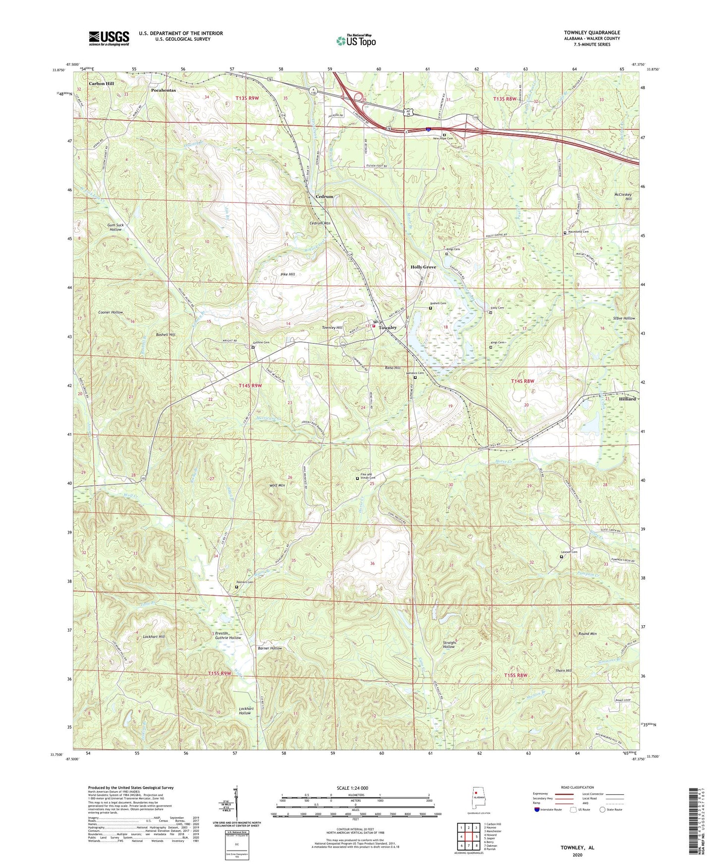
2024 topographic map quadrangle Townley in the state of Alabama. Scale: 1:24000. Based on the newly updated USGS 7.5' US Topo map series, this map is in the following counties: Walker. The map contains contour data, water features, and other items you are used to seeing on USGS maps, but also has updated roads and other features. This is the next generation of topographic maps. Printed on high-quality waterproof paper with UV fade-resistant inks.
Quads adjacent to this one:
West: Howard
Northwest: Carbon Hill
North: Nauvoo
Northeast: Manchester
East: Jasper
Southeast: Parrish
South: Oakman
Southwest: Berry
This map covers the same area as the classic USGS quad with code o33087g4.
Contains the following named places: Arker Mine, Baker Branch, Barner Hollow, Bean River, Beech Grove Freewill Baptist Church, Boshell Branch, Boshell Cemetery, Boshell Hill, Boshells Mill, Boshells Mill Dam, Boshells Mill Pond, Burton Creek, Cedrum, Cedrum Church, Cedrum Grove Church, Cedrum Mine, Cedrum Mountain, Cedrum Number 1 Mine, Center Hill Church, Cold Branch, Corona Mine, Downey Branch, Easley Cemetery, Edgil Branch, Fike Nelson Cemetery, First Baptist Church, Gum Suck Hollow, Guthrie Cemetery, Hilliard, Holly Creek Church, Holly Grove, Holly Grove Mine, Holly Grove Number 15 Mine, Horse Creek, Hurricane Creek, Jess Creek, Jim Branch, Johnny Ford, Kenney Branch, Kings Cemetery, Kings Chapel, Langs Shaft Mine, Lawson Cemetery, Lockhart Hill, Lockhart Hollow, Macedonia Church of Christ, Mackey Boshell Cemetery, Mammoth Mine, Manasco Cemetery, McCleskey Hill, Miner Branch, Mount Zion Church, Myers Branch, New Hope Cemetery, New Hope Methodist Church, Palmer Cemetery, Palmer School, Parsons Mine, Paul Creek, Payne Lake, Pike Hill, Pleasant Hill Methodist Church, Pocahontas, Pocahontas Church, Preston Guthrie Hollow, Reno Hill, Richard Branch, Right Fork Paul Creek, Rocky Branch, Round Mountain, Stave Hollow, Straight Hollow, Swindle Hill Church, Thorn Hill, Tittle Branch, Townley, Townley Church, Townley Division, Townley Hill, Townley Junior High School, Townley Mine, Townley Post Office, Townley Volunteer Fire Department, Union Hill Church, West Fork Lost Creek, West Walker Church of Christ, Wolf Creek Wildlife Management Area, Wolf Mountain, Wolf Mountain Mine, ZIP Code: 35587