MyTopo
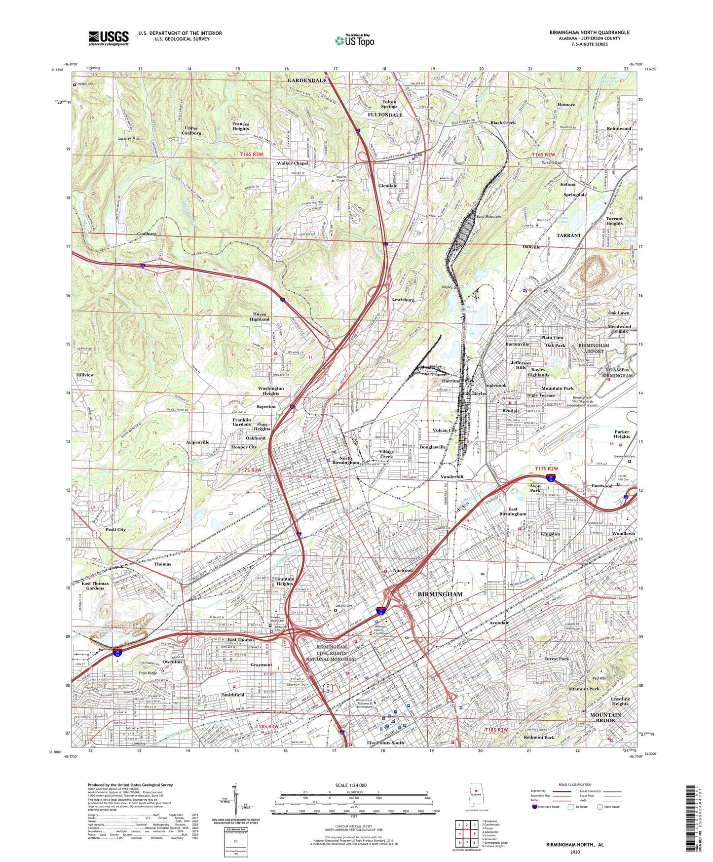
Birmingham North Alabama US Topo Map
Couldn't load pickup availability
2024 topographic map quadrangle Birmingham North in the state of Alabama. Scale: 1:24000. Based on the newly updated USGS 7.5' US Topo map series, this map is in the following counties: Jefferson. The map contains contour data, water features, and other items you are used to seeing on USGS maps, but also has updated roads and other features. This is the next generation of topographic maps. Printed on high-quality waterproof paper with UV fade-resistant inks.
Quads adjacent to this one:
West: Adamsville
Northwest: Brookside
North: Gardendale
Northeast: Pinson
East: Irondale
Southeast: Cahaba Heights
South: Birmingham South
Southwest: Bessemer
This map covers the same area as the classic USGS quad with code o33086e7.
Contains the following named places: Acipcoville, Airport Industrial Park, Alice Furnace, Altamont Park, Arcadia, Arcadia Mine, Automotive Historic District, Avon Park, Avondale, Avondale Elementary School, Avondale Mills Park, Avondale Park, Bailey Mine, Barker Park, Bartonville, Beachwood Park, Bendale, Big Ten Mine, Birmingham, Birmingham Army Air Field, Birmingham Civil Rights National Monument, Birmingham Division, Birmingham Terminal Station, Birmingham University School, Birmingham Veterans Affairs Medical Center, Birmingham-Shuttlesworth International Airport, Black Creek, Boshell Diabetes Center, Boswell Golf Course, Boyles Gap, Boyles Gap Lake, Boyles Gap Lake Dam, Boyles Highlands, Brooke Hill School, Butler Elementary School, Caldwell Park, Calloway Elementary School, Cameron Elementary School, Chestnut Hill Historic District, Children's Hospital of Alabama Main Campus, City of Birmingham, City of Fultondale, City of Tarrant, Clayton Park, Coalburg, Cooper Green Mercy Hospital, Crestline Heights, Cunningham School, Daisy City Mine, Danville, Davis Elementary School, Dolcito Quarry, Douglasville, Downtown Birmingham Historic District, Downtown Birmingham Retail and Theatre Historic District, Dudley Elementary School, Duke Park, Dupuy School, East Birmingham, East Boyles, East Thomas, East Thomas Gardens, East Thomas Gardens Dam, East Thomas Gardens Lake, East Thomas Park, East Thomas Yards, Eastwood, Elyton, Emanuel Cemetery, Enon Ridge, Fairfield, Fairmont Elementary School, Fairview Elementary School, Farmers Market, Five Points South, Forest, Forest Hill Cemetery, Forest Park, Fountain Heights, Fountain Heights Park, Fourth Avenue Historic District, Frances Heights, Franklin Gardens, Fulton Springs, Fultondale, Fultondale Estates, Fultondale Plaza Shopping Center, Gardner, Glendale, Graves Mines, Graymont, Graysons Addition, Greenleas Heights, Greenwood Cemetery, Hamilton Mine, Hanover Park, Harriman Park, Hayes Highland, Henderson Furnace, Highland Avenue Historic District, Highland Baptist Hospital, Highland Residence Park, Hodges Cemetery, Home of Mercy, Hooper City, Hugh Siding, Humoro, Ingle Terrace, Inglenook, Inglenook Cemetery, Inglenook Park, Ingram Park, Jefferson County Farm, Jefferson Hills, John Carroll High School, Joseph Riley Smith Historic District, Ketona, Ketona Lakes, Ketona Quarry, Kingston, Kirklin Clinic at University of Alabama Birmingham, Knesses Israel Cemetery, Lakeview, Lakeview Park, Lassiter Mountain, Lassiter Mountain Raceway Park, Legion Field, Lewisburg, Lewisburg Mine, Louisville and Nashville Railroad Station, Maclin Park, Magnolia Heights, Magnolia Park, Marconi Park, Mary Lee Mines, McConnell Mine, McLendon Park, Meadwood Heights, Mineral Park Municipal Golf Course, Morris Avenue-First Avenue North Historic District, Morrow Mines, Mounds, Mountain Brook, Mountain Park, North Birmingham, North Birmingham Park, Norwood, Norwood Park, Number One Fire Station Airport, Oak Forest, Oak Hill Cemetery, Oak Lawn, Oak Park, Oakhurst, Owenton, Park Place, Parker Heights, Perry Airport, Physicians Carraway Medical Center, Pit Twenty Mine, Plain View, Powell Avenue Airport, Pratt City, Red Mountain, Red Mountain Suburbs Historic District, Redmont Park, Remada Medical Center, Rhodes Park, Rickwood Field, Riviera Airport, Rock Mountain Lake Dam, Rosebud Mine, Rushton Park, Russell Ambulatory Center, Saint Vincent's Hospital Birmingham, Sayreton, Sayreton Number 2 Mine, Sharit Cemetery, Sloss Furnaces National Historic Landmark, Sloss Quarry, Smithfield, Smithfield Historic District, Smiths Park, Smolian Psychiatric Clinic, Snake Mine, Spain Rehabilitation Center Hospital, Sparks Center, Spencer Quarry, Spring Garden, Springdale, Stockham Park, Tarrant, Tarrant Gap, Tarrant Garden Estates, Tarrant Heights, Tarrant Shopping Center, The Magic Place Shopping Center, Thomas, Thomas Historic District, Underwood Park, University of Alabama at Birmingham Arena, University of Alabama at Birmingham Hospital, University of Alabama Callahan Eye Hospital, University of Alabama Medical Center, Upper Coalburg, Vanderbilt, Village Creek, Vulcan City, W237-FM (Birmingham), Walker Chapel, Walker Chapel Plaza Shopping Center, Walkers Chapel Cemetery, Wallace Tumor Institute, Washington Heights, WATV-AM (Birmingham), WCRT-AM (Birmingham), WENN-AM (Birmingham), WERC-AM (Birmingham), Willowwood Park, Woodcrest Park, Woodlawn, Woodlawn Commercial Historic District, Woodrow Wilson Park, Woolfe Family Practice Medical Center, Zion Heights, ZIP Codes: 35068, 35203, 35204, 35207, 35212, 35217, 35222, 35233, 35234, 35254


