
MyTopo
Blackburn Alabama US Topo Map
Couldn't load pickup availability
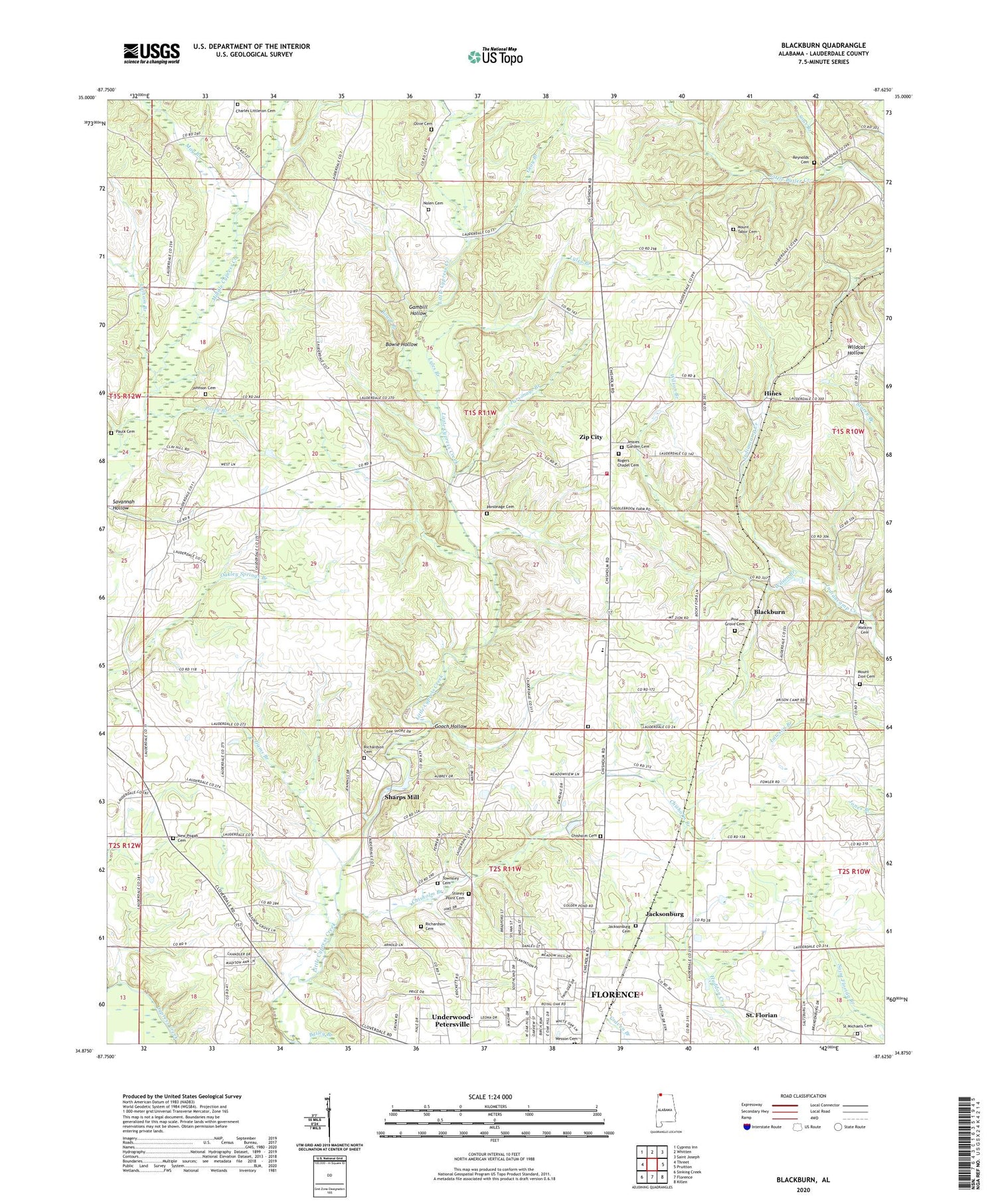
2024 topographic map quadrangle Blackburn in the state of Alabama. Scale: 1:24000. Based on the newly updated USGS 7.5' US Topo map series, this map is in the following counties: Lauderdale. The map contains contour data, water features, and other items you are used to seeing on USGS maps, but also has updated roads and other features. This is the next generation of topographic maps. Printed on high-quality waterproof paper with UV fade-resistant inks.
Quads adjacent to this one:
West: Threet
Northwest: Cypress Inn
North: Whitten
Northeast: Saint Joseph
East: Pruitton
Southeast: Killen
South: Florence
Southwest: Sinking Creek
This map covers the same area as the classic USGS quad with code o34087h6.
Contains the following named places: Bethel Berry Church of Christ, Bethel Grove, Bethel Grove Community United Methodist Church, Bethel Grove School, Big Cut Station, Blackburn, Bowie Branch, Bowie Hollow, Bretherick Plantation, Camp Florence, Chisholm Branch, Chisholm Cemetery, Chisholm Heights Church, Chisholm School, Community Church, Crossroads Church, Dry Branch, Fairview, Fairview School, Florence Division, Gambill Hollow, Gooch Hollow, Gray Branch, Hillsdale Methodist Church, Hines, Hope Post Office, Ijams Branch, Jacksonburg, Jacksonburg Church of Christ, Keys Chapel, Latham Branch, Lauderdale County, Lyles Branch, May Branch, Mount Tabor School, Mount Tabor United Methodist Church, Mount Zion Church of Christ, Mount Zion School, Nolen Cemetery, Oak Hill, Parker Chapel Missionary Baptist Church, Parsonage Branch, Parsonage Cemetery, Parsonage Chapel United Methodist Church, Paulk Cemetery, Pine Grove Cemetery, Piney Grove Church of Christ, Piney Grove School, Pisgah African Methodist Episcopal Church, Posey Branch, Richardson Cemetery, Rogers Chapel United Methodist Church, Salem Church of Christ, Savannah Hollow, Sharps Mill, Sharps Mill Dam, Sharps Mill Pond, Sour Branch, Stoney Point, Stoney Point Church of Christ, Stoney Point School, Striplin School, Suncrest, Terrace View, Twin Oaks, Underwood-Petersville Census Designated Place, Warren School, Webster, Wilkes Park, Wilson, Wilson Branch, Wilson Junior High School, Zip City, Zip City Volunteer Fire Department


