MyTopo
Boaz Alabama US Topo Map
Couldn't load pickup availability
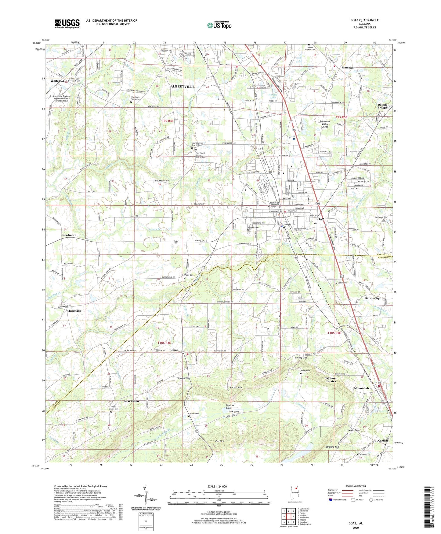
2024 topographic map quadrangle Boaz in the state of Alabama. Scale: 1:24000. Based on the newly updated USGS 7.5' US Topo map series, this map is in the following counties: Marshall, Etowah. The map contains contour data, water features, and other items you are used to seeing on USGS maps, but also has updated roads and other features. This is the next generation of topographic maps. Printed on high-quality waterproof paper with UV fade-resistant inks.
Quads adjacent to this one:
West: Douglas
Northwest: Guntersville
North: Albertville
Northeast: Painter
East: Rodentown
Southeast: Gadsden West
South: Howelton
Southwest: Altoona
This map covers the same area as the classic USGS quad with code o34086b2.
Contains the following named places: Albertville Fire and Rescue Training Facility, Albertville Fire Department Station 2, Albertville-Boaz Division, Alice, Aurora Mountain, Aurora Post Office, Bel Air Baptist Church, Bethsaida Baptist Church, Bethsaida Cemetery, Bethsaida School, Beulah Church Cemetery, Beulah Volunteer Fire Department, Bitty Branch, Boaz, Boaz Church of God, Boaz City Hall, Boaz Elementary School, Boaz Fire Department, Boaz First Baptist Church, Boaz Golf and Country Club, Boaz High School, Boaz Junior High School, Boaz Nursing Home, Boaz Police Department, Boaz Post Office, Boaz Second Baptist Church, Busby Branch, Calvary Church, Carl Creek, Central Church, City of Boaz, Crestview Church of Christ, Doolans, Forrest Home Church, Gilland Cemetery, Greer, Greer Post Office, Hillcrest Cemetery, Hope Independent Church, Horsley Lake, Jordan Cemetery, Jordan Gap, Julia Street Methodist Church, Lackey Gap, Lawson Gap, Lemon Branch, Little Slab Creek, Marshall, Marshall Medical Center South, Mizell Cemetery, Mizells Plantation, Mount Vernon Church, Mountainboro, Mountainboro Missionary Baptist Church, Mountainboro Volunteer Fire Department Station 1, Needmore, New Mount Vernon Church Cemetery, New Union Aurora Volunteer Fire Department Station 1, New Union Census Designated Place, New Union Church, New Union Congregational Methodist Church, Old Cemetery, Old Mount Vernon Cemetery, Pleasant Hill Church, Pleasant Hill School, Red Apple, Red Apple Cemetery, Red Apple Missionary Baptist Church, Saint Paul Methodist Church, Shiloh Church, Skyhaven Estates, Snead College, Springdale Baptist Church, The Jesus Name Church, The White Shepherd Church, Town of Mountainboro, Union, Union School, Upton Cemetery, Walls Chapel, Walls Chapel Cemetery, WAVU-AM (Albertville), WBSA-AM (Boaz), West Side Baptist Church, White Oak, White Oak Church, White Oak Church Cemetery, Whitesville, Whitesville Church, Whitesville School, WQSB-FM (Albertville), Yellow Branch, ZIP Codes: 35956, 35957