MyTopo
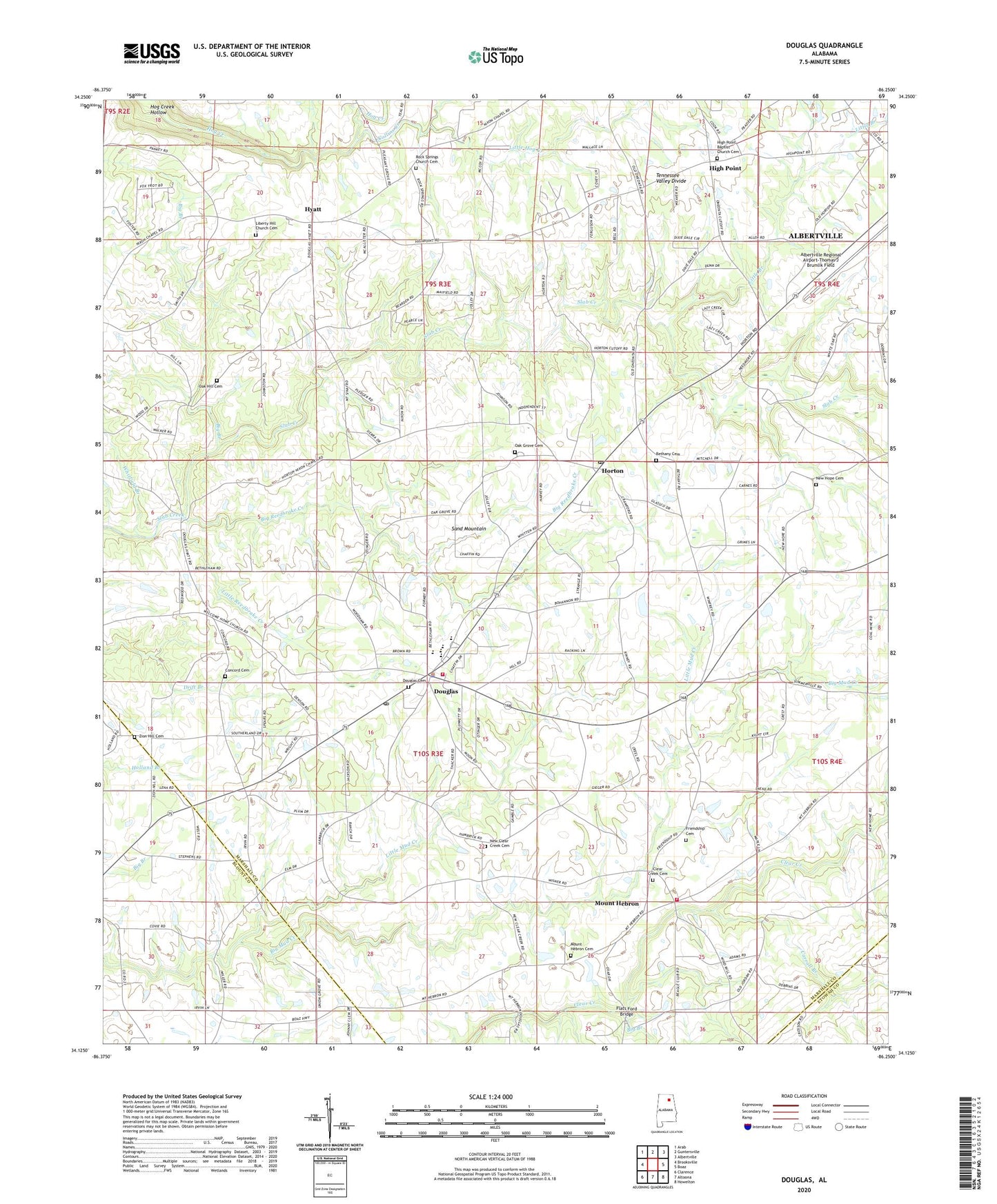
Douglas Alabama US Topo Map
Couldn't load pickup availability
2024 topographic map quadrangle Douglas in the state of Alabama. Scale: 1:24000. Based on the newly updated USGS 7.5' US Topo map series, this map is in the following counties: Marshall, Blount, Etowah. The map contains contour data, water features, and other items you are used to seeing on USGS maps, but also has updated roads and other features. This is the next generation of topographic maps. Printed on high-quality waterproof paper with UV fade-resistant inks.
Quads adjacent to this one:
West: Brooksville
Northwest: Arab
North: Guntersville
Northeast: Albertville
East: Boaz
Southeast: Howelton
South: Altoona
Southwest: Clarence
This map covers the same area as the classic USGS quad with code o34086b3.
Contains the following named places: Albertville Regional Airport-Thomas J Brumlik Field, Bartlett, Bethany Baptist Church, Bethany Cemetery, Bethlehem Church, Big Branch, Big Reedbrake Creek, Carroll Branch, Center Point, Cherokee Tribe of Northeast Alabama State Designated Tribal Statistical Area, Claborn School, Clear Creek Cemetery, Clear Creek Primitive Baptist Church, Collins Creek, Concord Baptist Church, Concord Cemetery, Douglas, Douglas Baptist Church, Douglas Cemetery, Douglas Division, Douglas Elementary School, Douglas High School, Douglas Methodist Church, Douglas Post Office, Douglas Volunteer Fire Department, Flats Ford Bridge, Friendship, Friendship Baptist Church, Friendship Cemetery, Friendship School, High Point, High Point Baptist Church, High Point Baptist Church Cemetery, Highview School, Holly Grove Church, Horton, Horton Post Office, Horton School, Hyatt, Liberty Hill Church, Liberty Hill Church Cemetery, Liberty Hill School, Little Branch, Little Branch Church, Little Hog Creek, Little Mud Creek, Little Reedbrake Creek, Mount Hebron, Mount Hebron Cemetery, Mount Hebron Church, Mount Hebron Grammar School, Mount Hebron Volunteer Fire Department, Mount Sinai Church, New Clear Creek Cemetery, New Clear Creek Primitive Baptist Church, New Home Church, New Hope Church, Oak Grove Cemetery, Oak Grove Church, Oak Grove Methodist Church, Oak Hill Baptist Church, Oak Hill Cemetery, Pine Grove School, Reedbrake, Rock Springs Church, Rock Springs Church Cemetery, Slab Creek Golf Course, Town of Douglas, Union Grove Church, Welcome Home Church, Wesley Chapel, Whitfield Branch, Zion Hill Cemetery, Zion Hill Primitive Baptist Church, ZIP Code: 35950