
MyTopo
Boyd Alabama US Topo Map
Couldn't load pickup availability
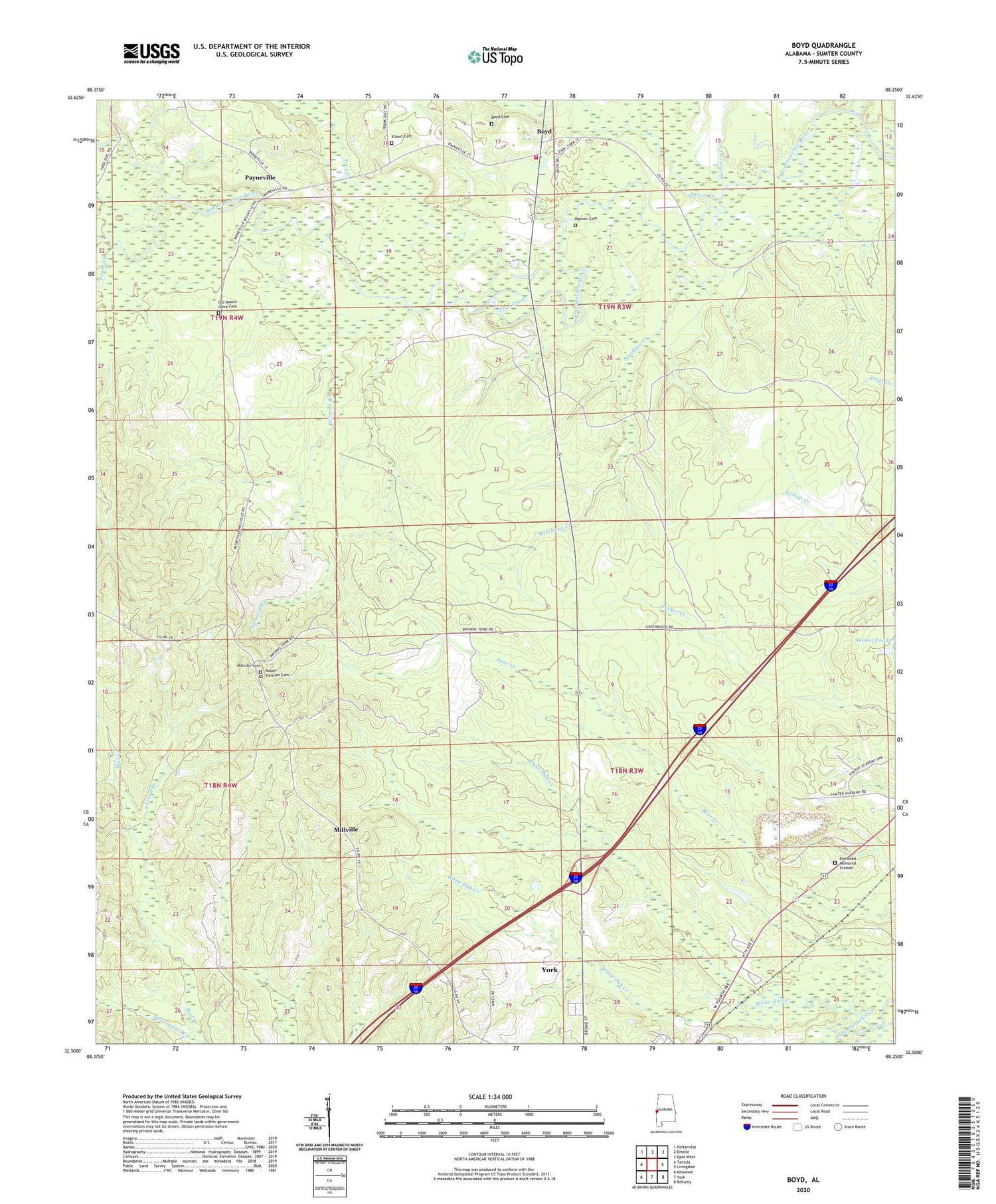
2024 topographic map quadrangle Boyd in the state of Alabama. Scale: 1:24000. Based on the newly updated USGS 7.5' US Topo map series, this map is in the following counties: Sumter. The map contains contour data, water features, and other items you are used to seeing on USGS maps, but also has updated roads and other features. This is the next generation of topographic maps. Printed on high-quality waterproof paper with UV fade-resistant inks.
Quads adjacent to this one:
West: Tamola
Northwest: Porterville
North: Emelle
Northeast: Epes West
East: Livingston
Southeast: Bellamy
South: York
Southwest: Kewanee
This map covers the same area as the classic USGS quad with code o32088e3.
Contains the following named places: Atanchiluka Creek, Barebone Creek, Boyd, Boyd Cemetery, Boyd Volunteer Fire Department, Cobbs Crossing, Danner Cemetery, Edmond Branch, Elliott Cemetery, Elmwood Memorial Estates, Greater Mount Olive Primitive Baptist Church, Hadden Presbyterian Church, Leard Branch, Millville, Millville Cemetery, Mount Herman Cemetery, Mount Herman Church, Mount Herman School, Mount Olive Church, Mount Powell Baptist Church, Mount Powell School, Mud Creek, Old Mount Olive Cemetery, Old Mount Olive Primitive Baptist Church, Payneville, Payneville School, Ponta Creek, Sambo Creek, Sanusi Creek, Sicolocco Creek, Smiths Chapel, Sparkman, Sumter Academy, Sumter Country Club, Sumter Fire Tower, Teoc Creek, Tubby Creek, White Hall Creek, White Oak Creek, WSLY-FM (York), WYLS-AM (York)


