MyTopo
Tamola Mississippi US Topo Map
Couldn't load pickup availability
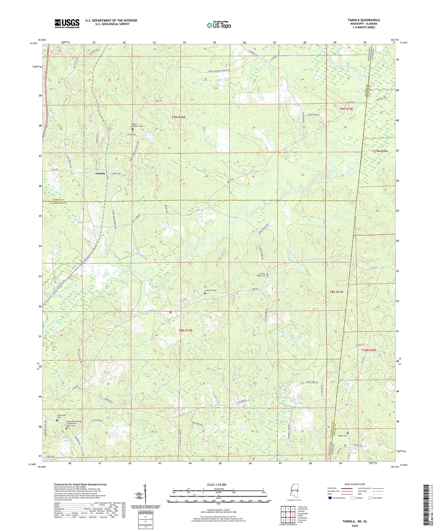
2024 topographic map quadrangle Tamola in the states of Mississippi, Alabama. Scale: 1:24000. Based on the newly updated USGS 7.5' US Topo map series, this map is in the following counties: Lauderdale, Kemper, Sumter. The map contains contour data, water features, and other items you are used to seeing on USGS maps, but also has updated roads and other features. This is the next generation of topographic maps. Printed on high-quality waterproof paper with UV fade-resistant inks.
Quads adjacent to this one:
West: Lauderdale
Northwest: Oak Grove
North: Porterville
Northeast: Emelle
East: Boyd
Southeast: York
South: Kewanee
Southwest: Toomsuba
This map covers the same area as the classic USGS quad with code o32088e4.
Contains the following named places: Anna York Cemetery, Atwood School, Bethlehem Church, Big Reed Creek, Center Ridge Cemetery, Center Ridge Church, Center Ridge School, Center Ridge Volunteer Fire and Rescue Department, Church of God, Coonville, Delk School, Gibbs Cemetery, Green Valley Church, Grigsbys Springs, H S Wedgeworth Catfish Ponds Dam, Lauderdale Cemetery, Lauderdale Springs Confederate-Union Cemetery, Mount Carmel Church, Mount Cephus Church, Mount Hebron Cemetery, Mount Hebron Church, Oak Grove Baptist Church, Oxford Church, Running Creek, Simmons Creek, Tamola, Tamola Church, Tamola Lookout Tower, Tamola School, W B Boutwell Pond Dam, ZIP Code: 39335