MyTopo
Bellamy Alabama US Topo Map
Couldn't load pickup availability
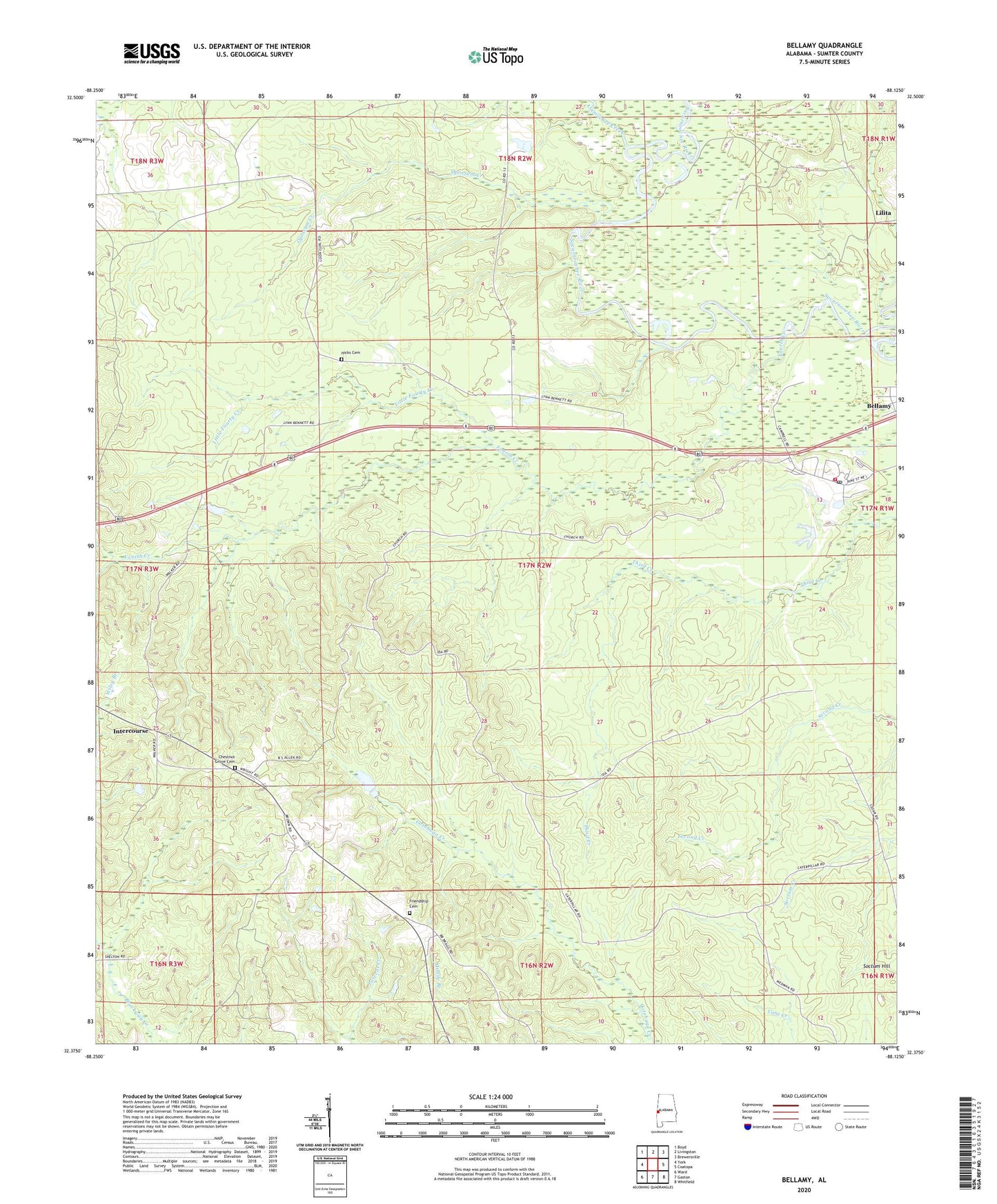
2024 topographic map quadrangle Bellamy in the state of Alabama. Scale: 1:24000. Based on the newly updated USGS 7.5' US Topo map series, this map is in the following counties: Sumter. The map contains contour data, water features, and other items you are used to seeing on USGS maps, but also has updated roads and other features. This is the next generation of topographic maps. Printed on high-quality waterproof paper with UV fade-resistant inks.
Quads adjacent to this one:
West: York
Northwest: Boyd
North: Livingston
Northeast: Brewersville
East: Coatopa
Southeast: Whitfield
South: Gaston
Southwest: Ward
This map covers the same area as the classic USGS quad with code o32088d2.
Contains the following named places: Alamuchee Creek, Bellamy, Bellamy Census Designated Place, Bellamy Post Office, Bellamy Volunteer Fire Department, Bennett, Chesnut Grove, Chestnut Grove Methodist Church, Chilies Mill, Curl Station, Elizabeth Church, Fourth Creek, Fourth Creek Methodist Church, Fourth Creek School, Friendship Baptist Church, Friendship Cemetery, H and Y Hunting Lodge, Hicks Cemetery, Intercourse, Lamkin Church, Lilita, Lillies Chapel Methodist Church, Lillies Chapel School, Little Fourth Creek, Morning Star Church, Mount Zion Baptist Church, Opossum Creek, Walk, York Division, ZIP Codes: 36901, 36925