MyTopo
Kewanee Mississippi US Topo Map
Couldn't load pickup availability
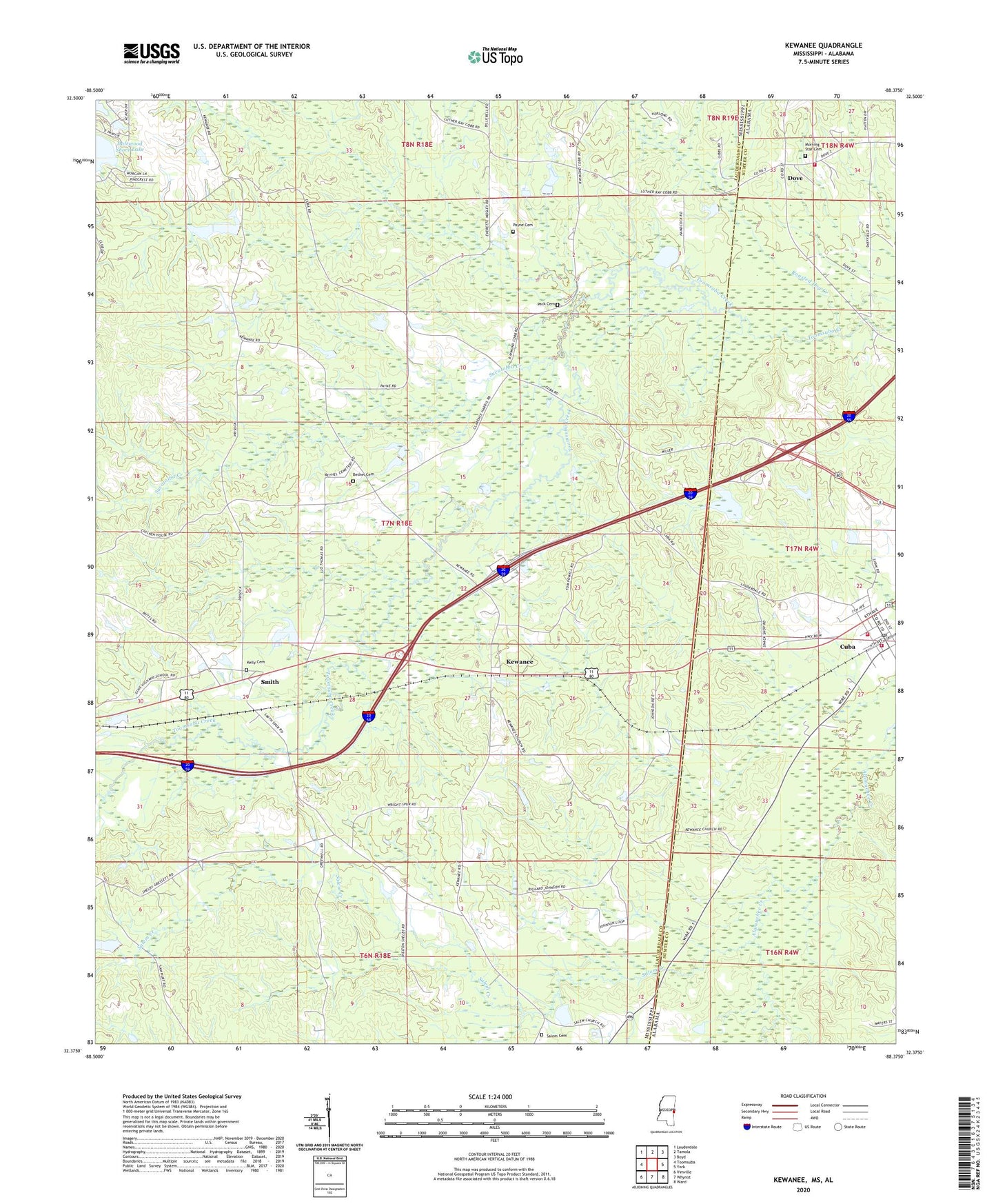
2024 topographic map quadrangle Kewanee in the states of Mississippi, Alabama. Scale: 1:24000. Based on the newly updated USGS 7.5' US Topo map series, this map is in the following counties: Lauderdale, Sumter. The map contains contour data, water features, and other items you are used to seeing on USGS maps, but also has updated roads and other features. This is the next generation of topographic maps. Printed on high-quality waterproof paper with UV fade-resistant inks.
Quads adjacent to this one:
West: Toomsuba
Northwest: Lauderdale
North: Tamola
Northeast: Boyd
East: York
Southeast: Ward
South: Whynot
Southwest: Vimville
This map covers the same area as the classic USGS quad with code o32088d4.
Contains the following named places: Bell Station, Bethel Cemetery, Bethel Church, Buddy Webb Pond Dam, Cuba, Cuba Elementary School, Cuba Post Office, Cuba Volunteer Fire Department Station 1, Cuba Volunteer Fire Department Station 2, Dalewood Shore Lake, Dogwood Lake Dam, Dove, Ed Snow Lake Dam, Elizabeth Church, H A Pickett Lake Dam, Johnny Allen Pond Dam, K B Mitchell Pond Dam, Kelly Cemetery, Kewanee, Little Hope Baptist Church, Morning Star Baptist Church, Morning Star Cemetery, Morning Star Volunteer Fire Department, Mrs Jack Morman Pond Dam, Mrs R E Payne Pond Dam, Pack Cemetery, Payne Cemetery, Pickfords Lake Dam, R B Lynch Catfish Ponds Dam, Roasted Hog Creek, Salem Baptist Church, Salem Cemetery, Salem Creek, Simmons Church, Smith, Spring Hill Church, Sucatolba Creek, Supervisor District 2, Sweet Pilgrim Church, Town of Cuba, W T Simmons Pond Dam, ZIP Code: 39364