MyTopo
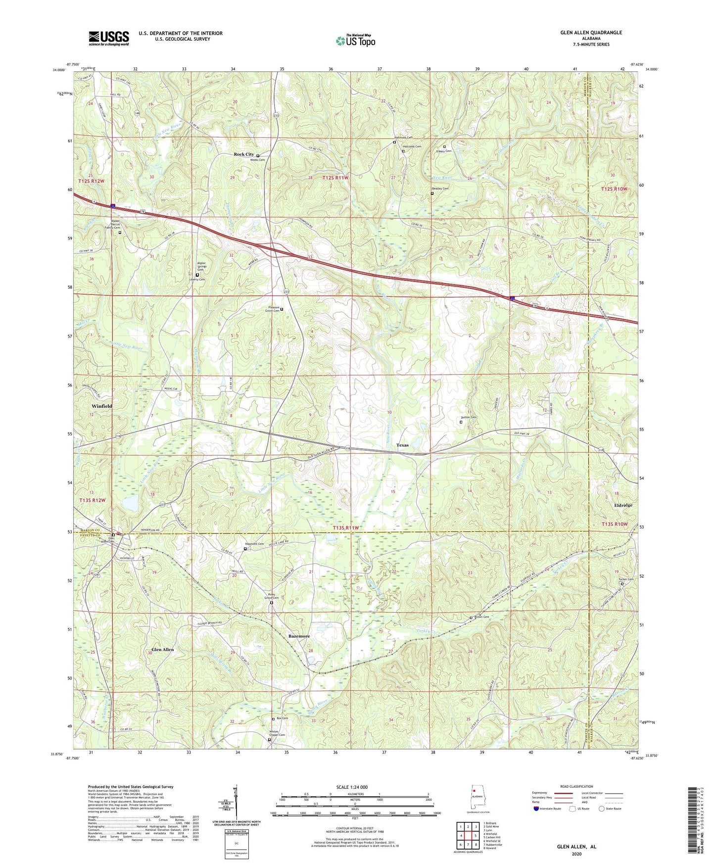
Glen Allen Alabama US Topo Map
Couldn't load pickup availability
2024 topographic map quadrangle Glen Allen in the state of Alabama. Scale: 1:24000. Based on the newly updated USGS 7.5' US Topo map series, this map is in the following counties: Marion, Fayette, Walker. The map contains contour data, water features, and other items you are used to seeing on USGS maps, but also has updated roads and other features. This is the next generation of topographic maps. Printed on high-quality waterproof paper with UV fade-resistant inks.
Quads adjacent to this one:
West: Winfield
Northwest: Brilliant
North: Gold Mine
Northeast: Lynn
East: Carbon Hill
Southeast: Howard
South: Hubbertville
Southwest: Winfield SE
This map covers the same area as the classic USGS quad with code o33087h6.
Contains the following named places: Bazemore, Beasley Cemetery, Box Cemetery, Brown Cemetery, Central Church, Clifty Creek, Dutton Cemetery, Fern Springs Church, Freeman Branch, Glen Allen, Glen Allen Cemetery, Glen Allen Post Office, Glen Allen Volunteer Fire Department, Gooden Creek, Goodwin Creek, Gulf Branch, Hallmark Cemetery, Holcomb Cemetery, Hopewell Cemetery, Hopewell Church, Humphrey Branch, Liberty Cemetery, Little Goodwin Creek, Little New River, Mallards Creek, Mill Creek, Mills Spring Branch, New Poplar Church, New River, O'Mary Cemetery, Piney Grove Cemetery, Piney Grove Church, Piney Grove Junior High School, Pleasant Grove Cemetery, Pleasant Grove Church, Poplar Springs Cemetery, Poplar Springs School, Rock City, Rock City Church, Rocky Branch, Texas, Thompson Branch, Town of Glen Allen, Tucker Branch, Tucker Cemetery, Turkey Creek, Walker Baccus Family Cemetery, Weeks Cemetery, Whites Chapel Cemetery, Whites Chapel Church of Christ, ZIP Codes: 35554, 35559