MyTopo
Bullock Alabama US Topo Map
Couldn't load pickup availability
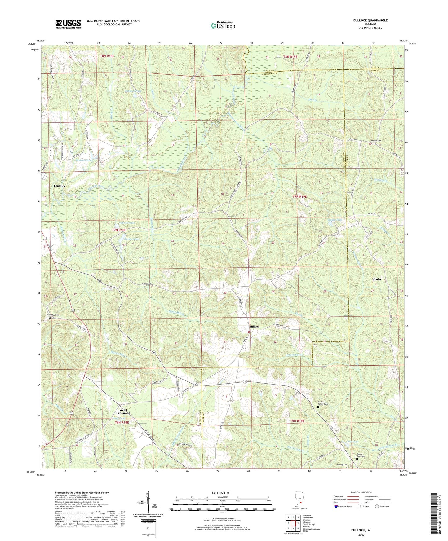
2024 topographic map quadrangle Bullock in the state of Alabama. Scale: 1:24000. Based on the newly updated USGS 7.5' US Topo map series, this map is in the following counties: Crenshaw, Coffee, Pike. The map contains contour data, water features, and other items you are used to seeing on USGS maps, but also has updated roads and other features. This is the next generation of topographic maps. Printed on high-quality waterproof paper with UV fade-resistant inks.
Quads adjacent to this one:
West: Brantley
Northwest: Luverne
North: Glenwood
Northeast: Goshen
East: Bluff Springs
Southeast: Elba
South: Danleys Crossroads
Southwest: Dozier
This map covers the same area as the classic USGS quad with code o31086e2.
Contains the following named places: Aiken, Antioch Cemetery, Antioch Primitive Baptist Church, Bailey Lakes, Beaver Dam Cemetery, Beaverdam Primitive Baptist Church, Beulah Church, Blue Creek, Bryan Mill Creek, Bryans Pond, Buck Creek, Bullock, Bullock Volunteer Fire Department, Calvary Church, Club Pond, Coffee Corner Post Office, Driskell Family Cemetery, Ellis School, Folmars Pond, Friendship Church, Honey Jones Mill Creek, Jones Branch, Jones Mill, Lake Norman, Lowery Cemetery, Moody Mill Creek, Mount Zion Church, Newbia Baptist Church, Newby, Newby School, Oak Grove Cemetery, Old Union Church, Peacock, Rainer School, Sandy Creek, Sasser Store, Sassers Mill Church, Soldiers Camp Creek, Wallaces Pond, Weed Church, Weed Crossroad, Weed Pond, West Fork Pea Creek, Zion Chapel