MyTopo
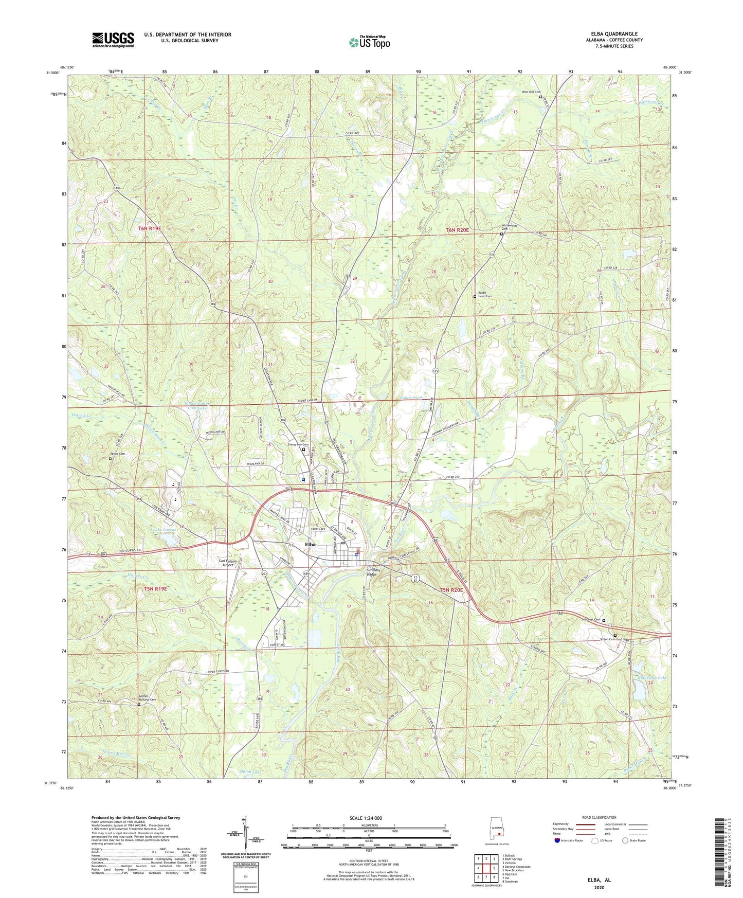
Elba Alabama US Topo Map
Couldn't load pickup availability
2024 topographic map quadrangle Elba in the state of Alabama. Scale: 1:24000. Based on the newly updated USGS 7.5' US Topo map series, this map is in the following counties: Coffee. The map contains contour data, water features, and other items you are used to seeing on USGS maps, but also has updated roads and other features. This is the next generation of topographic maps. Printed on high-quality waterproof paper with UV fade-resistant inks.
Quads adjacent to this one:
West: Danleys Crossroads
Northwest: Bullock
North: Bluff Springs
Northeast: Victoria
East: New Brockton
Southeast: Goodman
South: Ino
Southwest: Opp East
This map covers the same area as the classic USGS quad with code o31086d1.
Contains the following named places: Babes Pond, Beaverdam Creek, Bethel Church, Big Creek, Bone Branch, Buffalo, Carl Folsom Airport, City of Elba, Devaughn Lake Dam, Dorsey Branch, Double Branch, Elba, Elba Country Club, Elba Country Club Lake, Elba Country Club Lake Dam, Elba Division, Elba General Hospital, Elba High School, Elba Police Department, Elba Post Office, Elba Volunteer Fire Department, Evergreen Cemetery, Evergreen Primitive Baptist Church, First Baptist Church, Grimes - Holland Cemetery, Halls School, Ham Branch, Ham Church, Ham School, Harpers Ferry, Hillcrest Cemetery, Hurricane Creek, J B Simmons Bridge, Lake Lorene, Lake Lorene Lake Dam, Lee, Lees School, Moores Creek, Morris Branch, New Providence Baptist Church, New Zion Baptist Church, Patrick Creek, Pea Creek, Reeves School, Rhoads School, Ridgeway Lake, Rocky Head Cemetery, Rocky Head Church, Shiloh Cemetery, Shiloh Church, Slough Branch, Taylor Cemetery, Taylor School, The Hour of Faith Church, Westside Church, Whitewater Baptist Church, Whitewater Cemetery, Whitewater Creek, Wise Mill Cemetery, Wise Mill Church, ZIP Code: 36323