
MyTopo
Camp Hill Alabama US Topo Map
Couldn't load pickup availability
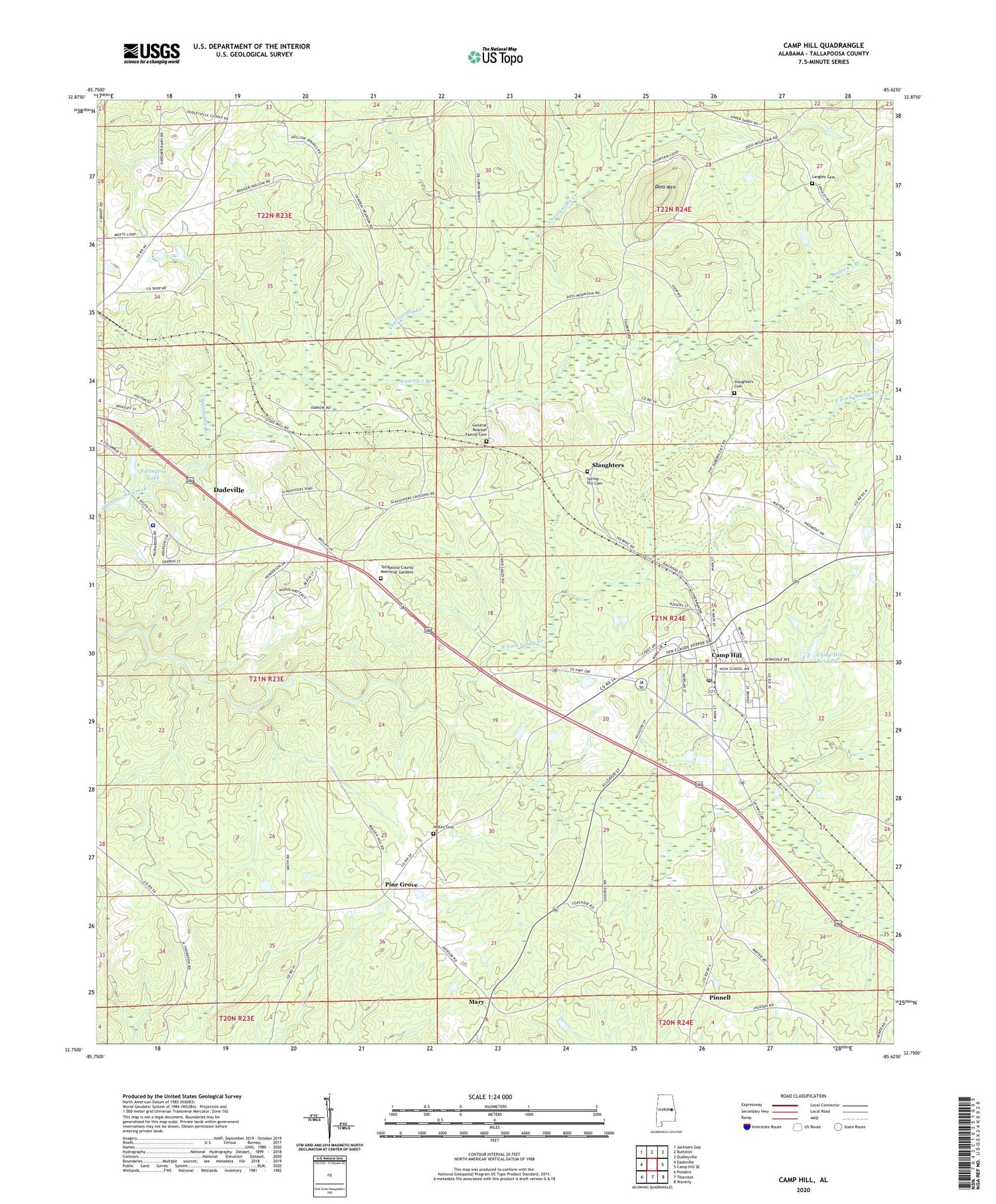
2024 topographic map quadrangle Camp Hill in the state of Alabama. Scale: 1:24000. Based on the newly updated USGS 7.5' US Topo map series, this map is in the following counties: Tallapoosa. The map contains contour data, water features, and other items you are used to seeing on USGS maps, but also has updated roads and other features. This is the next generation of topographic maps. Printed on high-quality waterproof paper with UV fade-resistant inks.
Quads adjacent to this one:
West: Dadeville
Northwest: Jacksons Gap
North: Buttston
Northeast: Dudleyville
East: Camp Hill SE
Southeast: Waverly
South: Thornton
Southwest: Ponders
This map covers the same area as the classic USGS quad with code o32085g6.
Contains the following named places: Agricola, Andrews Branch, Baskins Chapel, Beulah Number 2 Church, Bradshaw Dam, Bradshaw Lake, Camp Hill, Camp Hill Baptist Church, Camp Hill Division, Camp Hill High School, Camp Hill Post Office, Camp Hill Reservoir, Camp Hill Reservoir Dam, Camp Hill Volunteer Fire Department, Camp Hill-Tallapoosa County Airport, Civilian Conservation Corps Camp Number 1405, Collum Mine, Doss Mountain, Edward Bell High School, Farington Dam, Farington Lake, First Methodist Episcopal Church, First Universalist Church, General Pearson Family Cemetery, Holley Cemetery, Lake Martin Community Hospital, Langley Cemetery, Little Sandy Creek, Lyman Ward Military Academy, Mary, Mount Carmel Church, Mount Carmel School, New Poplar Springs Church, North Fork Sandy Creek, Pine Grove, Pine Grove Church, Pinkston Prospects, Pinnell, Slaughters, Slaughters Cemetery, Spring Hill Cemetery, Tallapoosa Academy, Tallapoosa County Memorial Gardens, Town of Camp Hill, ZIP Code: 36850


