MyTopo
Jacksons Gap Alabama US Topo Map
Couldn't load pickup availability
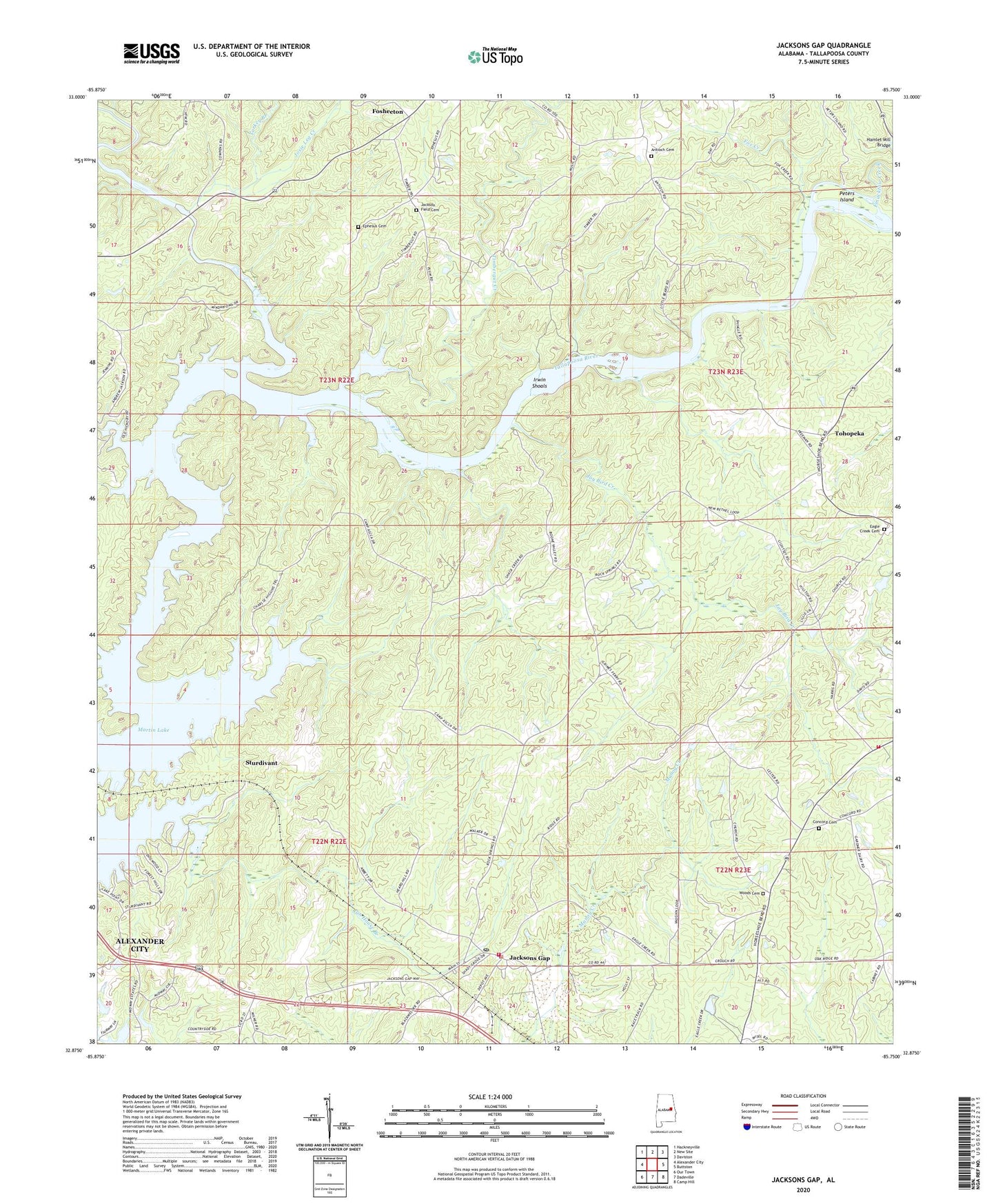
2024 topographic map quadrangle Jacksons Gap in the state of Alabama. Scale: 1:24000. Based on the newly updated USGS 7.5' US Topo map series, this map is in the following counties: Tallapoosa. The map contains contour data, water features, and other items you are used to seeing on USGS maps, but also has updated roads and other features. This is the next generation of topographic maps. Printed on high-quality waterproof paper with UV fade-resistant inks.
Quads adjacent to this one:
West: Alexander City
Northwest: Hackneyville
North: New Site
Northeast: Daviston
East: Buttston
Southeast: Camp Hill
South: Dadeville
Southwest: Our Town
This map covers the same area as the classic USGS quad with code o32085h7.
Contains the following named places: Antioch Cemetery, Assembly of Yahweh, Bethel Church, Camp Assca, Church of God, Concord Cemetery, Eagle Creek, Eagle Creek Baptist Church, Eagle Creek Cemetery, Eagle Creek Volunteer Fire Department, Emuckfaw Creek, Ephesus Cemetery, Ephesus Primitive Baptist Church, Fosheeton, Fox Creek, Gin House Branch, Hams Cut, Hillabee Creek, Irwin Shoals, Jackson Field Cemetery, Jacksons Gap, Jackson's Gap Fire Department, Jackson's Gap Police Department, Jacksons Gap Post Office, Jacksons Gap School, Jay Bird Creek, Jones Chapel, Josie Leg Creek, Midway, Midway Golf Club, Mount Olive Church, New Concord Church, New Pine Grove Baptist Church, Oak Ridge Church, Peters Island, Rock Springs Church, Rocky Mount Baptist Church, Stow Ferry, Sturdivant, Sturdivant Creek, Timbergut Creek, Tohopeka, Town of Jacksons' Gap, Turkey Branch, Welch Ferry, Whaley Ferry, Woods Cemetery, Woods Presbyterian Church, ZIP Code: 36861