
MyTopo
Buttston Alabama US Topo Map
Couldn't load pickup availability
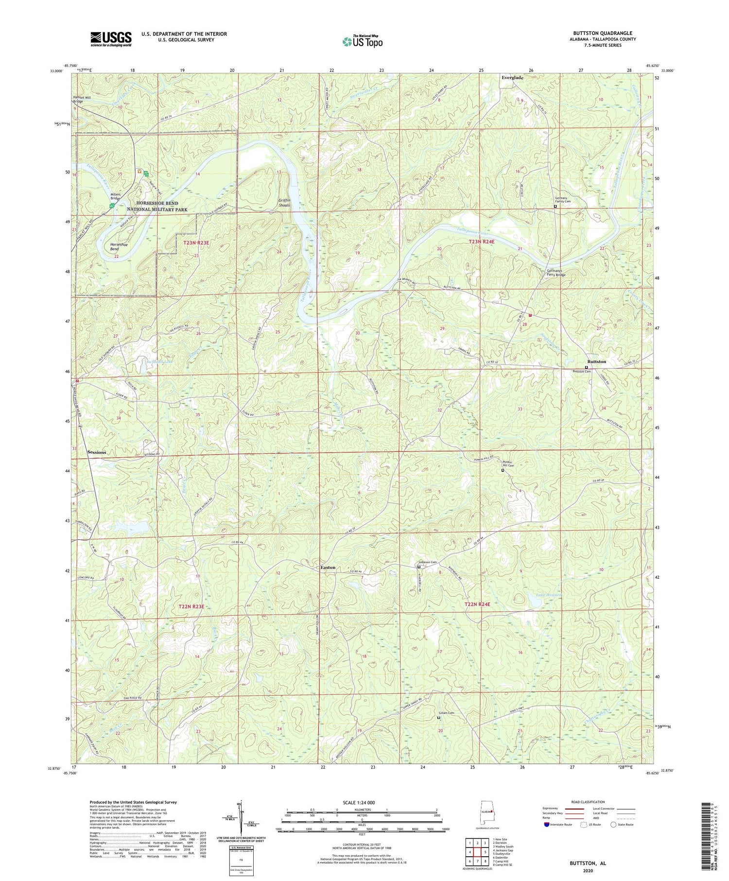
2024 topographic map quadrangle Buttston in the state of Alabama. Scale: 1:24000. Based on the newly updated USGS 7.5' US Topo map series, this map is in the following counties: Tallapoosa. The map contains contour data, water features, and other items you are used to seeing on USGS maps, but also has updated roads and other features. This is the next generation of topographic maps. Printed on high-quality waterproof paper with UV fade-resistant inks.
Quads adjacent to this one:
West: Jacksons Gap
Northwest: New Site
North: Daviston
Northeast: Wadley South
East: Dudleyville
Southeast: Camp Hill SE
South: Camp Hill
Southwest: Dadeville
This map covers the same area as the classic USGS quad with code o32085h6.
Contains the following named places: Abernathy Prospects, Berry Mine, Bethlehem Church, Buttston, Buttston Baptist Church, Buttston Cemetery, Buttston School, Buttston Volunteer Fire Department, Carlton Mine, Chatahospee Creek, Cholocco Litabixee, County Line Creek, Eagle Creek, Easton, Elder Church, Elder School, Everglade, Everglade School, Galloway Creek, Germany Family Cemetery, Germany Ferry, Germanys Ferry Bridge, Gillam Cemetery, Griffin Ferry, Griffin Shoals, Hamlet, Hamlet Mill Bridge, Horseshoe Bend, Horseshoe Bend National Military Park, Howard Mine, Kidd Mine, Lake Howard, Lebanon Cemetery, Lebanon Church, Matilda, Matilda Ferry, Mica Hill Mine, Miller Creek, Millers Bridge, Millers Ferry, Niuyaka, Oakfuskee Council House, Oakfuskudshi, Poplar Springs Church, Popular Springs School, Punkin Hill Cemetery, Saunders Prospect, Schryer Dam, Sessions, Soapstone Creek, Sweetwater Creek, Swindall Dam, Swindall Lake, Vines Prospect, Washburne Prospect, Zion Hill Church, Zions Hill School


