MyTopo
Clarence Alabama US Topo Map
Couldn't load pickup availability
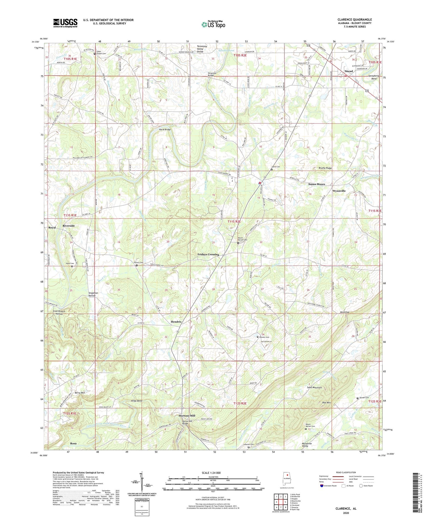
2024 topographic map quadrangle Clarence in the state of Alabama. Scale: 1:24000. Based on the newly updated USGS 7.5' US Topo map series, this map is in the following counties: Blount. The map contains contour data, water features, and other items you are used to seeing on USGS maps, but also has updated roads and other features. This is the next generation of topographic maps. Printed on high-quality waterproof paper with UV fade-resistant inks.
Quads adjacent to this one:
West: Blountsville
Northwest: Holly Pond
North: Brooksville
Northeast: Douglas
East: Altoona
Southeast: Hyatt Gap
South: Oneonta
Southwest: Cleveland
This map covers the same area as the classic USGS quad with code o34086a4.
Contains the following named places: Bethel Baptist Church, Bird, Brown Cemetery, Brushy Ridge, Buzzard Branch, Bynum Cemetery, Camp Branch, Center Church, Clarence Division, Cold Branch, Cold Branch Hollow, Craig, Dry Creek, Ebenezer Methodist Church, Faulkner Ford, Fridays Chapel, Fridays Crossing, Gibbs Chapel, Gibbs Chapel Cemetery, Hales Creek, Hamby Branch, Handley Branch, Hendrix, Hendrix Church, Hendrix Mine, Honey Branch, Hood Cemetery, Hood Creek, Horton Mill Bridge, Hortons Mill, Huldah, Jones Creek, Kenneth Wright Dam, Kings Bend, Lamb Cemetery, Lebanon Cemetery, Lebanon United Methodist Church, Liberty Hill Baptist Church, Maple Hill Golf Course, Mount Moriah Cemetery, Mount Moriah Church, Mount View, Mount View School, Mount Zion Church of God, Murphy Ford, New Home Church, Painter Cemetery, Parker Branch, Pleasant Hope Church, Reid Gap, Riverside, Rocky Branch, Royal Church, Sand Valley Creek, Scott Road Mine, Singleton Hollow, Snead, Snead Police Department, Snead Post Office, Snead Volunteer Fire Department, Spradlin Pond, Sprayberry Bend, Stracener Bridge, Susan Moore, Susan Moore Police Department, Susan Moore School, Susan Moore Volunteer Fire Department, Tappan, Town of Snead, Town of Susan Moore, Wards Bridge, Whippoorwill Creek, Wilson Chapel, Wrights Lake, Wynnville, Wynnville Community Church, Wynnville Creek, Yellow Branch