MyTopo
Brooksville Alabama US Topo Map
Couldn't load pickup availability
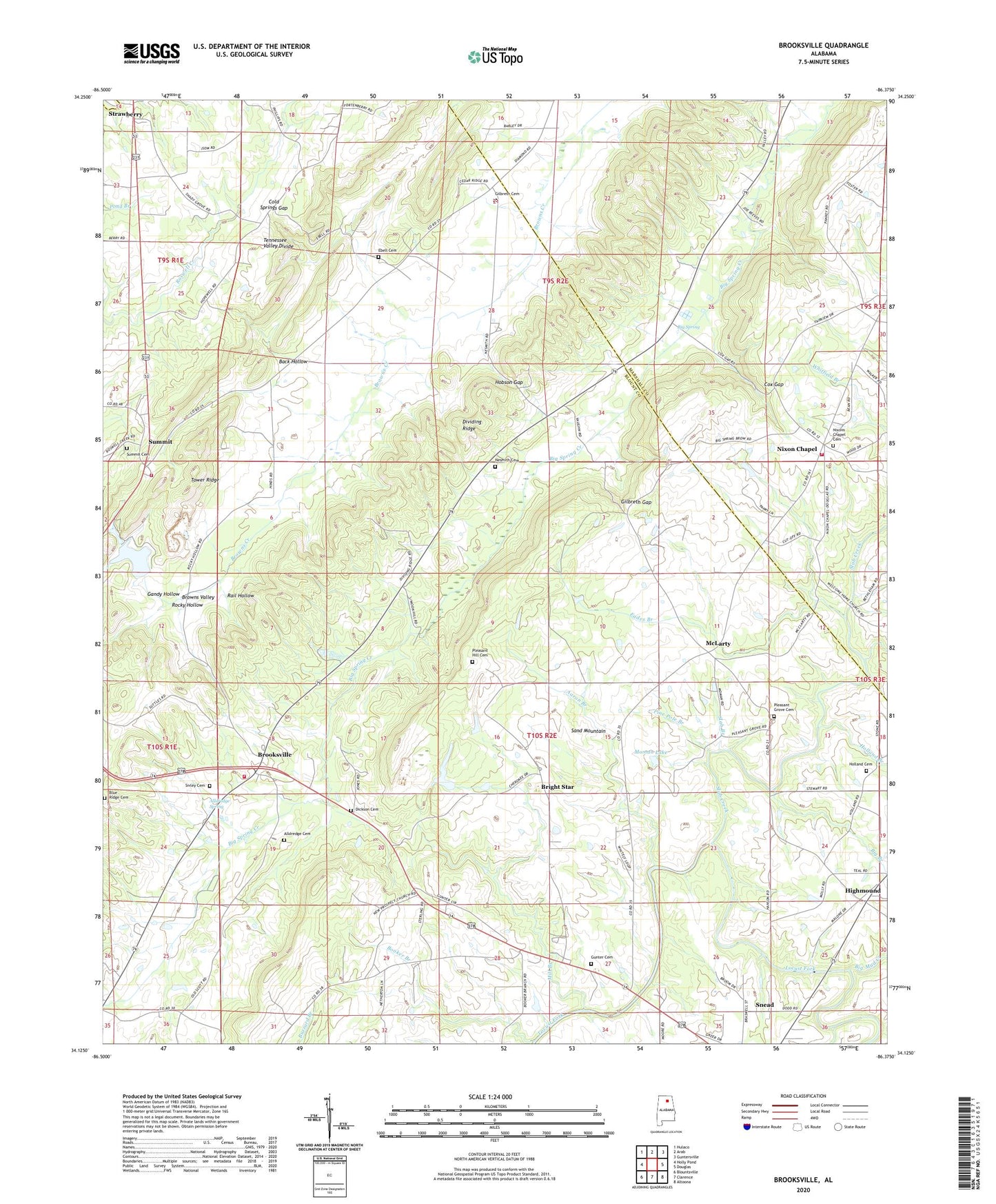
2024 topographic map quadrangle Brooksville in the state of Alabama. Scale: 1:24000. Based on the newly updated USGS 7.5' US Topo map series, this map is in the following counties: Blount, Marshall, Cullman. The map contains contour data, water features, and other items you are used to seeing on USGS maps, but also has updated roads and other features. This is the next generation of topographic maps. Printed on high-quality waterproof paper with UV fade-resistant inks.
Quads adjacent to this one:
West: Holly Pond
Northwest: Hulaco
North: Arab
Northeast: Guntersville
East: Douglas
Southeast: Altoona
South: Clarence
Southwest: Blountsville
This map covers the same area as the classic USGS quad with code o34086b4.
Contains the following named places: Aaron Branch, Alldredge Cemetery, Alldredge Spring, Back Hollow, Big Branch, Big Mud Creek, Big Spring, Big Spring Post Office, Big Spring Valley School, Blue Ridge Cemetery, Booker Branch, Bowen, Bright Star, Brooksville, Brooksville Division, Brooksville Missionary Baptist Church, Brooksville Volunteer Fire and Rescue, Browns Valley, Cedar Grove Church, Cold Springs Gap, Cox Gap, Curtis Williams Lake, Curtis Williams Lake Dam, Curtis Williams Upper Dam, Dickson Cemetery, Drift Branch, Eades Branch, Eargle School, Ebell Cemetery, Ebell Church, Fowler, Gandy Hollow, Gilbreth Cemetery, Gilbreth Gap, Gunter Cemetery, Highmound, Highmound Church, Hobson Gap, Holland Branch, Holland Cemetery, Macedonia Church, McLarty, Mill Branch, Moman Lake, Nesmith Cemetery, New Prospect Church, Nixon Chapel, Nixon Chapel Church, Nixon Chapel School, Nixon Chapel Volunteer Fire Department, Nixons Chapel Cemetery, Oak Hill School, Pine Pole Branch, Pleasant Grove Cemetery, Pleasant Grove Methodist Church, Pleasant Hill Cemetery, Pleasant Hill Church, Pleasant Ridge Church, Pleasant Valley Church, Rail Hollow, Rocky Hollow, Salem Primitive Baptist Church, Scofield Poultry Farm, Shady Grove Church, Sivley Cemetery, Slab Branch, Slab Creek, Strawberry, Strawpen School, Summit, Summit Cemetery, Summit Church, Summit Elementary School, Summit Volunteer Fire and Rescue, Tower Ridge, ZIP Code: 35980