MyTopo
Blountsville Alabama US Topo Map
Couldn't load pickup availability
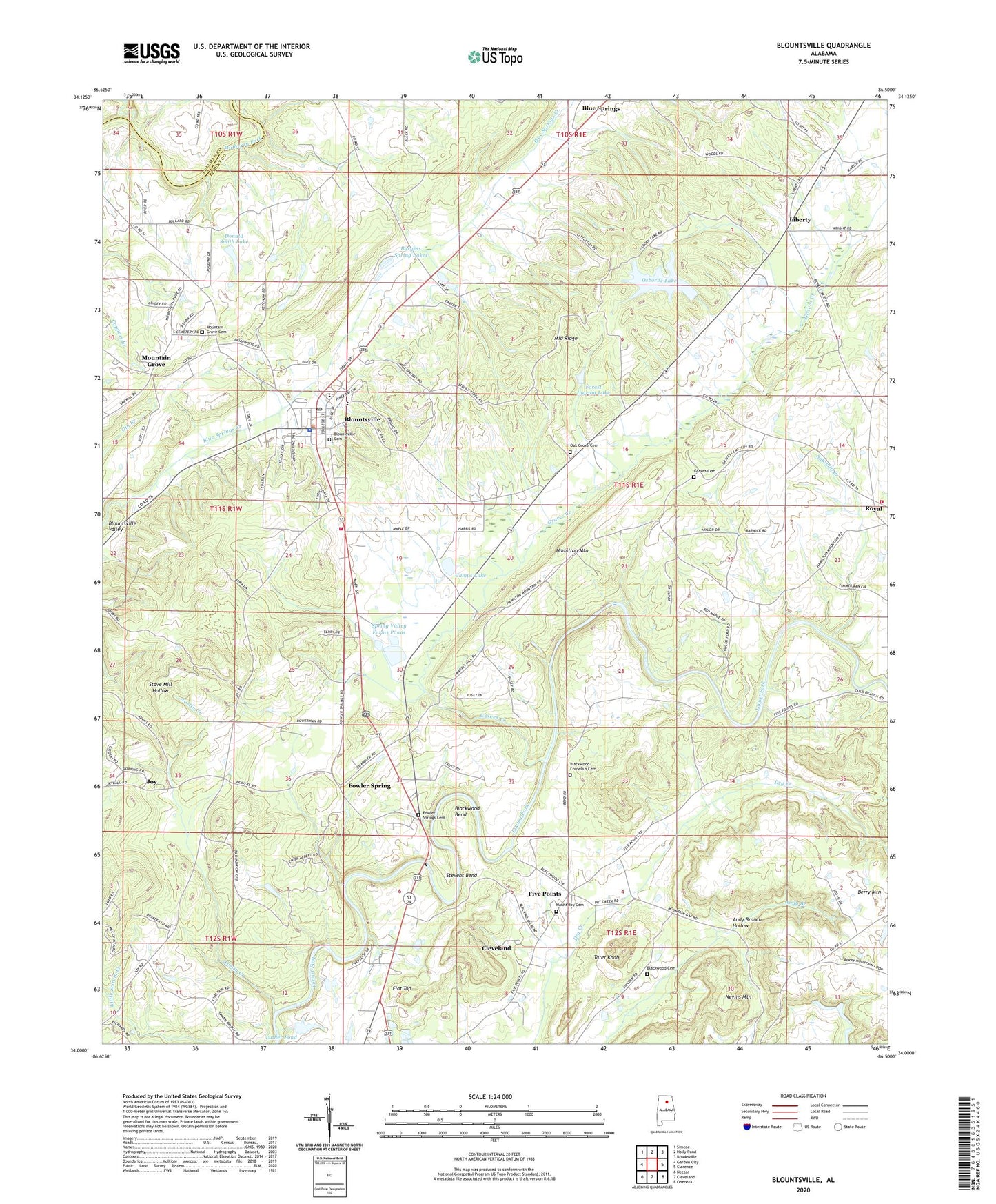
2024 topographic map quadrangle Blountsville in the state of Alabama. Scale: 1:24000. Based on the newly updated USGS 7.5' US Topo map series, this map is in the following counties: Blount, Cullman. The map contains contour data, water features, and other items you are used to seeing on USGS maps, but also has updated roads and other features. This is the next generation of topographic maps. Printed on high-quality waterproof paper with UV fade-resistant inks.
Quads adjacent to this one:
West: Garden City
Northwest: Simcoe
North: Holly Pond
Northeast: Brooksville
East: Clarence
Southeast: Oneonta
South: Cleveland
Southwest: Nectar
This map covers the same area as the classic USGS quad with code o34086a5.
Contains the following named places: Andy Branch Hollow, Antioch Baptist Church, Austin Creek, Austin Creek Baptist Church, Berry Mountain, Blackwood Bend, Blackwood Cemetery, Blackwood-Cornelius Cemetery, Blountsville, Blountsville Baptist Church, Blountsville Cemetery, Blountsville Elementary School, Blountsville Fire and Rescue Department, Blountsville High School, Blountsville Municipal Park, Blountsville Police Department, Blountsville Post Office, Blountsville Town Hall, Blountsville United Methodist Church, Burgess Spring Lakes, Calvary Missionary Baptist Church, Camps Lake, Cleveland Church of Christ, Doctor Wittmeier Lake Number Two Dam, Donald Smith Lake, Donald Smith Lake Dam, Five Points, Flat Top, Forest Ingram Lake, Forest Ingram Lake Dam, Fowler Spring, Fowler Springs Baptist Church, Fowler Springs Cemetery, Graves Cemetery, Graves Creek, Hamilton Mountain, Haw Grove Baptist Church, Joy, Liberty, Lick Creek, Luther Pond, Manor Lake Dam, Middle Ridge, Mount Joy Cemetery, Mount Joy Primitive Baptist Church, Mountain Grove, Mountain Grove Baptist Church, Mountain Grove School, Nevins Mountain, Oak Grove Cemetery, Oak Grove Church, Osborne Lake, Pine Acres, Royal, Royal Community Volunteer Fire Department, Royal Pit Mine, Sawmill Branch, Slippery Ford, South Cemetery, Spring Valley Beach, Spring Valley Farms Ponds, Spring Valley Ponds Dam, Stevens Bend, Tater Knob, Town of Blountsville, Welcome Church, Whitmire Lake Dam, Whitmire Ponds, ZIP Code: 35031