
MyTopo
Coker Alabama US Topo Map
Couldn't load pickup availability
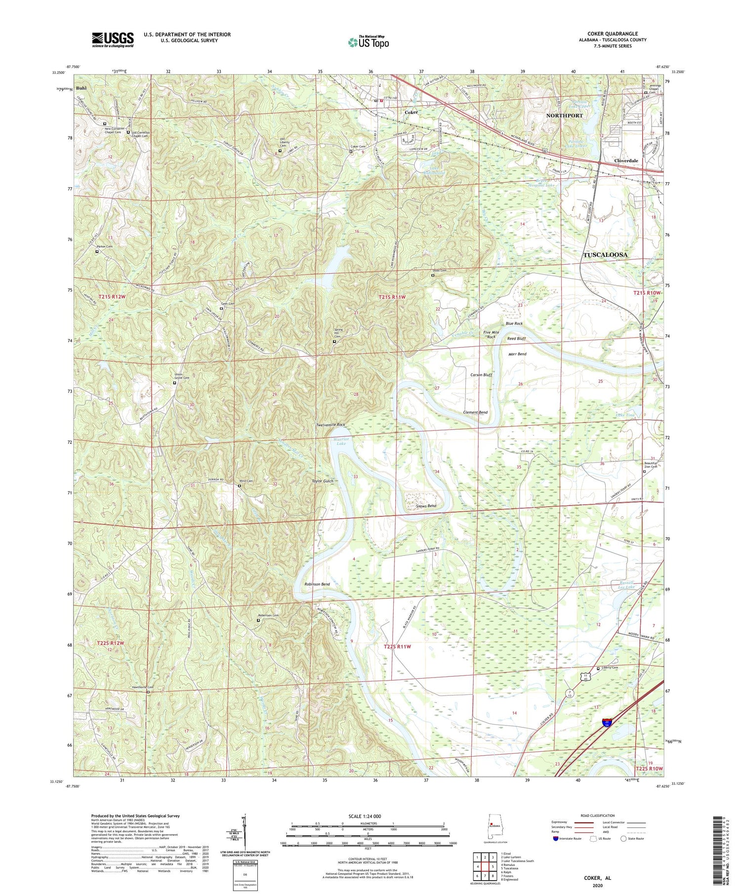
2024 topographic map quadrangle Coker in the state of Alabama. Scale: 1:24000. Based on the newly updated USGS 7.5' US Topo map series, this map is in the following counties: Tuscaloosa. The map contains contour data, water features, and other items you are used to seeing on USGS maps, but also has updated roads and other features. This is the next generation of topographic maps. Printed on high-quality waterproof paper with UV fade-resistant inks.
Quads adjacent to this one:
West: Romulus
Northwest: Elrod
North: Lake Lurleen
Northeast: Lake Tuscaloosa South
East: Tuscaloosa
Southeast: Englewood
South: Fosters
Southwest: Ralph
This map covers the same area as the classic USGS quad with code o33087b6.
Contains the following named places: Barringers Mill, Beautiful Zion African Methodist Episcopal Zion Church, Beautiful Zion Cemetery, Berkshire Estates, Big Bend School, Big Creek, Blue Rock, Bobo Farms, Booth Estates, Bozeman Landing, Bryce Hospital Dam, Bryce Hospital Lake, Butterfield Catfish Farm, Carson Bluff, Carsons Bluff Landing, Clement Bend, Cloverdale, Coker, Coker Baptist Church, Coker Cemetery, Coker Church of God, Coker Cumberland Presbyterian Church, Coker Division, Coker Heights, Coker Post Office, Coker Southern Baptist Church, Coker Station, Coker United Methodist Church, Coker Volunteer Fire Department, Concord Church, Cornelius Chapel, Deerfield, Dodd Cemetery, Evergreen Farms, Fellowship Baptist Church, Five Mile Rock, Forest Green, Forest Green Park, Geer Cemetery, Goose Pond, Harper School, Harperwood, Hawthorne Cemetery, Jay Creek, Jaycee Partlow Dam Number One, Jaycee Partlow Dam Number Two, Jennings Chapel Cemetery, Jennings Chapel United Methodist Church, Lake Robinwood, Lake Tina, Lake Tina Dam, Lake Warner, Liberty Baptist Church, Liberty Cemetery, Liberty School, Little Branch, Lower Ophelia Landing, Lurleen Estates, Marr Bend, Mildred Warner Dam, Moody Slough, New Cornelius Chapel Cemetery, New Prospect Baptist Church, Nubbin Creek, Old Cornelius Chapel Cemetery, Old Liberty Cemetery, Parker Cemetery, Partlow Lake Lower, Partlow Lake Upper, Pembroke Farms, Pine Circle, Pinehaven Church, Potatoe Creek, Pumphreys Mill, Reed Bluff, Robertson Cemetery, Robinson Bend, Romulus Acres, Romulus School, Russell Lee Lake, Russell Lee Lake Dam, Sanders Ferry, Sanders Ferry Landing, Sanders Mill Creek, Skelton Number 1 Dam, Slaughter Creek, Snows Bend, Spring Hill Cemetery, Spring Hill Church, Spring Hill School, State Colony for Negroes, Tater Hill Creek, Taylor Gulch, Town of Coker, Tuscaloosa County Industrial Park, Twelvemile Rock, Union Grove Baptist Church, Union Grove Cemetery, Union Grove School, Upper Ophelia Landing, Valliwood, Venable Creek, Wensa Place, Western Plains, Westervelt Fire Tower, Westland, Westwood Elementary School, Winn Cemetery


