
MyTopo
Lake Lurleen Alabama US Topo Map
Couldn't load pickup availability
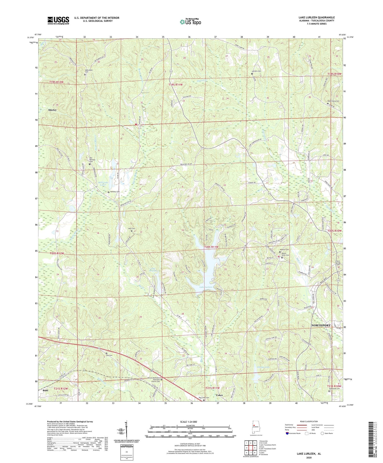
2024 topographic map quadrangle Lake Lurleen in the state of Alabama. Scale: 1:24000. Based on the newly updated USGS 7.5' US Topo map series, this map is in the following counties: Tuscaloosa. The map contains contour data, water features, and other items you are used to seeing on USGS maps, but also has updated roads and other features. This is the next generation of topographic maps. Printed on high-quality waterproof paper with UV fade-resistant inks.
Quads adjacent to this one:
West: Elrod
Northwest: Brownville
North: Gin Creek
Northeast: Lake Tuscaloosa North
East: Lake Tuscaloosa South
Southeast: Tuscaloosa
South: Coker
Southwest: Romulus
This map covers the same area as the classic USGS quad with code o33087c6.
Contains the following named places: African Methodist Episcopal Church, African Methodist Episcopal Church Cemetery, Bel Air Estates, Bethabara School, Bethany, Bethany Baptist Church, Bethany Cemetery, Bethany School, Big Creek Cemetery, Bone Camp Cemetery, Bone Camp Church, Calvery School, Chapelwood, Cloverdale Estates, Elledge Lake, Elledge Lake Dam, Fellowship Church, Flatwoods Baptist Church, Flatwoods Cemetery, Gem, Guy Cemetery, Hendrix Cemetery, Highview, Hughes Mill, Hughes Mill Creek, Lake Anedna Dam, Lake Arnedra, Lake Lurleen, Lake Lurleen Dam, Lake Lurleen State Park, Mills Lake Dam Lower, Mills Lake Lower, Montgomery Volunteer Fire Department Station 2, Mount Olive, Mount Olive Baptist Church, Mount Olive Cemetery, Mount Olive Community Club, Mount Olive Fire Protection District, Mount Olive School, Northport Division, Old Bethany Cemetery, Pool Cemetery, Prices Store, Sand Springs Cemetery, Sand Springs Church, Saratoga Estates, Shirley, Tabernacle Church, Thorndale, Watkins Cemetery, Western Hills, Western Hills Estates, Westhill, ZIP Code: 35452


