
MyTopo
Eastaboga Alabama US Topo Map
Couldn't load pickup availability
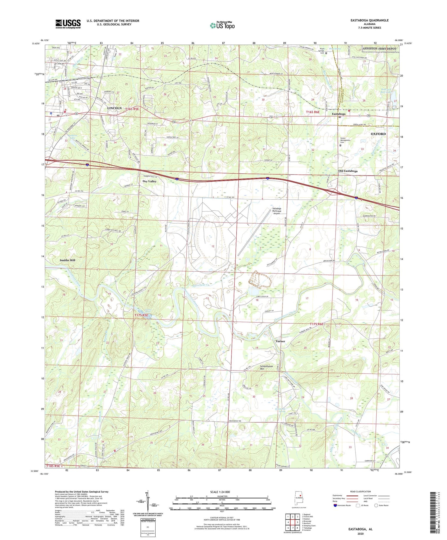
2024 topographic map quadrangle Eastaboga in the state of Alabama. Scale: 1:24000. Based on the newly updated USGS 7.5' US Topo map series, this map is in the following counties: Talladega, Calhoun. The map contains contour data, water features, and other items you are used to seeing on USGS maps, but also has updated roads and other features. This is the next generation of topographic maps. Printed on high-quality waterproof paper with UV fade-resistant inks.
Quads adjacent to this one:
West: Riverside
Northwest: Ragland
North: Francis Mill
Northeast: Eulaton
East: Munford
Southeast: Ironaton
South: Talladega
Southwest: Sleeping Giant
This map covers the same area as the classic USGS quad with code o33086e1.
Contains the following named places: Abercrombies Mill, Alabama International Motorsports Hall of Fame Museum, Alabama Short Track Raceway, Anniston Air Force Base, Ben Lomond Plantation, Carver School, Cheaha Creek, City of Lincoln, Conchardee, Craig Memorial United Methodist Church, Cunninghams Ford, Drunkards Spring, Dry Valley, Dry Valley Church, East Providence Fire Department, Eastaboga, Eastaboga Baptist Church, Eastaboga Creek, Eastaboga Post Office, Eastaboga School, Eastaboga Volunteer Fire Department Station 1, Echo Hills, Finley African Methodist Episcopal Chapel, Franksdale Farm, Groce-Montgomery Cemetery, Hollingworths School, Indian Hill Farm, International Speedway, Jackson Shoals, Jemisons Mill, Kelly Creek, Kiddstreet Church, Lake Whitwood, Lincoln, Lincoln Baptist Church, Lincoln Division, Lincoln Fire and Rescue Department Station 1, Lincoln High School, Lincoln Police Department, Lincoln Post Office, Lincoln United Methodist Church, Little Jerusalem Church of God, Miracle Prayer House Church, Oak Grove Baptist Church, Old Eastaboga, Pine Grove Church, Plum Spring, Plum Springs, Plum Springs Academy, Plum Springs Baptist Church Cemetery Number 1, Plum Springs Branch, Plum Springs Church, Providence, Providence Baptist Church, Red Hill Plantation, Rod and Reel Dam, Rod and Reel Lake, Saint Marys Baptist Church, Salem Baptist Church, Salem School, Schoolhouse Mountain, Shelton Lake Shores, Smiths Mill, Stoney Branch, Sunlight Baptist Church, Sunnyside Plantation, Sunnyside Post Office, Talladega Area Vocational School, Talladega County Elementary School, Talladega Industrial Park, Talladega Municipal Airport, Tasqui, The Brick Store, Turner, Turners Mill, Union Springs Freewill Baptist Church, Watkins Dam, Watkins Lake, Willow Glen Plantation, Yatesville, ZIP Code: 35096


