MyTopo
Francis Mill Alabama US Topo Map
Couldn't load pickup availability
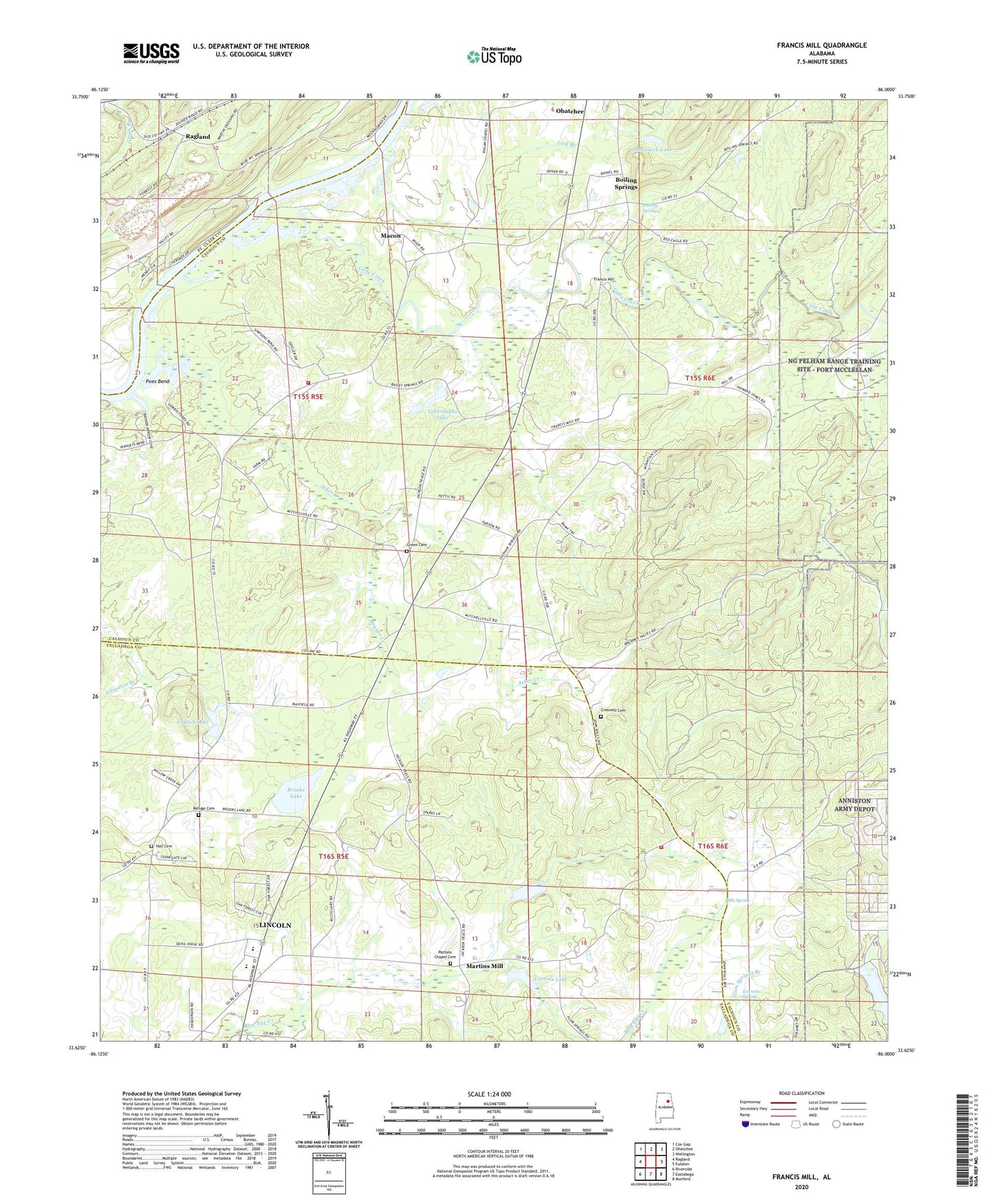
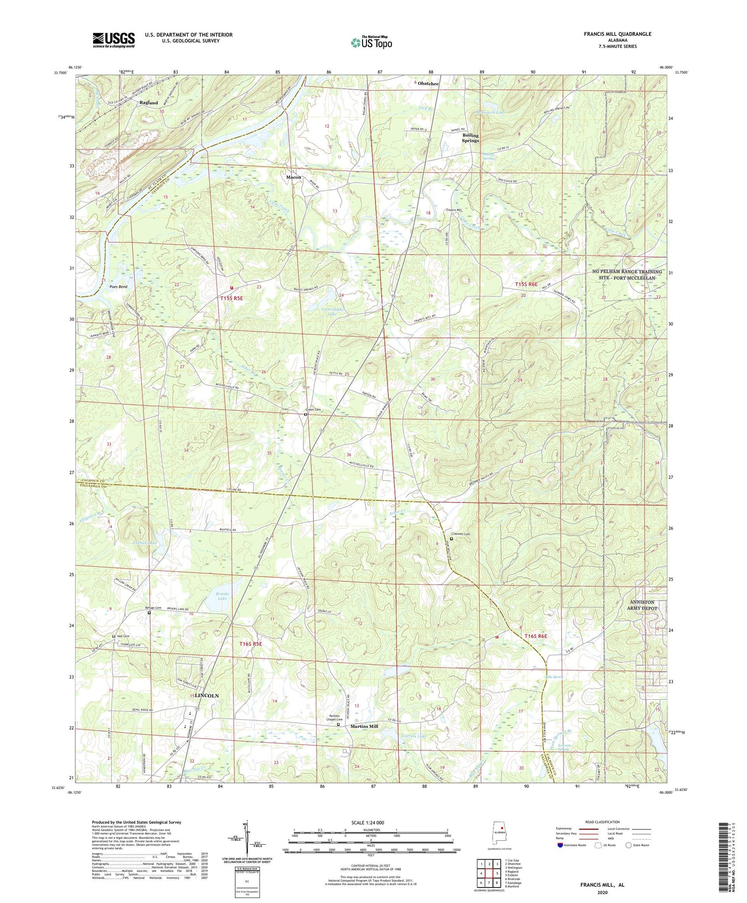
2024 topographic map quadrangle Francis Mill in the state of Alabama. Scale: 1:24000. Based on the newly updated USGS 7.5' US Topo map series, this map is in the following counties: Calhoun, Talladega, St. Clair. The map contains contour data, water features, and other items you are used to seeing on USGS maps, but also has updated roads and other features. This is the next generation of topographic maps. Printed on high-quality waterproof paper with UV fade-resistant inks.
Quads adjacent to this one:
West: Ragland
Northwest: Cox Gap
North: Ohatchee
Northeast: Wellington
East: Eulaton
Southeast: Munford
South: Eastaboga
Southwest: Riverside
This map covers the same area as the classic USGS quad with code o33086f1.
Contains the following named places: Acker Creek, Alligator Branch, Bailey Springs Church, Bailey Springs School, Blue Eye, Blue Eye Creek Watershed Dam Number 1, Blue Eye Creek Watershed Dam Number 2, Blue Eye Post Office, Boiling Springs, Boiling Springs Missionary Baptist Church, Boozer, Boozer Post Office, Brooks Dam, Brooks Lake, Bruner, Bruner Creek, Cane Creek, Cane Creek Covered Bridge, Cane Creek Post Office, Carrols Lake, Catfish Lake, Cone Reservoir, Creswell Cemetery, Dills Spring, Eastaboga Volunteer Fire Department Station 2, Everetts Spring, Faith Assembly Lighthouse Church, Fombys Ferry, Francis Mill, Green Cemetery, Hall Cemetery, Jones Blue Eye Lake, Lick Branch, Macon, Macon Post Office, Macon Quarter Church, Martins Mill, McGouirk Dam, McGouirk Lake, Minden, Minden Post Office, Mitchellville, Mount Olive, Mount Olive Baptist Church, Mount Olive Volunteer Fire Department, Ohatchee Farms, Old Sulphur Springs School, Patton Chapel Baptist Church, Patton Chapel Community Cemetery, Poes Bend, Refuge, Refuge Baptist Church, Refuge Cemetery, Refuge Post Office, Steed Dam, Steeds Lake, Stillhouse Branch, Sulfur Springs Church, Sulphur Springs, Union Grove Cumberland Methodist Church, Womack, Womack Post Office, Yarbrough Dam, Yarbroughs Lake