MyTopo
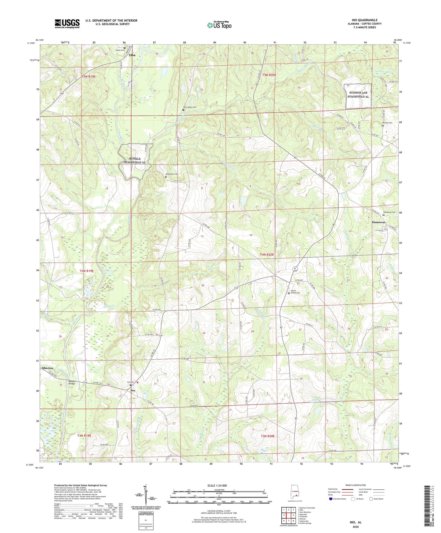
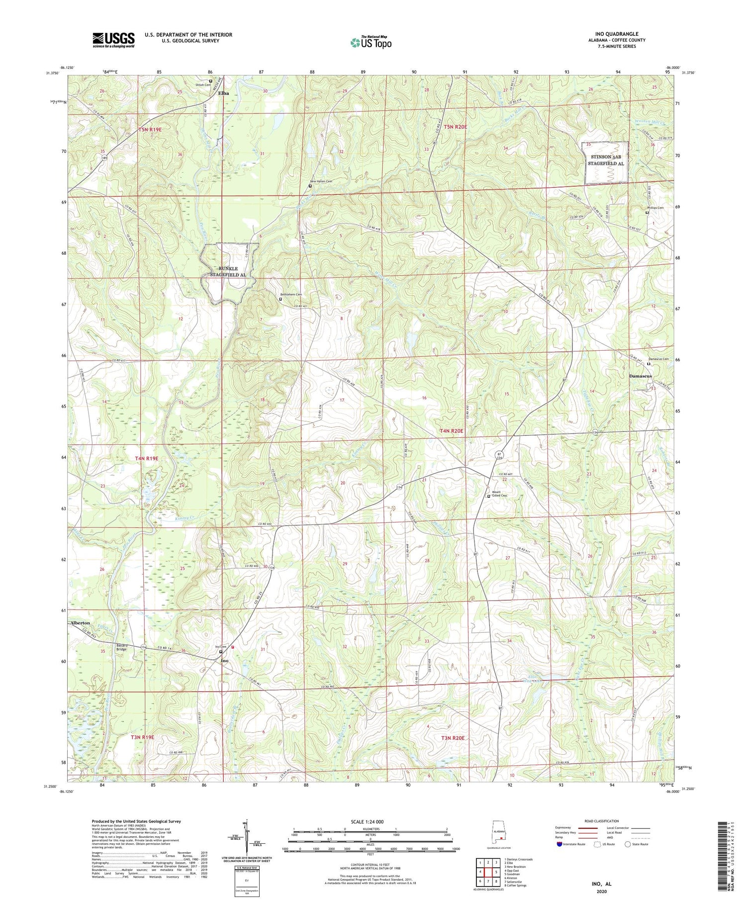
Ino Alabama US Topo Map
Couldn't load pickup availability
2024 topographic map quadrangle Ino in the state of Alabama. Scale: 1:24000. Based on the newly updated USGS 7.5' US Topo map series, this map is in the following counties: Coffee. The map contains contour data, water features, and other items you are used to seeing on USGS maps, but also has updated roads and other features. This is the next generation of topographic maps. Printed on high-quality waterproof paper with UV fade-resistant inks.
Quads adjacent to this one:
West: Opp East
Northwest: Danleys Crossroads
North: Elba
Northeast: New Brockton
East: Goodman
Southeast: Coffee Springs
South: Sellersville
Southwest: Kinston
This map covers the same area as the classic USGS quad with code o31086c1.
Contains the following named places: Ballard Bridge, Basin Baptist Church, Beaver Pond, Bethlehem Cemetery, Bethlehem Primitive Baptist Church, Bills Branch, Bradshaw Church, Bradshaw School, Buck Branch, Bucks Mill Creek, Damascus, Damascus Baptist Church, Damascus Cemetery, Damascus Lookout Tower, Elba Dam, Elba Reservoir, Ellis Wise Dam, Ellis Wise Lake, Fox Branch, Goodman Division, Hays Creek, Helms Mill Creek, Herron Church, Ino, Ino Baptist Church, Ino Cemetery, Ino Church, Ino Volunteer Fire Department, Kimmy Creek, Liberty Church, MaChis Lower Creek State Designated Tribal Statistical Area, Morrows Mill, Mount Gilead Baptist Church, Mount Gilled Cemetery, New Haven Baptist Church, New Haven Cemetery, Pages Creek, Phillips Cemetery, Rattle Branch, Sand Hill School, Shiloh Baptist Church, Shiloh Cemetery, Shiloh Lake, Windham Poultry Farm, Wises Mill, Wises Mill Creek, Wooten Mill Creek, Yelverton School