MyTopo
Florala Alabama US Topo Map
Couldn't load pickup availability
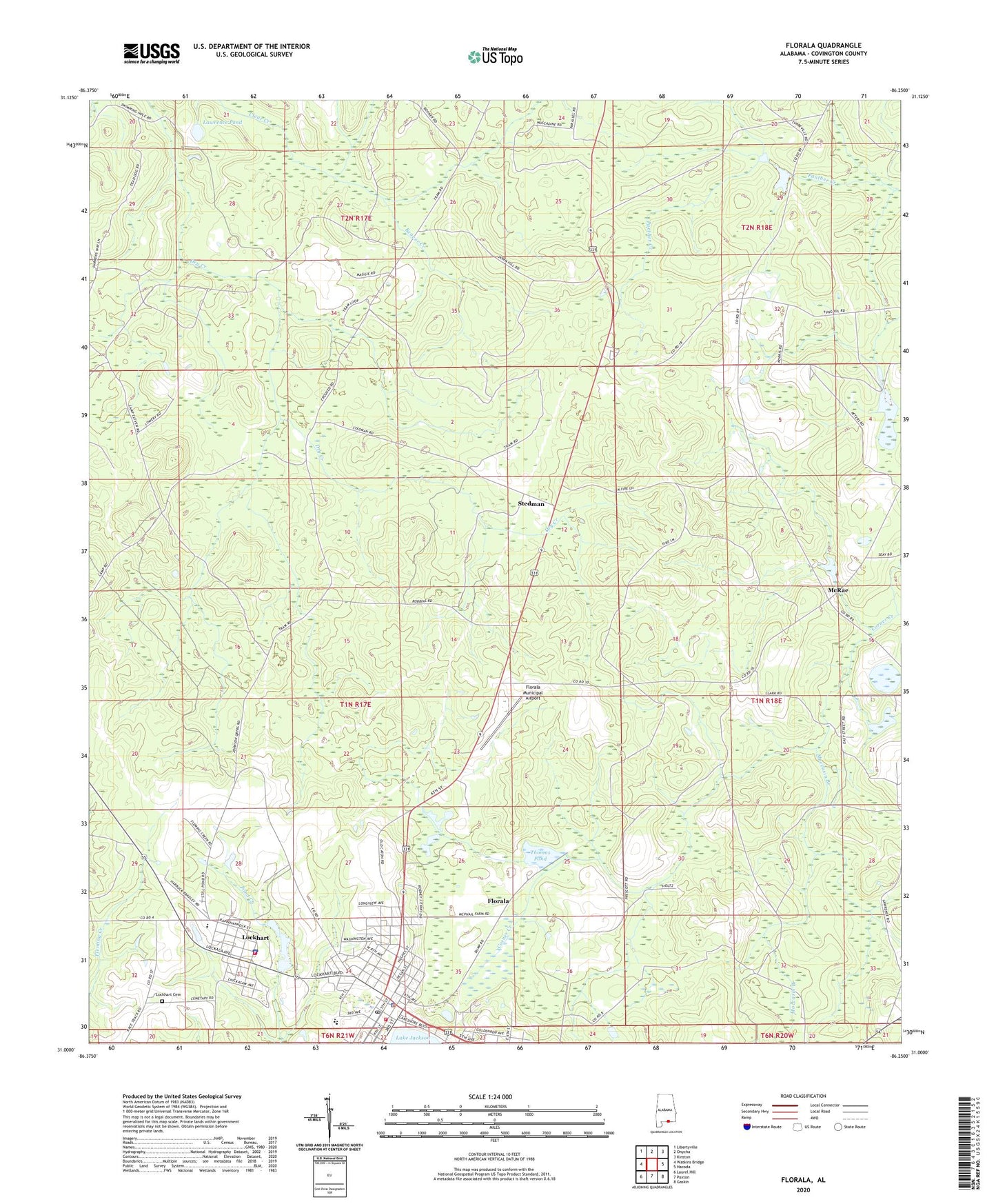
2024 topographic map quadrangle Florala in the state of Alabama. Scale: 1:24000. Based on the newly updated USGS 7.5' US Topo map series, this map is in the following counties: Covington. The map contains contour data, water features, and other items you are used to seeing on USGS maps, but also has updated roads and other features. This is the next generation of topographic maps. Printed on high-quality waterproof paper with UV fade-resistant inks.
Quads adjacent to this one:
West: Watkins Bridge
Northwest: Libertyville
North: Onycha
Northeast: Kinston
East: Hacoda
Southeast: Gaskin
South: Paxton
Southwest: Laurel Hill
This map covers the same area as the classic USGS quad with code o31086a3.
Contains the following named places: Beaver Creek, Church of Christ, First African Baptist Church, First Assembly of God Church, First Baptist Church, First Methodist Church, First Presbyterian Church, First Universalist Church, Florala, Florala Division, Florala Elementary School, Florala High School, Florala Industrial Park, Florala Memorial Hospital, Florala Memorial Public Library, Florala Municipal Airport, Florala Police Department, Florala Post Office, Florala Rescue Squad, Florala Volunteer Fire Department, Gateway Baptist Church, George Washington Carver Junior High School, Grace Baptist Church, Grace Christian Academy, Hidden Acres Mobile Home Park, Johnsons Quarters, Lakeview Hospital, Lawrence Pond, Lockhart, Lockhart Cemetery, Lockhart Florala Wastewater Treatment Plant, Lockhart Police Department, Lockhart Post Office, Lockhart Volunteer Fire Department, McRae, Moccasin Branch, New Bethel African Methodist Episcopal Church, Saint Johns Baptist Church, Stedman, Thomas Pond, Town of Florala, Town of Lockhart, W S Harlan Junior High School, Wade Martin Lake Dam, Westside Baptist Church, WKWL-AM (Florala), ZIP Codes: 36442, 36455