MyTopo
Paxton Florida US Topo Map
Couldn't load pickup availability
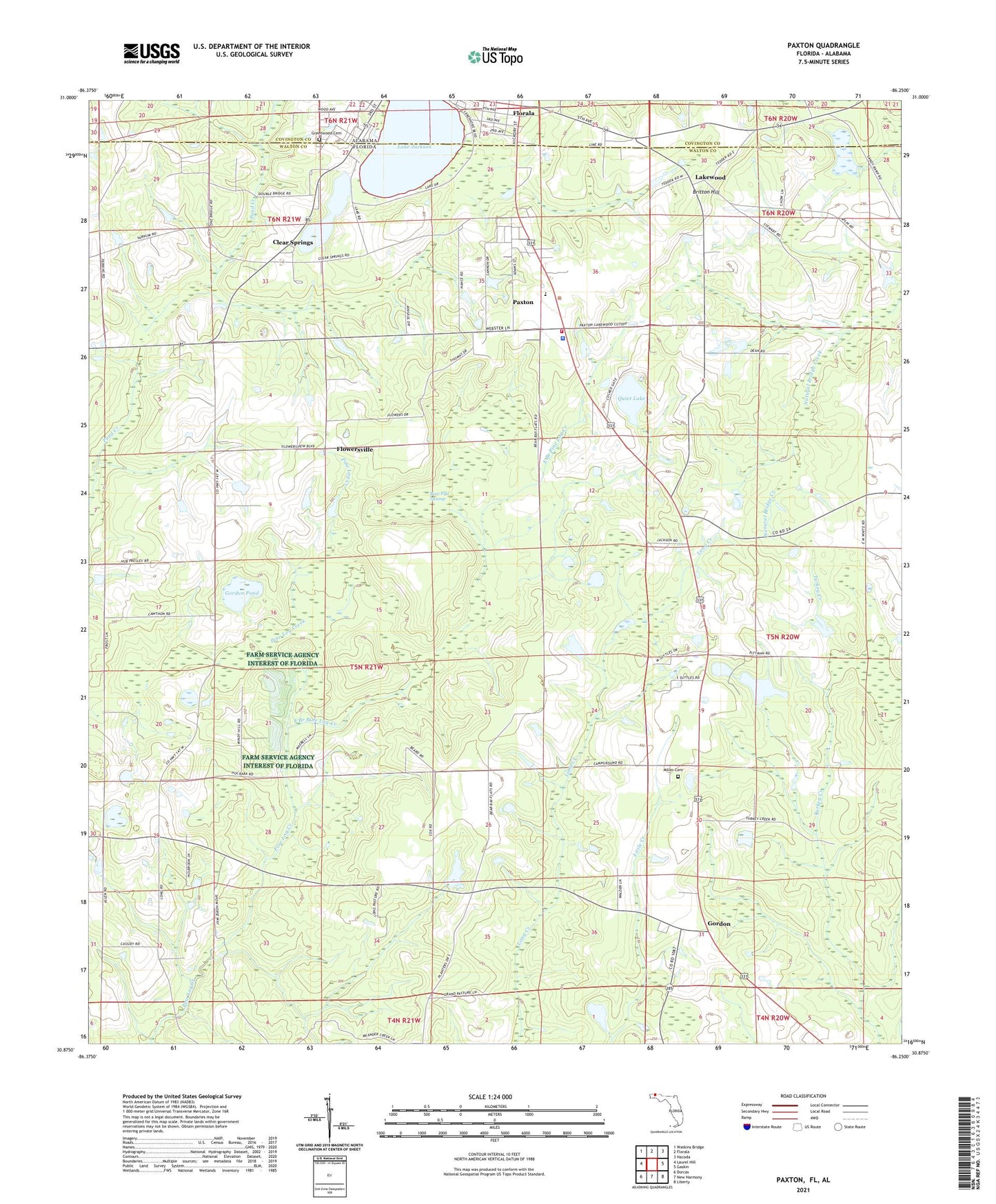
2024 topographic map quadrangle Paxton in the states of Florida, Alabama. Scale: 1:24000. Based on the newly updated USGS 7.5' US Topo map series, this map is in the following counties: Walton, Covington. The map contains contour data, water features, and other items you are used to seeing on USGS maps, but also has updated roads and other features. This is the next generation of topographic maps. Printed on high-quality waterproof paper with UV fade-resistant inks.
Quads adjacent to this one:
West: Laurel Hill
Northwest: Watkins Bridge
North: Florala
Northeast: Hacoda
East: Gaskin
Southeast: Liberty
South: New Harmony
Southwest: Dorcas
This map covers the same area as the classic USGS quad with code o30086h3.
Contains the following named places: Bear Flat Swamp, Britton Hill, Clear Springs, East Branch Pine Log Creek, Ellis Agricultural Field Airport, First Lutheran Church, Fleming Creek, Florala State Park, Flowersville, Gordon, Gordon Pond, Greenwood Cemetery, J M Wise Pond, Lake Jackson, Lakewood, Lakewood Post Office, Miller Cemetery, Mount Pleasant Church, Paxton, Paxton High School, Paxton Post Office, Pleasant Grove, Prospect Church, Quiet Lake, Saint Marks Church, Town of Paxton, Walton County Fire Rescue Station 1 - Paxton Fire Station, Walton County Sheriff's Office Paxton Substation