
MyTopo
Kinston Alabama US Topo Map
Couldn't load pickup availability
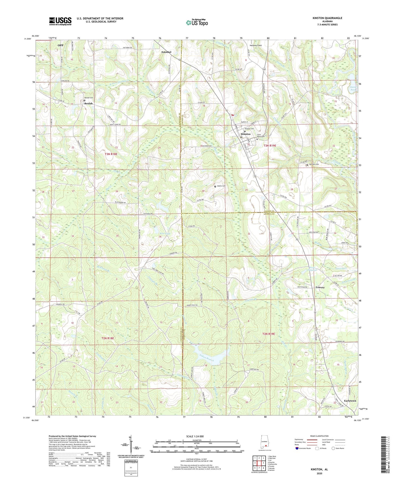
2024 topographic map quadrangle Kinston in the state of Alabama. Scale: 1:24000. Based on the newly updated USGS 7.5' US Topo map series, this map is in the following counties: Covington, Geneva, Coffee. The map contains contour data, water features, and other items you are used to seeing on USGS maps, but also has updated roads and other features. This is the next generation of topographic maps. Printed on high-quality waterproof paper with UV fade-resistant inks.
Quads adjacent to this one:
West: Onycha
Northwest: Opp West
North: Opp East
Northeast: Ino
East: Sellersville
Southeast: Samson
South: Hacoda
Southwest: Florala
This map covers the same area as the classic USGS quad with code o31086b2.
Contains the following named places: Adams Cemetery, Bethel Church, Beulah, Beulah Cemetery, Beulah Church, Bula School, Caney Branch, Cowhead Creek, Cripple Creek, Dry Creek, Earlytown, Earlytown Church, Estothel, Geneva State Forest, Harold Wise Dam, Harrison Cemetery, Harrison Church, Hataway Field, Hollys Ferry, Kinston, Kinston Cemetery, Kinston First Baptist Church, Kinston High School, Kinston Police Department, Kinston Post Office, Kinston Volunteer Fire Department, Lowery, McKinney Branch, Pilgrims Rest Baptist Church, Pine Level Church, Pink, Saint Pauls Cemetery, Shotbag Creek, South Alabama Motor Speedway, Stump Pond, Town of Kinston, Triangle Branch, Weeks Fishpond, Welcome Springs School, West Fork Shotbag Creek, Wise Pond, ZIP Code: 36453


