MyTopo
Hacoda Alabama US Topo Map
Couldn't load pickup availability
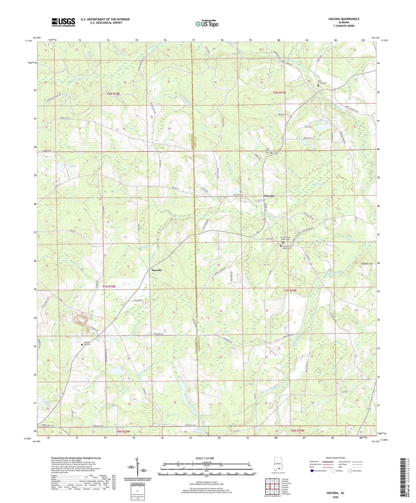
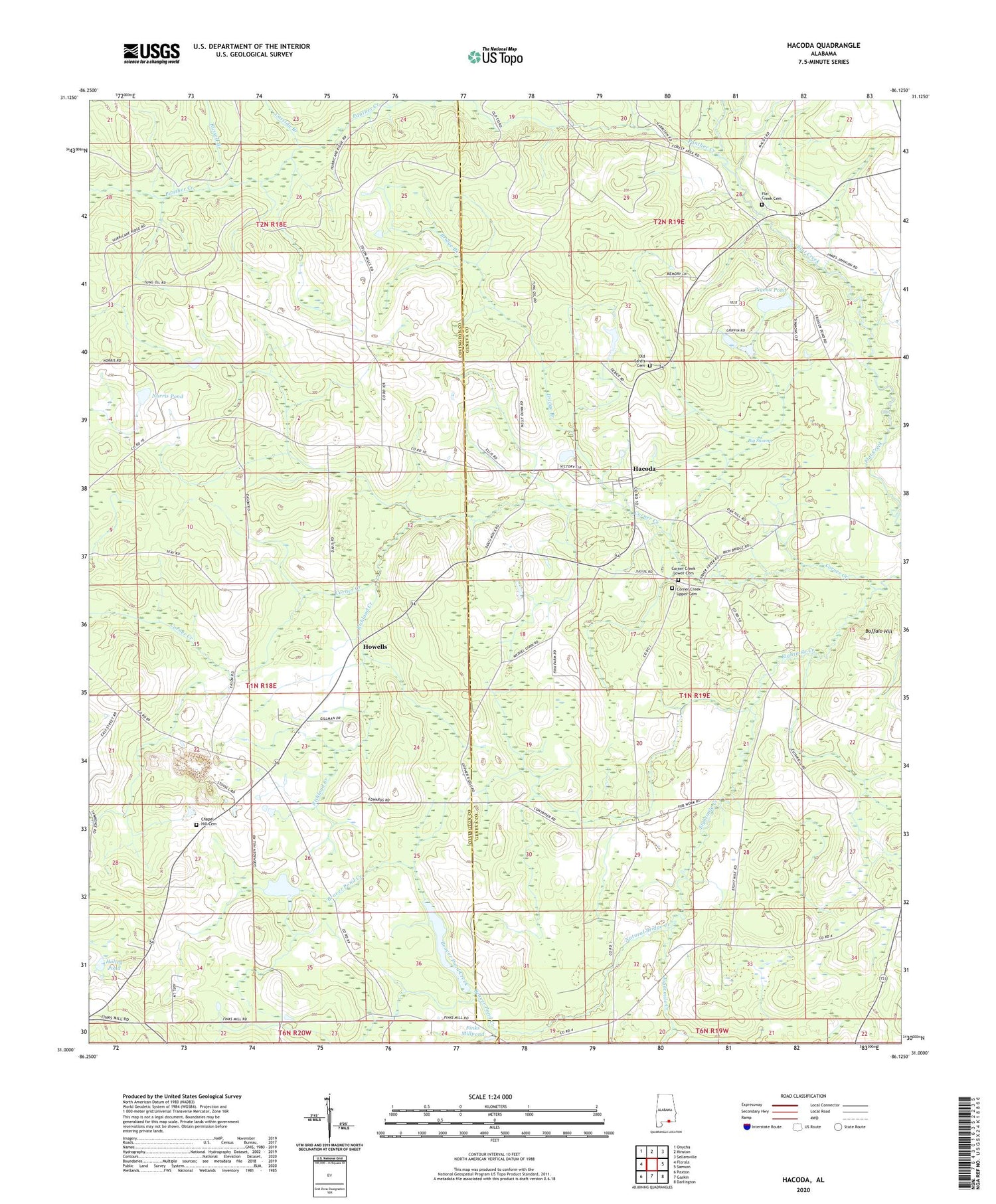
2024 topographic map quadrangle Hacoda in the state of Alabama. Scale: 1:24000. Based on the newly updated USGS 7.5' US Topo map series, this map is in the following counties: Covington, Geneva. The map contains contour data, water features, and other items you are used to seeing on USGS maps, but also has updated roads and other features. This is the next generation of topographic maps. Printed on high-quality waterproof paper with UV fade-resistant inks.
Quads adjacent to this one:
West: Florala
Northwest: Onycha
North: Kinston
Northeast: Sellersville
East: Samson
Southeast: Darlington
South: Gaskin
Southwest: Paxton
This map covers the same area as the classic USGS quad with code o31086a2.
Contains the following named places: Adams Pond, Argus Post Office, Beaver Pond Creek, Big Swamp, Breeds Creek, Bridge Branch, Buffalo Hill, Camp Victory, Cassidy Branch, Chapel Hill, Chapel Hill Cemetery, Chapel Hill Missionary Baptist Church, Corner Creek, Corner Creek Lower Cemetery, Corner Creek Methodist Church, Corner Creek Upper Cemetery, Davis School, Elitha Grove Church, Finks Millpond, Flat Creek Cemetery, Flat Creek Church, Hacoda, Hacoda Union Church, Holley Pond, Howells, Indian Branch, Jones School, Meadowbrook, Natural Bridge Creek, Norris Pond, Old Sardis Cemetery, Panther Creek, Pigeon Pond, Richland Creek, Russell Branch, Smyrna Baptist Church