MyTopo
Fort Dale Alabama US Topo Map
Couldn't load pickup availability
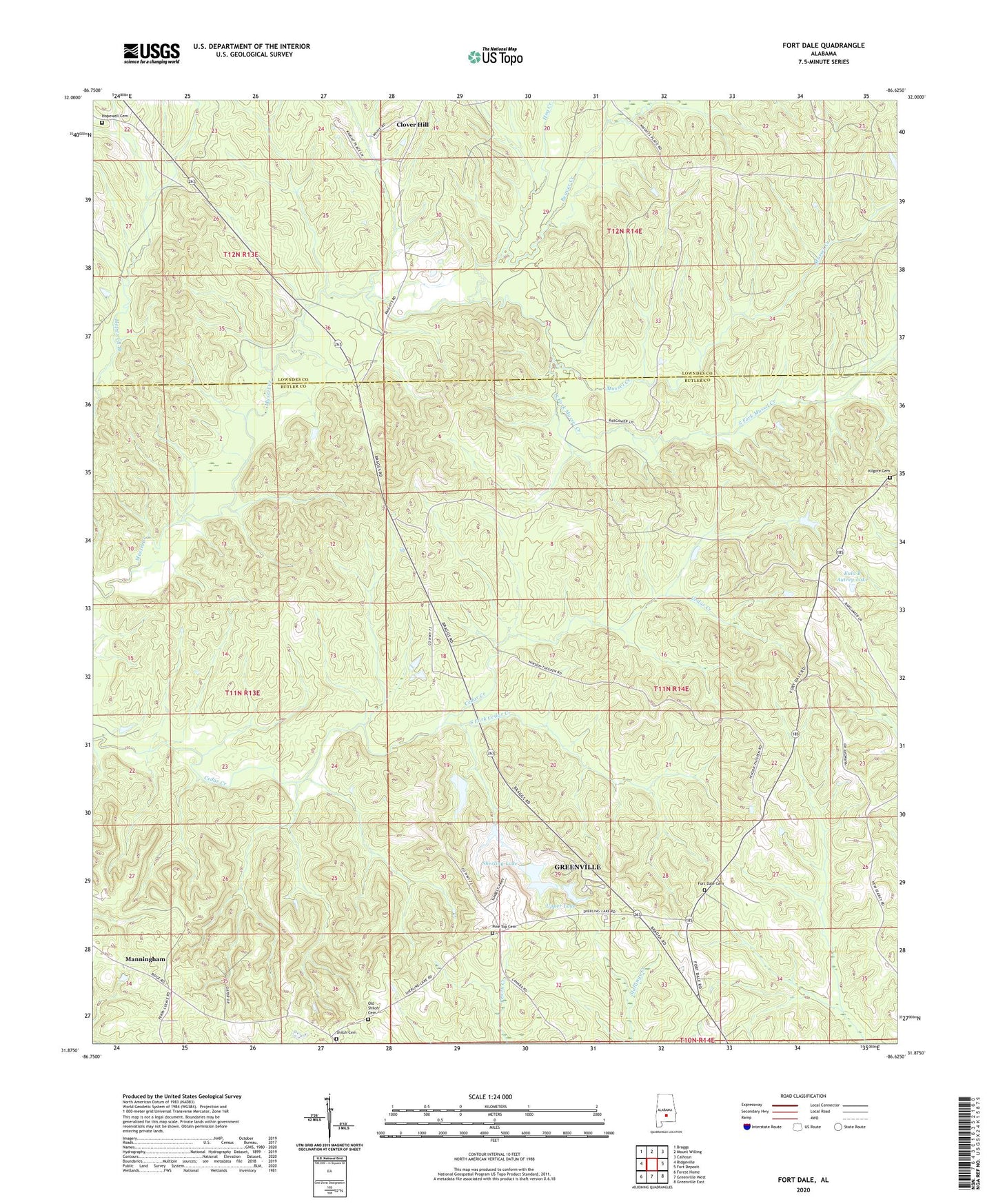
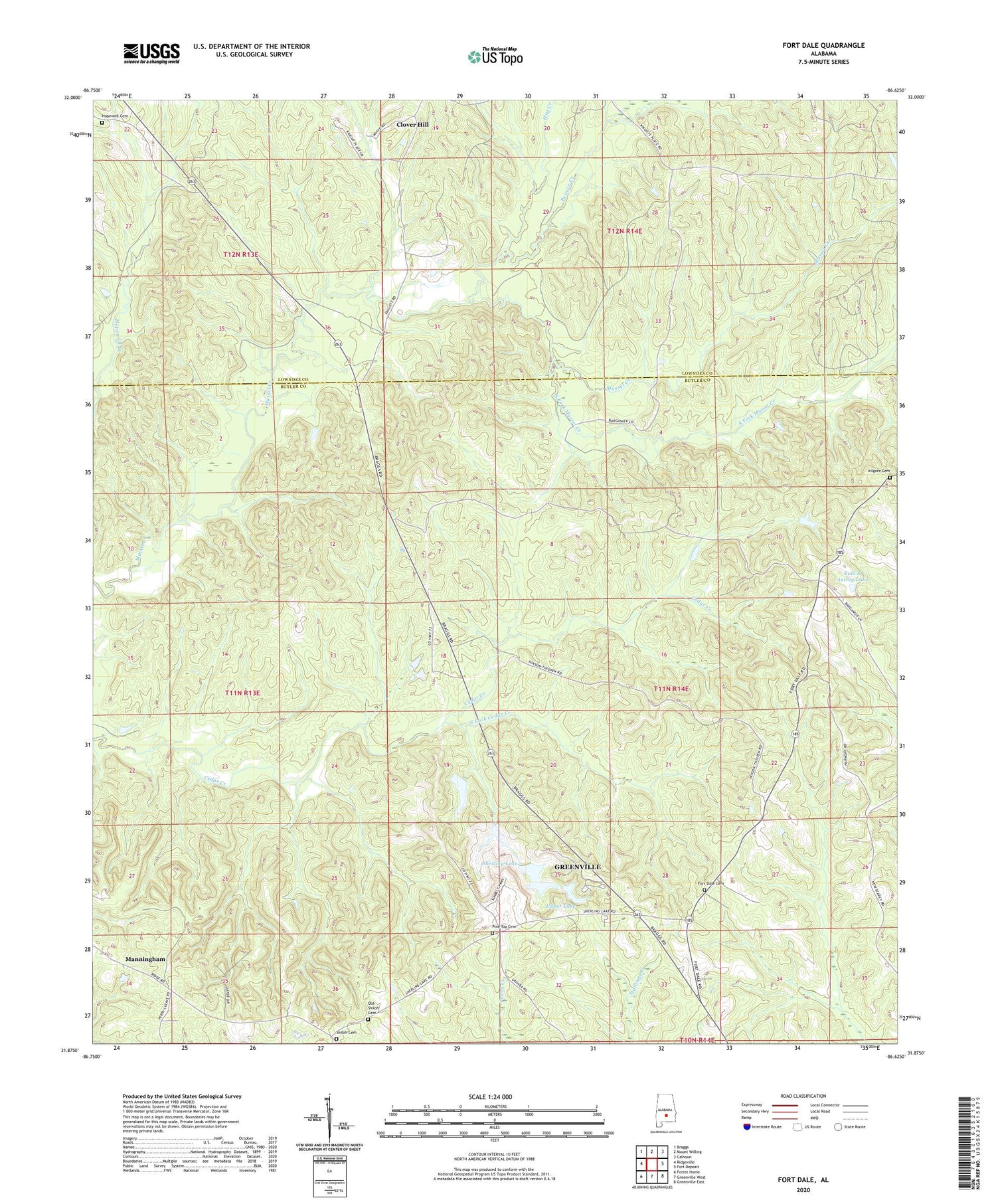
2024 topographic map quadrangle Fort Dale in the state of Alabama. Scale: 1:24000. Based on the newly updated USGS 7.5' US Topo map series, this map is in the following counties: Butler, Lowndes. The map contains contour data, water features, and other items you are used to seeing on USGS maps, but also has updated roads and other features. This is the next generation of topographic maps. Printed on high-quality waterproof paper with UV fade-resistant inks.
Quads adjacent to this one:
West: Ridgeville
Northwest: Braggs
North: Mount Willing
Northeast: Calhoun
East: Fort Deposit
Southeast: Greenville East
South: Greenville West
Southwest: Forest Home
This map covers the same area as the classic USGS quad with code o31086h6.
Contains the following named places: Antioch Church, Barganier Lookout Tower, Beaver Creek, Butler County Number 1 Dam, Clover Hill, Clover Hill Church, Damascus Church, Damascus School, Eula B Autrey Lake, Eula B Autrey Lake Dam, Fort Dale, Fort Dale Cemetery, Grove Hill Church, Hog Creek, Hopewell Branch, Hopewell Cemetery, Kilgore Cemetery, Lower Lake, Manningham, Mussel, Oak Grove Church, Old Shiloh Cemetery, Pine Top Cemetery, Pine Top Church, Poplar Spring School, Poplar Springs Church, Sherling Lake, Sherling Lake Number 1 Dam, Shiloh Cemetery, Shiloh Primitive Baptist Church, South Fork Cedar Creek, South Fork Mussel Creek, Thigpens Pond, Upper Lake