
MyTopo
Greenville East Alabama US Topo Map
Couldn't load pickup availability
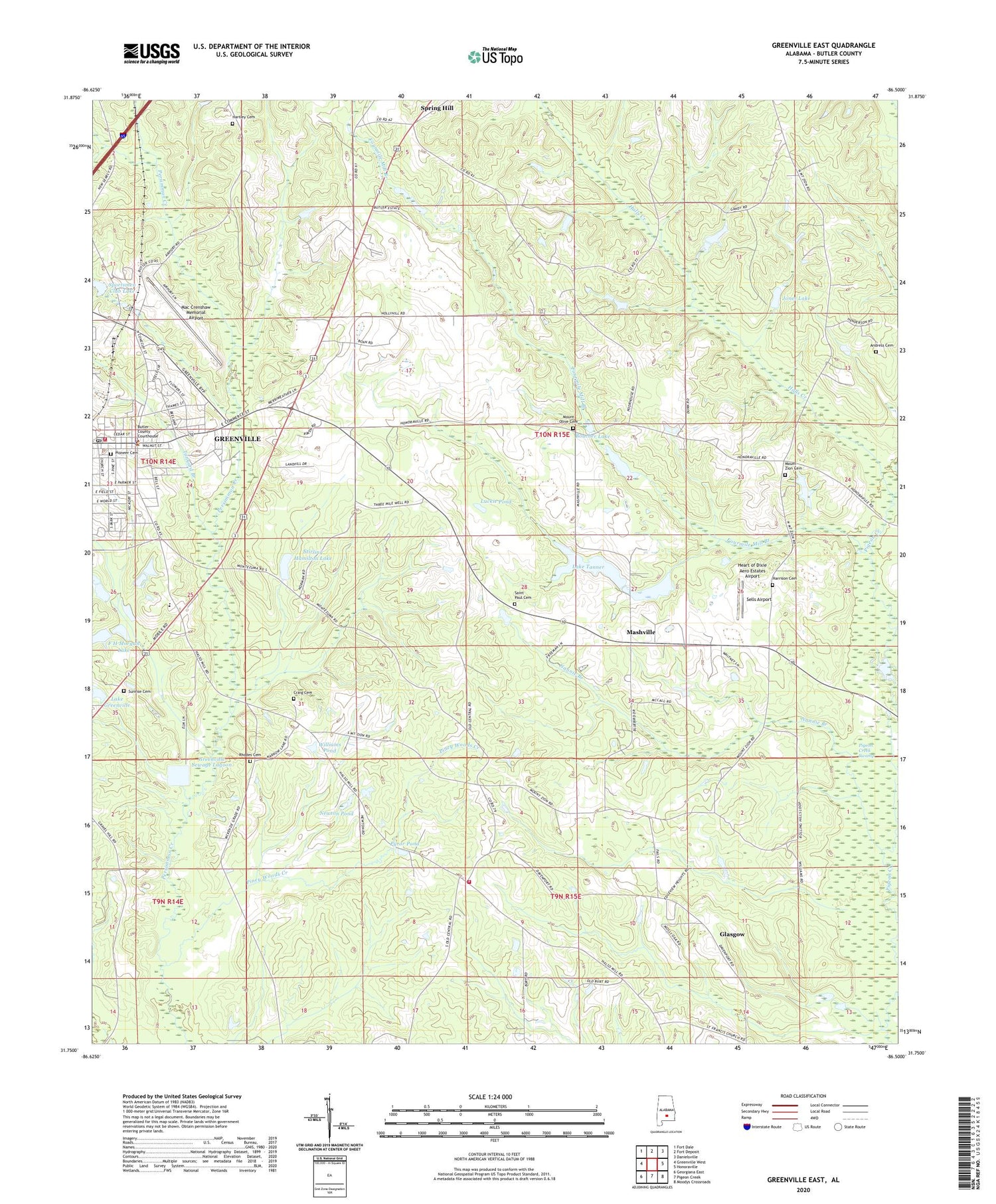
2024 topographic map quadrangle Greenville East in the state of Alabama. Scale: 1:24000. Based on the newly updated USGS 7.5' US Topo map series, this map is in the following counties: Butler. The map contains contour data, water features, and other items you are used to seeing on USGS maps, but also has updated roads and other features. This is the next generation of topographic maps. Printed on high-quality waterproof paper with UV fade-resistant inks.
Quads adjacent to this one:
West: Greenville West
Northwest: Fort Dale
North: Fort Deposit
Northeast: Danielsville
East: Honoraville
Southeast: Moodys Crossroads
South: Pigeon Creek
Southwest: Georgiana East
This map covers the same area as the classic USGS quad with code o31086g5.
Contains the following named places: Andress Cemetery, Beeland Park, Boucher Lake, Brushey / Mashey Creek Volunteer Fire Department, Butler Chapel African Methodist Episcopal Zion Church, Butler County Courthouse, Butler County Sheriff's Office, Central Church, Central School, Commerce Street Residential Historic District, Confederate Park, Craig Cemetery, Day Memorial Park, East Commerce Street Historic District, East Greenville Baptist Church, Ebenezer East Church, F H Morgan Lake, F H Morgan Lake Dam, First Baptist Church, First Christian Church, First Presbyterian Church, First United Methodist Church, Fourmile Mill Branch, Garfield Street Park, Glasgow, Greenville, Greenville Academy, Greenville Division, Greenville Fire Department Station 1, Greenville Post Office, Greenville Public Library, Greenville Sewage Lagoon, Greenville Sewage Lagoon Dam, Halls Creek, Harrison Cemetery, Hartley Cemetery, Hatchee Branch, Heart of Dixie Aero Estates Airport, Hickory Street Church of Street, Jones Lake, Lake Greenville, Lake Greenville Dam, Lake Tanner, Lake Tanner Dam, Lomax-Hannon Junior College, Luckie Pond, Mac Crenshaw Memorial Airport, Mashville, Mount Olive Cemetery, Mount Olive Methodist Church, Mount Zion Cemetery, Mount Zion Church, Mount Zion Primitive Baptist Church, Mount Zion School, Nannie Branch, New Bethel Christian Church, Newton Pond, Ninemile Branch, Oglesby Church of Christ, Piney Woods Creek, Pioneer Cemetery, Post Office Historic District, Pyror Pond, Rhodes Cemetery, Saint Elizabeths Roman Catholic Church, Saint Francis Church, Saint Paul Cemetery, Saint Paul Methodist Church, Saint Thomas Episcopal Church, Sells Airport, South Greenville Historic District, South Side High School, Sportsmen Club Lake, Sportsmen Club Lake Dam, Spring Hill, Stirling Hamilton Lake, Stirling Hamilton Lake Dam, Sunrise Cemetery, Tanyard Branch, WGYV-AM (Greenville), Williams Pond


