MyTopo
Frisco City Alabama US Topo Map
Couldn't load pickup availability
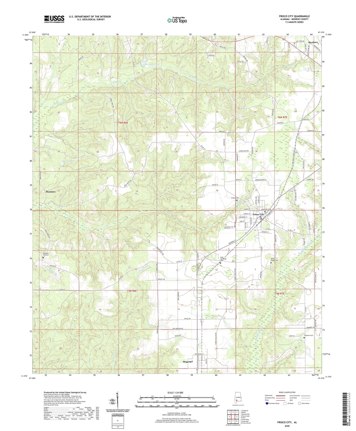
2024 topographic map quadrangle Frisco City in the state of Alabama. Scale: 1:24000. Based on the newly updated USGS 7.5' US Topo map series, this map is in the following counties: Monroe. The map contains contour data, water features, and other items you are used to seeing on USGS maps, but also has updated roads and other features. This is the next generation of topographic maps. Printed on high-quality waterproof paper with UV fade-resistant inks.
Quads adjacent to this one:
West: Flynns Lake
Northwest: Claiborne
North: Mexia
Northeast: Monroeville
East: Excel
Southeast: Frisco City SE
South: Uriah East
Southwest: Uriah West
This map covers the same area as the classic USGS quad with code o31087d4.
Contains the following named places: Baas Memorial Cemetery, Beaumont Church, Bert Boroughs Pond Dam, Boroughs Pond, Bright Morning Star Baptist Church, Coleman Cemetery, Coleman Church, Community Chapel Holiness Church, First Baptist Church, Frisco City, Frisco City Division, Frisco City Oil Field, Frisco City Police Department, Frisco City Post Office, Frisco City United Methodist Church, Frisco City Volunteer Fire Department, Lilly Church, Macedonia Baptist Church, Macedonia Church, Manistee, Megargel, Megargel Assembly of God Church, Megargel Census Designated Place, Mexia Church, Moores Pond, Mount Pisgah Cemetery, Mount Pisgah Primitive Baptist Church, Negro Pond, New Chapel Baptist Church, Oak Grove Baptist Church, Pleasant Hill Baptist Church, Pleasant Hill Cemetery, Provo School, Shiloh Cemetery, Shiloh Primitive Baptist Church, Snider, Town of Frisco City, ZIP Code: 36445