MyTopo
Claiborne Alabama US Topo Map
Couldn't load pickup availability
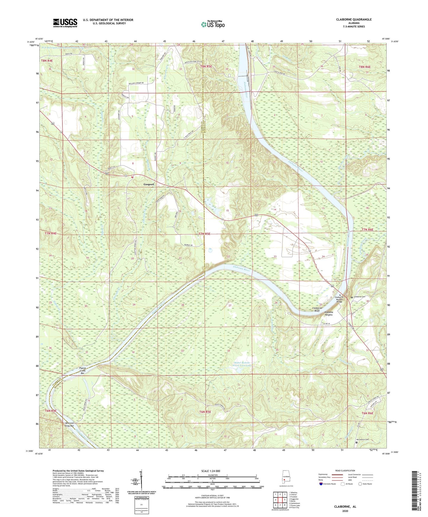
2024 topographic map quadrangle Claiborne in the state of Alabama. Scale: 1:24000. Based on the newly updated USGS 7.5' US Topo map series, this map is in the following counties: Monroe, Clarke. The map contains contour data, water features, and other items you are used to seeing on USGS maps, but also has updated roads and other features. This is the next generation of topographic maps. Printed on high-quality waterproof paper with UV fade-resistant inks.
Quads adjacent to this one:
West: Suggsville
Northwest: Whatley
North: Chance
Northeast: Franklin
East: Mexia
Southeast: Frisco City
South: Flynns Lake
Southwest: Gainestown
This map covers the same area as the classic USGS quad with code o31087e5.
Contains the following named places: Alabama Heights, Barefield Landing, Bedsole Farm Airport, Big Flat Creek, Brewers Store, Campbells Mills, Cedar Creek, Cedar Creek Landing, Choctaw Creek, Claiborne, Claiborne Bluff, Claiborne Cemetery, Claiborne Ferry, Claiborne Lake, Claiborne Landing, Claiborne Lock and Dam, Claiborne State Dock, Claiborne-Murphy Bridge, Galliard Creek, Gibbons Landing, Gosport, Gosport Landing, Harris Landing, House of Prayer, Lamberts Gin, Lees Landing, Lees Store, Limestone Creek, Limestone Landing, Lisbon Landing, Little Mill Creek, Little Rock Baptist Church, Mabel Bedsole Ward Trust Lake, Mabel Bedsole Ward Trust Lake Dam, Mackey Branch, MacKey Branch Church Number 2, Mackey Branch Church Number Two, Mackey Branch Number One Baptist Church, Mackey Branch School, Masons Ferry, McConnico Cemetery, Mistress Gray Bar, Mount Zion Church, Nancy Hall Landing, Pigeon Creek, Pigeon Creek Bar, Pure Gospel of Jesus Christ Church, River Heritage Museum, Roane Landing, Strodes Landing, Tri - Community Fire Department, Zion Church, ZIP Code: 36470