MyTopo
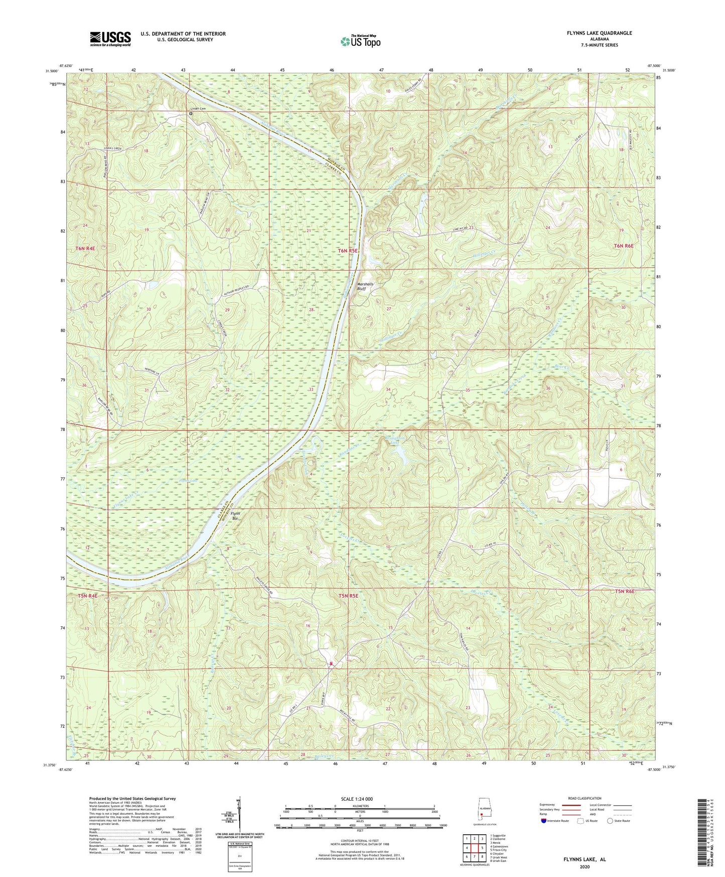
Flynns Lake Alabama US Topo Map
Couldn't load pickup availability
2024 topographic map quadrangle Flynns Lake in the state of Alabama. Scale: 1:24000. Based on the newly updated USGS 7.5' US Topo map series, this map is in the following counties: Monroe, Clarke. The map contains contour data, water features, and other items you are used to seeing on USGS maps, but also has updated roads and other features. This is the next generation of topographic maps. Printed on high-quality waterproof paper with UV fade-resistant inks.
Quads adjacent to this one:
West: Gainestown
Northwest: Suggsville
North: Claiborne
Northeast: Mexia
East: Frisco City
Southeast: Uriah East
South: Uriah West
Southwest: Chrysler
This map covers the same area as the classic USGS quad with code o31087d5.
Contains the following named places: Baileys Creek, Baileys Landing, Barlow Bend Oil Field, Bear Creek, Bowdens Landing, Broughton Dam, Broughton Lake, Dale Ferry Landing, English Mill, Flynn Bar, Flynn Gin Landing, Flynns Lake, Herons Landing, Hollinger Creek, Hollingers Landing, Howard Landing, James Landing, Jamestown Church, Linder Cemetery, Lovetts Creek, Lovetts Creek Oil Field, Marriotts Landing, Marshall Ferry Landing, Marshall Gin Landing, Marshalls Bluff, Marshalls Creek, Mount Gilead Church, Mount Gilead School, Olivers Ferry, Peggy Baileys Bluff Lime Works, Porter Branch, Randons Creek, Rocky Hill Church, Rocky Hill Volunteer Fire Department, Shackleford Bar, Shiloh Church, Shiloh School, Sunflower Church