MyTopo
Fruithurst Alabama US Topo Map
Couldn't load pickup availability
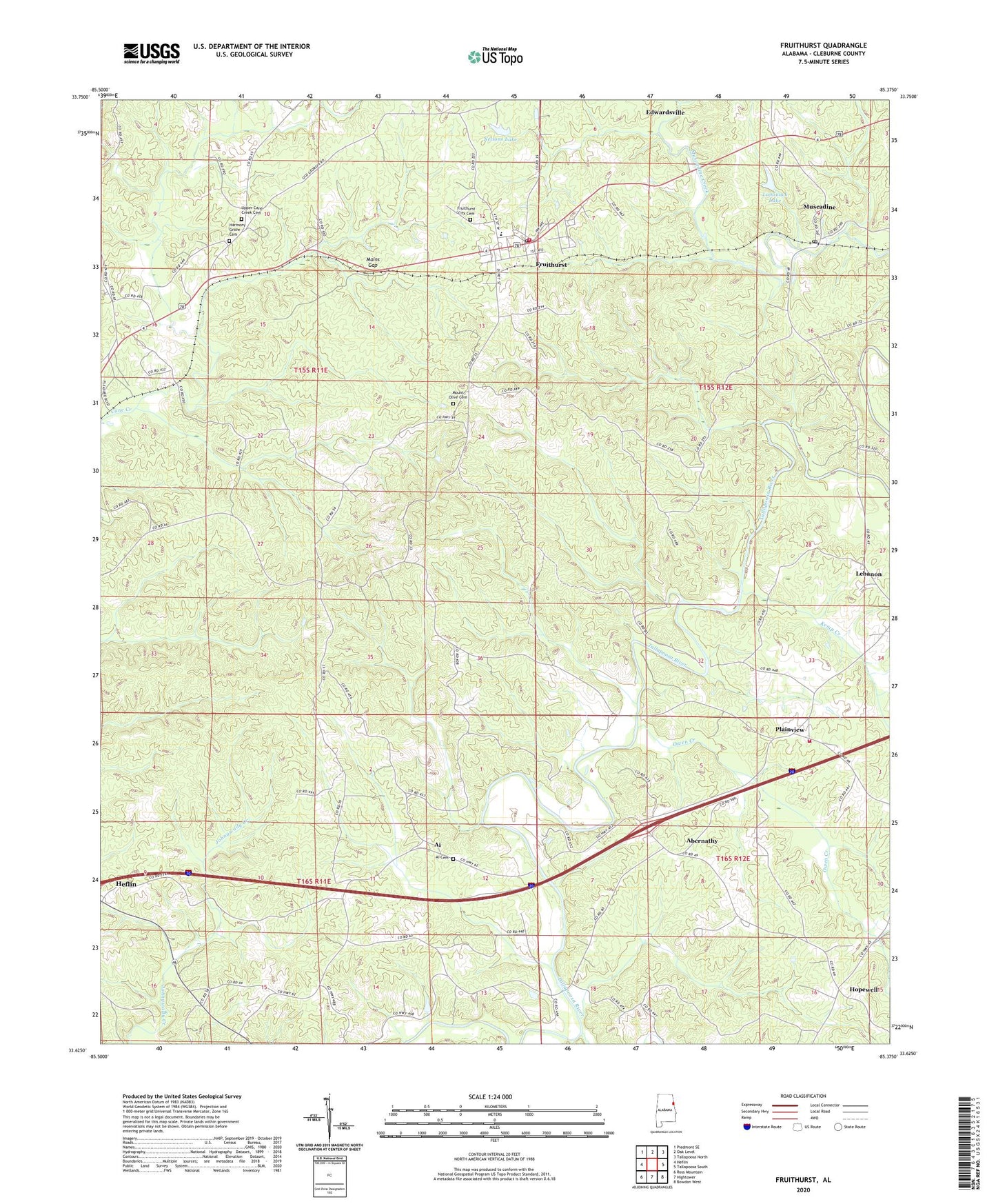
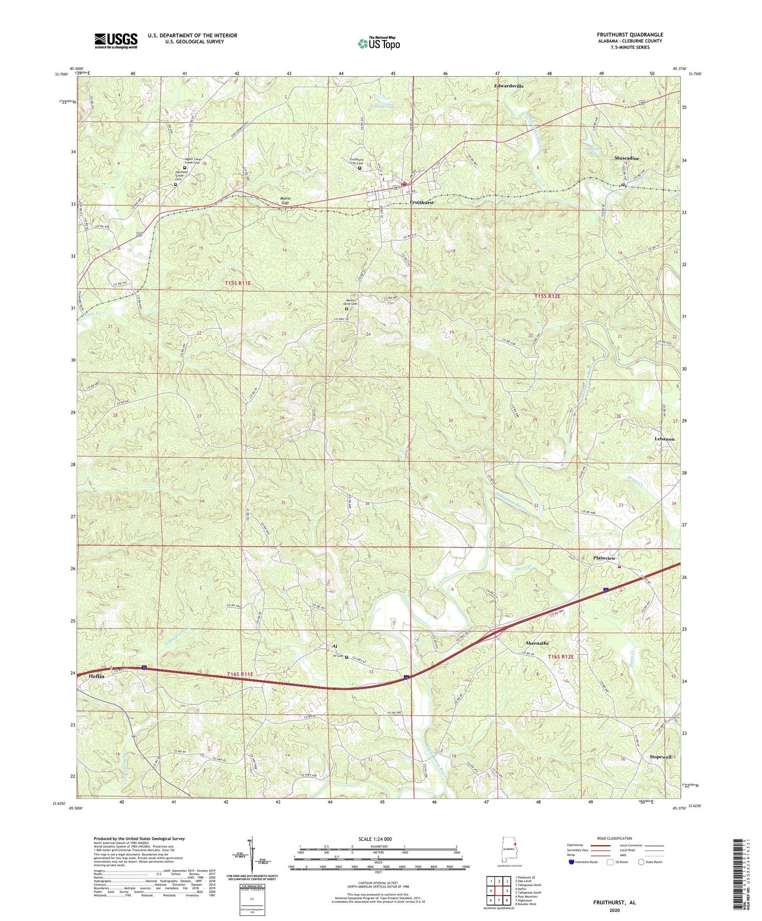
2024 topographic map quadrangle Fruithurst in the state of Alabama. Scale: 1:24000. Based on the newly updated USGS 7.5' US Topo map series, this map is in the following counties: Cleburne. The map contains contour data, water features, and other items you are used to seeing on USGS maps, but also has updated roads and other features. This is the next generation of topographic maps. Printed on high-quality waterproof paper with UV fade-resistant inks.
Quads adjacent to this one:
West: Heflin
Northwest: Piedmont SE
North: Oak Level
Northeast: Tallapoosa North
East: Tallapoosa South
Southeast: Bowdon West
South: Hightower
Southwest: Ross Mountain
This map covers the same area as the classic USGS quad with code o33085f4.
Contains the following named places: Abernathy, Abernathy Volunteer Fire Department, Ai, Ai Baptist Church, Ai Cemetery, Albright Creek, Antioch Church, Bennett Creek, Cicero, Crossroads Church, Fair Play Post Office, Fruithurst, Fruithurst Elementary School, Fruithurst Post Office, Fruithurst Volunteer Fire Department, Harmony Grove Baptist Church, Harmony Grove Cemetery, Hopewell, Kemp Creek, Kemps Post Office, Laminack Dam, Laminack Lake, Macola Creek, Mains Gap, Mount Olive Cemetery, Muscadine, Muscadine Church, Muscadine Post Office, Nelson Dam, Nelsons Lake, New Hope Church, New Hopewell Baptist Church, Oak Grove Church, Oak Grove Lookout Tower, Old Harmony Church, Owen Creek, Pine Grove Church, Plainview, Pound Mill, Pound School, Smith Ford, Town of Fruithurst, Upper Cane Creek Cemetery, Upper Cane Creek Church, ZIP Code: 36269