MyTopo
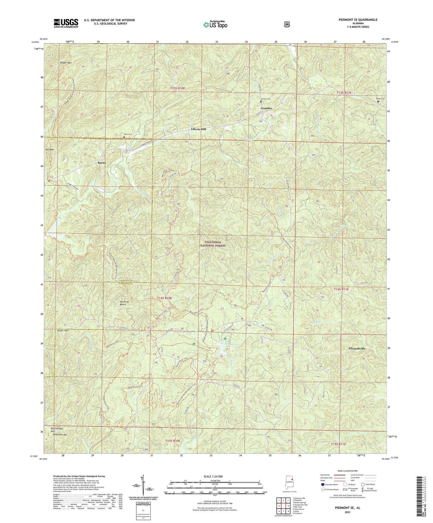
Piedmont SE Alabama US Topo Map
Couldn't load pickup availability
Also explore the Piedmont SE Forest Service Topo of this same quad for updated USFS data
2024 topographic map quadrangle Piedmont SE in the state of Alabama. Scale: 1:24000. Based on the newly updated USGS 7.5' US Topo map series, this map is in the following counties: Cleburne, Calhoun. The map contains contour data, water features, and other items you are used to seeing on USGS maps, but also has updated roads and other features. This is the next generation of topographic maps. Printed on high-quality waterproof paper with UV fade-resistant inks.
Quads adjacent to this one:
West: Jacksonville East
Northwest: Piedmont NW
North: Piedmont
Northeast: Borden Springs
East: Oak Level
Southeast: Fruithurst
South: Heflin
Southwest: Choccolocco
This map covers the same area as the classic USGS quad with code o33085g5.
Contains the following named places: Abernathy, Burns, Burns School, Choccolocco Number 2 Dam, Choccolocco Ranger Station, Choccolocco Wildlife Management Area, Coleman Dam, Coleman Lake, Coleman Lake Campground and Picnic Area, Dry Creek, Dugger Mountain Wilderness, Dunn Cemetery, Grantley, Grantley Church, Grimes Cemetery, Hitching Beech, Laurel Shelter-Forest Service Facility, Liberty Hill, Marys Creek, Potter Mountain, Rattlesnake Mountain, Shoal Creek, Shoal Creek Church, Shoal Creek Picnic Area, Stead Cemetery, Wilkinson Mountain