MyTopo
Fulton East Alabama US Topo Map
Couldn't load pickup availability
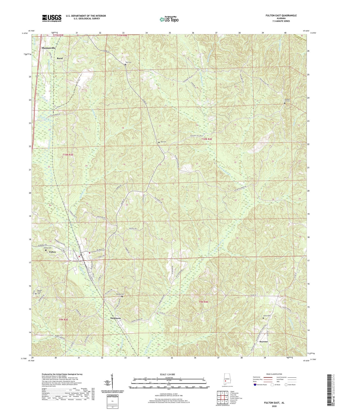
2024 topographic map quadrangle Fulton East in the state of Alabama. Scale: 1:24000. Based on the newly updated USGS 7.5' US Topo map series, this map is in the following counties: Clarke, Wilcox. The map contains contour data, water features, and other items you are used to seeing on USGS maps, but also has updated roads and other features. This is the next generation of topographic maps. Printed on high-quality waterproof paper with UV fade-resistant inks.
Quads adjacent to this one:
West: Fulton West
Northwest: Bashi
North: Thomasville
Northeast: Pine Hill
East: Lower Peach Tree
Southeast: Chance
South: Whatley
Southwest: Grove Hill
This map covers the same area as the classic USGS quad with code o31087g6.
Contains the following named places: Allen Branch, Almeda, Bassett Creek, Bassett Creek Cemetery, Bassett Creek Church, Centerline Methodist Church, Dickinson, Dickinson Baptist Church, First Baptist Church of Fulton, First Century Church, Fulton, Fulton Division, Fulton Elementary School, Fulton Post Office, Fulton Volunteer Fire Department Station 1, Fulton Volunteer Fire Department Station 2, Henley Cemetery, Liberty Church, Liley Church, McWer, Midway Cemetery, Midway Church, New Hope Church, North Clarke Industrial Park, Okolona Church, Orphans Creek, Pleasant Hill, Pleasant Hill Cemetery, Pleasant Hill Methodist Church, Rock West African Methodist Episcopal Church, Rural, Saint Paul Post Office, Salem Baptist Church, Salem Cemetery, Scyrene, Spencer Chapel Church, Tantroft Branch, Tate Cemetery, Thomasville Sewage Lagoon, Town of Fulton, Truevine Church, ZIP Codes: 36436, 36446