MyTopo
Chance Alabama US Topo Map
Couldn't load pickup availability
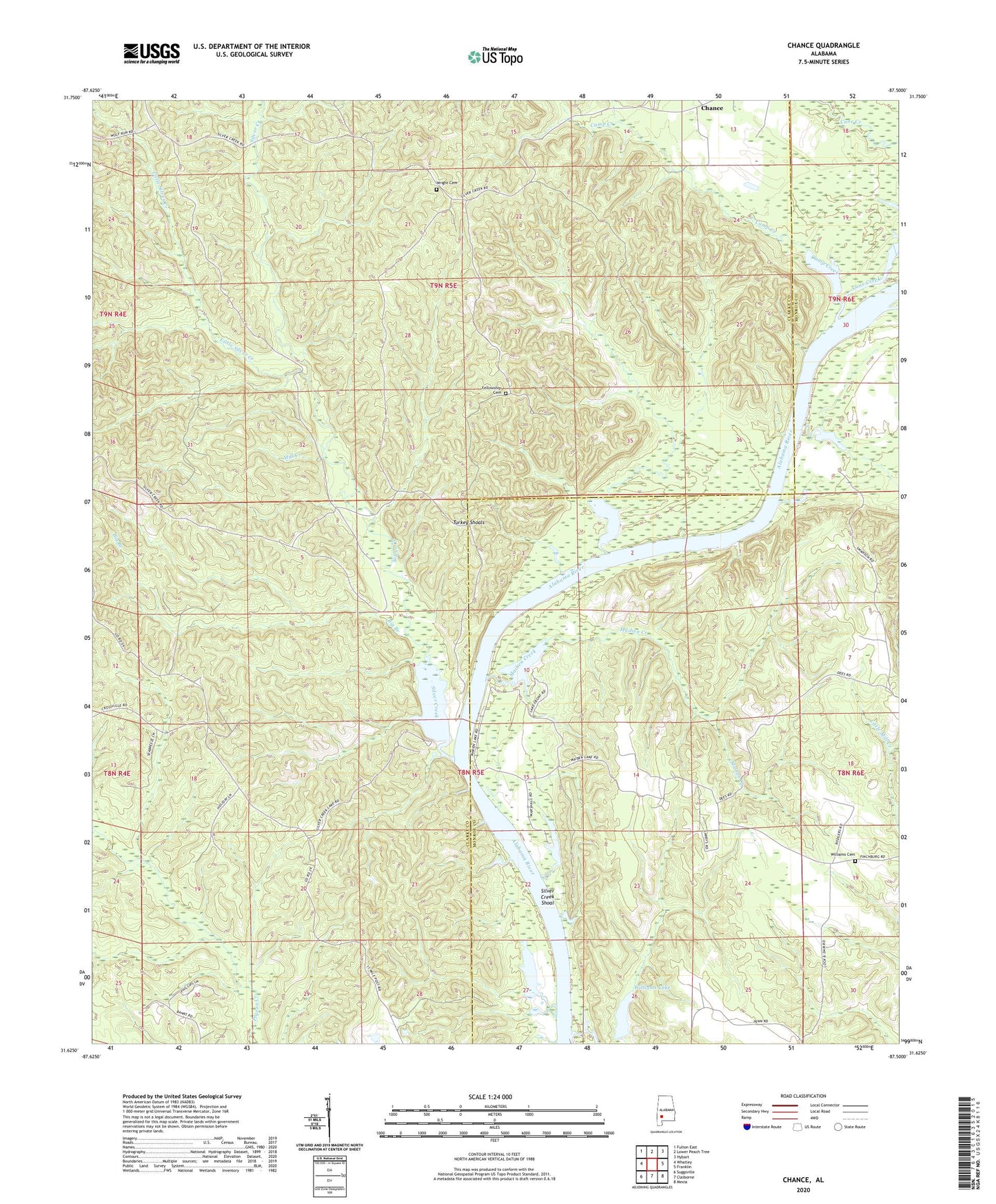
2024 topographic map quadrangle Chance in the state of Alabama. Scale: 1:24000. Based on the newly updated USGS 7.5' US Topo map series, this map is in the following counties: Clarke, Monroe. The map contains contour data, water features, and other items you are used to seeing on USGS maps, but also has updated roads and other features. This is the next generation of topographic maps. Printed on high-quality waterproof paper with UV fade-resistant inks.
Quads adjacent to this one:
West: Whatley
Northwest: Fulton East
North: Lower Peach Tree
Northeast: Hybart
East: Franklin
Southeast: Mexia
South: Claiborne
Southwest: Suggsville
This map covers the same area as the classic USGS quad with code o31087f5.
Contains the following named places: Big Branch, Camp Creek, Cane Creek, Chance, Chance Church, Cobb Landing, Fellowship Cemetery, Fellowship Church, Finchburg, Finchburg Landing, Foster Landing, Good Hope Church, Hendersons Landing, Isaac Creek, Little Rock Church, Little Silver Creek, Maiben Creek, Maiben Landing, Marshall Upper Landing, Mill Creek, Presnall Landing, Silver Creek, Silver Creek Park, Silver Creek Shoal, Swanson, Turkey Shoals, Williams Cemetery, Williams Chapel, Williams Lake, Williams Lake Dam, Williams Store, Williamsons Store, Wright Cemetery