MyTopo
Whatley Alabama US Topo Map
Couldn't load pickup availability
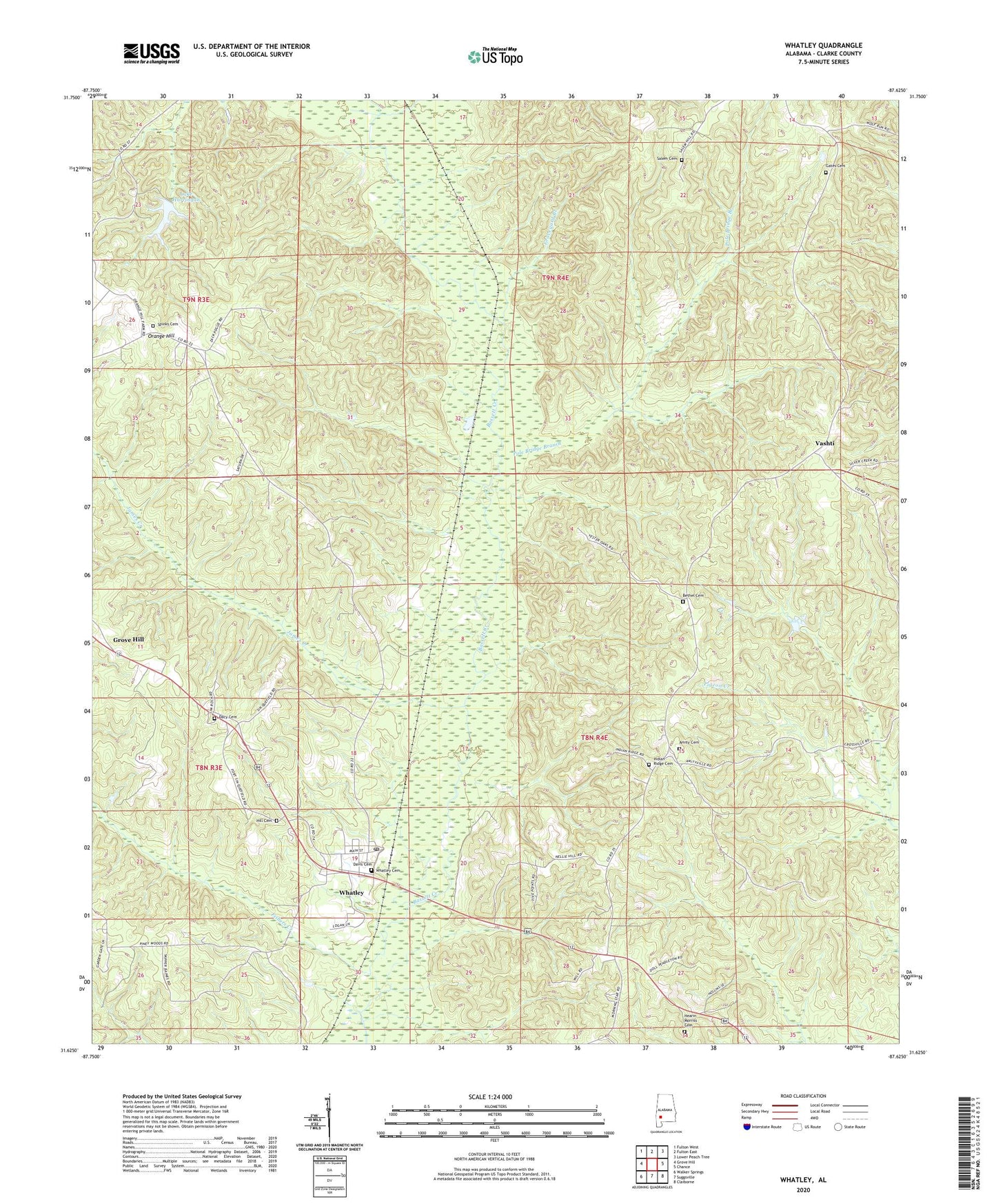
2024 topographic map quadrangle Whatley in the state of Alabama. Scale: 1:24000. Based on the newly updated USGS 7.5' US Topo map series, this map is in the following counties: Clarke. The map contains contour data, water features, and other items you are used to seeing on USGS maps, but also has updated roads and other features. This is the next generation of topographic maps. Printed on high-quality waterproof paper with UV fade-resistant inks.
Quads adjacent to this one:
West: Grove Hill
Northwest: Fulton West
North: Fulton East
Northeast: Lower Peach Tree
East: Chance
Southeast: Claiborne
South: Suggsville
Southwest: Walker Springs
This map covers the same area as the classic USGS quad with code o31087f6.
Contains the following named places: Amity Baptist Church, Amity Cemetery, Amity School, Andrew Jackson Memorial Park, Aoh Church, Asbury, Asbury Church, Bethel Cemetery, Bethel Church, Church of God, Cobbville, Dacy Cemetery, Davis Cemetery, Fishers Creek, Fort Sinquefield, Gates Cemetery, Graveyard Branch, Grove Hill Division, Hearin Morriss Cemetery, Hill Cemetery, Horeb Baptist Church, Indian Ridge Cemetery, Indian Ridge Church, James Creek, Lake Harringan, Little Bassett Creek, Moncrief School House, Morning Star Baptist Church, Orange Hill, Orange Hill Baptist Church, Orange Hill School, Pole Bridge Branch, Pouncey, Salem Cemetery, Spinks Cemetery, Spinks Chapel, Vashti, W D Harrigan Dam, Whatley, Whatley Cemetery, Whatley Census Designated Place, Whatley First Assembly of God Church, Whatley Post Office, ZIP Code: 36482