MyTopo
Brooks Alabama US Topo Map
Couldn't load pickup availability
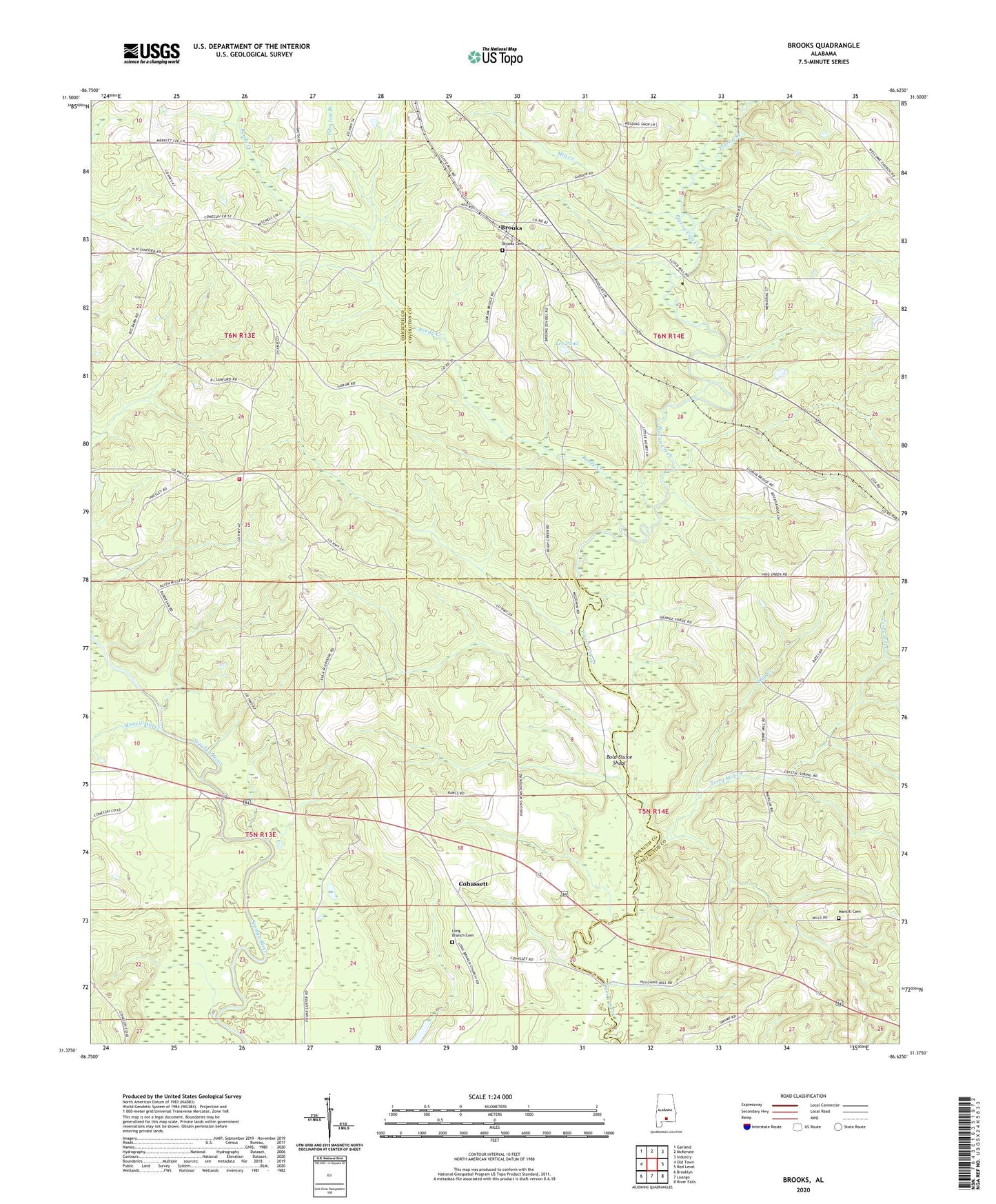
2024 topographic map quadrangle Brooks in the state of Alabama. Scale: 1:24000. Based on the newly updated USGS 7.5' US Topo map series, this map is in the following counties: Conecuh, Covington. The map contains contour data, water features, and other items you are used to seeing on USGS maps, but also has updated roads and other features. This is the next generation of topographic maps. Printed on high-quality waterproof paper with UV fade-resistant inks.
Quads adjacent to this one:
West: Old Town
Northwest: Garland
North: McKenzie
Northeast: Industry
East: Red Level
Southeast: River Falls
South: Loango
Southwest: Brooklyn
This map covers the same area as the classic USGS quad with code o31086d6.
Contains the following named places: Antioch Church, Beat Volunteer Fire Department 8, Bold Sluice Shoal, Brooks, Brooks Cemetery, Brooks Church, Brooks Lookout Tower, Cohassett, Cohassett Church, Fergerson Lake Dam, Hog Creek, Lee Pond, Long Branch Cemetery, Long Branch Church, Mancil Mill Creek, Mancill Cemetery, Mill Creek, Motts Bridge, Nehoma Church, New Home Church, Pine Log Branch, Reedy Creek, Shreve Division, Terry Mill Creek, Terry School, ZIP Code: 36474