MyTopo
Gateswood Alabama US Topo Map
Couldn't load pickup availability
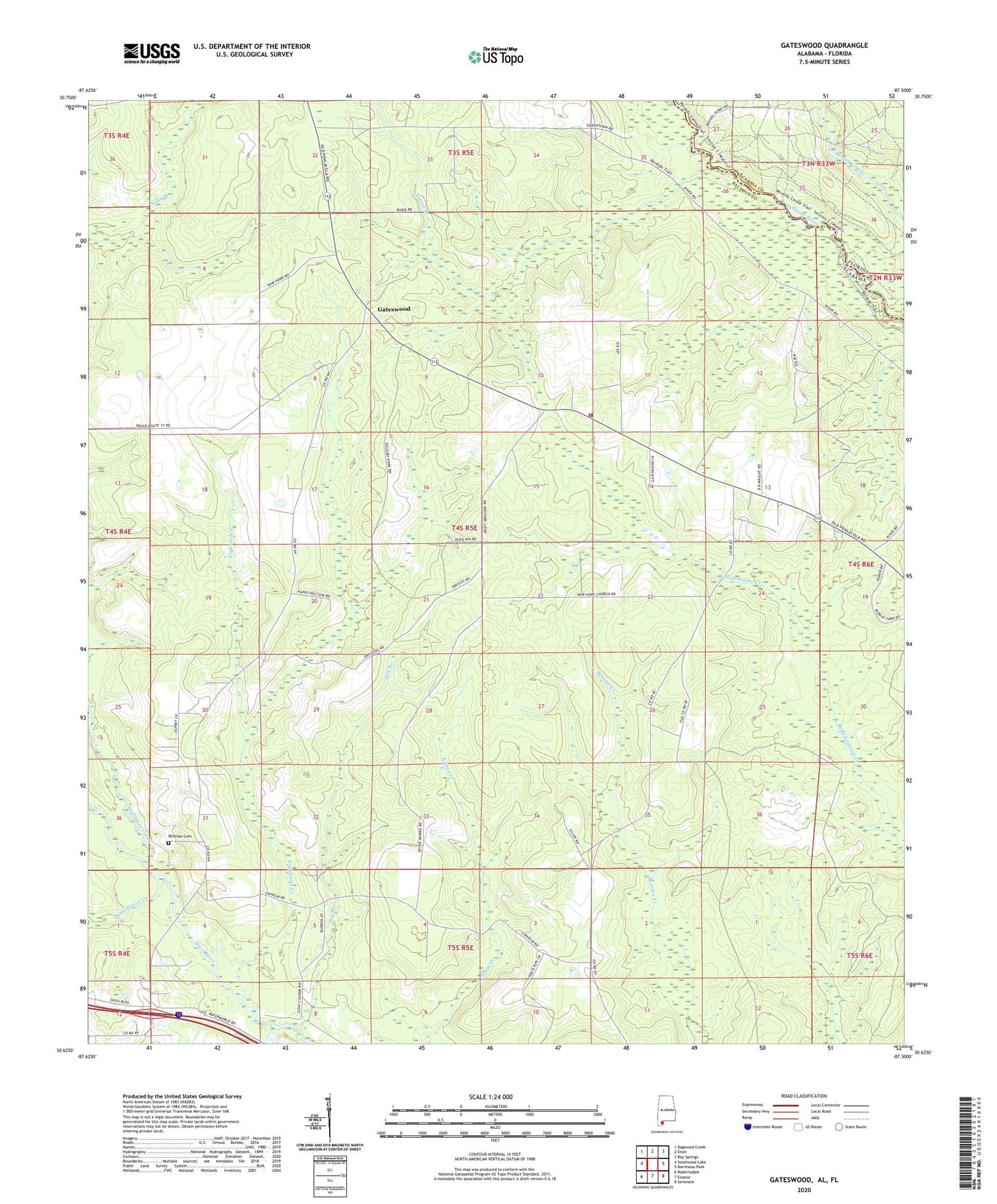
2024 topographic map quadrangle Gateswood in the state of Alabama. Scale: 1:24000. Based on the newly updated USGS 7.5' US Topo map series, this map is in the following counties: Baldwin, Escambia. The map contains contour data, water features, and other items you are used to seeing on USGS maps, but also has updated roads and other features. This is the next generation of topographic maps. Printed on high-quality waterproof paper with UV fade-resistant inks.
Quads adjacent to this one:
West: Steelwood Lake
Northwest: Dogwood Creek
North: Enon
Northeast: Bay Springs
East: Barrineau Park
Southeast: Seminole
South: Elsanor
Southwest: Robertsdale
Contains the following named places: Bellefontaine School, Chandler Fire Tower, Dry Branch, Eightmile Creek, Gateswood, Gateswood Volunteer Fire Department, Hamilton Church, Hollinger Creek, Nelson Branch, New Hope Church, Persimmon Creek, Pittman Cemetery