MyTopo
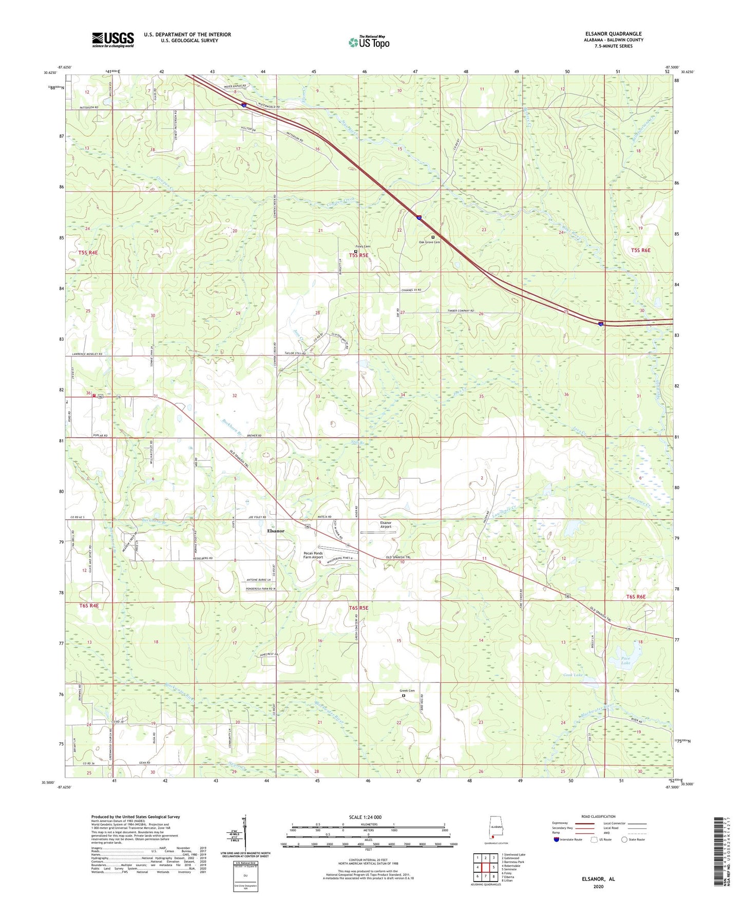
Elsanor Alabama US Topo Map
Couldn't load pickup availability
2024 topographic map quadrangle Elsanor in the state of Alabama. Scale: 1:24000. Based on the newly updated USGS 7.5' US Topo map series, this map is in the following counties: Baldwin. The map contains contour data, water features, and other items you are used to seeing on USGS maps, but also has updated roads and other features. This is the next generation of topographic maps. Printed on high-quality waterproof paper with UV fade-resistant inks.
Quads adjacent to this one:
West: Robertsdale
Northwest: Steelwood Lake
North: Gateswood
Northeast: Barrineau Park
East: Seminole
Southeast: Lillian
South: Elberta
Southwest: Foley
This map covers the same area as the classic USGS quad with code o30087e5.
Contains the following named places: Allen Spring Branch, Baldwin County Express Traveling Museum Headquarters, Bear Branch, Beetree Creek, Bellefontaine Creek, Bob Pace Dam, Buckhorn Branch, Burnstand Branch, Cook Lake, Cook Lake Dam, Cowpen Creek, Elam Creek, Elsanor, Elsanor Airport, Elsanor Community Center, Elsanor School, Elsanor Volunteer Fire and Rescue Department, Foley Cemetery, Greek Cemetery, Greenwood Church, Horsecollar Branch, Joes Creek, Lawrence Creek, Lees Ferry, Oak Grove Cemetery, Oak Grove Church, Pace Lake, Pecan Ponds Farm Airport, Saint Matthew Church, Seminole Church, Seminole Lookout Tower, Still Branch, Styx River Estates, Taylors Camp, Vick's Mobile Home Park, Wallace Field, Waterhole Branch, ZIP Code: 36567