MyTopo
Seminole Alabama US Topo Map
Couldn't load pickup availability
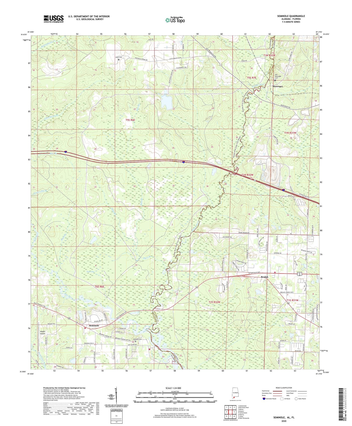
2024 topographic map quadrangle Seminole in the states of Alabama, Florida. Scale: 1:24000. Based on the newly updated USGS 7.5' US Topo map series, this map is in the following counties: Baldwin, Escambia. The map contains contour data, water features, and other items you are used to seeing on USGS maps, but also has updated roads and other features. This is the next generation of topographic maps. Printed on high-quality waterproof paper with UV fade-resistant inks.
Quads adjacent to this one:
West: Elsanor
Northwest: Gateswood
North: Barrineau Park
Northeast: Molino
East: Cantonment
Southeast: West Pensacola
South: Lillian
Southwest: Elberta
Contains the following named places: Alabama Department of Transportation Interstate 10 Welcome Center Lagoon, Allen Cemetery, Beulah, Beulah Academy of Science, Beulah Church, Beulah Volunteer Fire Department, Browns Landing, Coastal Airport, Davis Branch, Gibbons Branch, Mitchell Cemetery, Mobile Highway Church, Muscogee, Nunez Ferry, Old Muscogee Cemetery, Rices Branch, Seminole, Seminole Church, Seminole Volunteer Fire Department Station 1, Seminole Volunteer Fire Department Station 2, Soper Bay, Soper Branch, Styx River, Vaughn Airport, ZIP Code: 36574