
MyTopo
Hatchechubbee Alabama US Topo Map
Couldn't load pickup availability
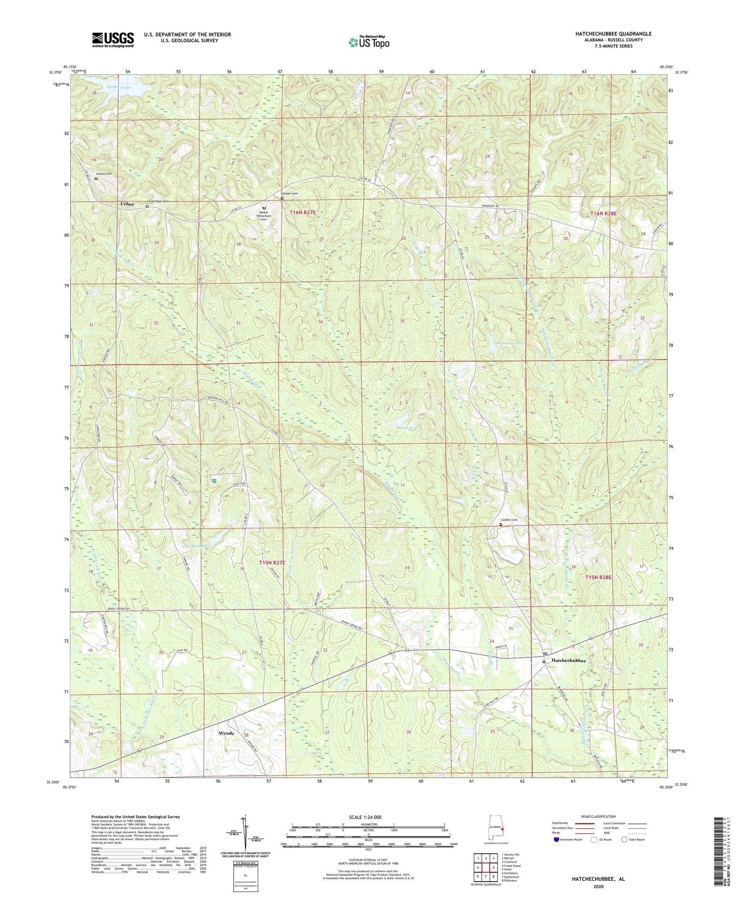
2024 topographic map quadrangle Hatchechubbee in the state of Alabama. Scale: 1:24000. Based on the newly updated USGS 7.5' US Topo map series, this map is in the following counties: Russell. The map contains contour data, water features, and other items you are used to seeing on USGS maps, but also has updated roads and other features. This is the next generation of topographic maps. Printed on high-quality waterproof paper with UV fade-resistant inks.
Quads adjacent to this one:
West: Creek Stand
Northwest: Society Hill
North: Marvyn
Northeast: Crawford
East: Seale
Southeast: Pittsview
South: Rutherford
Southwest: Hurtsboro
This map covers the same area as the classic USGS quad with code o32085c3.
Contains the following named places: Butlers Pond, Carden Cemetery, Good Hope Baptist Church, Good Hope Cemetery, Hatchechubbee, Hatchechubbee Church, Hatchechubbee Post Office, Hatchechubbee Volunteer Fire Department Station 1, Hatchichapa, High Log Creek, Howard Chapel, Hurtsboro Division, Joshua Cemetery, King Branch, Lake Morgloba, Margloba Dam, Mount Arie Church, Mount Olive Church, Mount Sinai Church, Polecat Branch, Porters Mill Creek, Saint Luke Church, Sandford Post Office, Skinners Lake, Smiths Pond, Torbert Lake, Torberts Lake Dam, Uchee, Uchee Cemetery, Uchee Church, Uchee Methodist Church, Walker Williamson Cemetery, Welcome Church, Wende, Wende School, ZIP Code: 36858


