
MyTopo
Pittsview Alabama US Topo Map
Couldn't load pickup availability
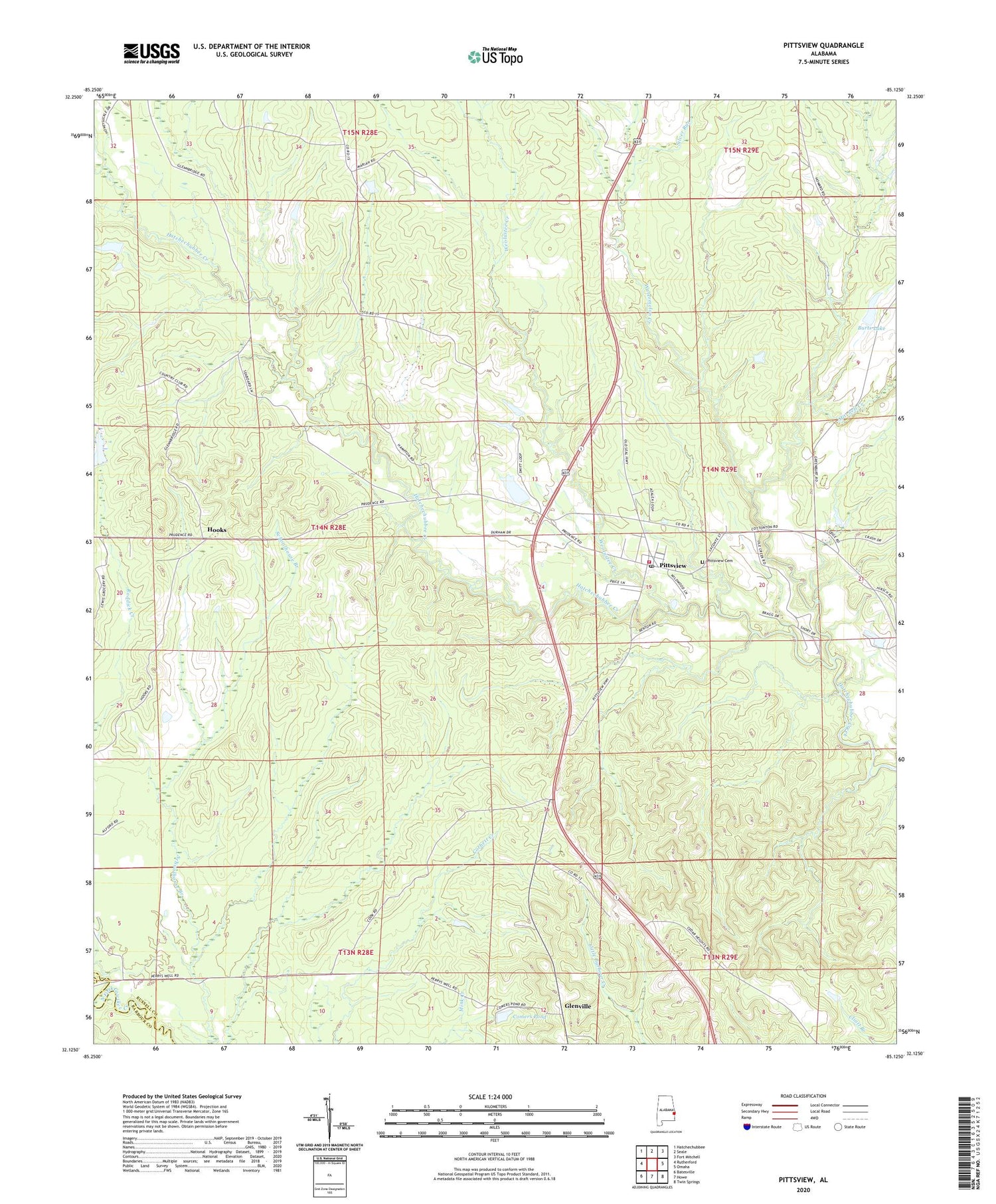
2024 topographic map quadrangle Pittsview in the state of Alabama. Scale: 1:24000. Based on the newly updated USGS 7.5' US Topo map series, this map is in the following counties: Russell, Barbour. The map contains contour data, water features, and other items you are used to seeing on USGS maps, but also has updated roads and other features. This is the next generation of topographic maps. Printed on high-quality waterproof paper with UV fade-resistant inks.
Quads adjacent to this one:
West: Rutherford
Northwest: Hatchechubbee
North: Seale
Northeast: Fort Mitchell
East: Omaha
Southeast: Twin Springs
South: Howe
Southwest: Batesville
This map covers the same area as the classic USGS quad with code o32085b2.
Contains the following named places: B B Burts Dam, Balfore Lake Dam, Benevolence Grove Church, Bethel Church, Burkes Lake Dam, Burts Lake, Comers Pond, Cool Springs Baptist Church, Cottonton-Seale Division, Glenville, Glenville Historic District, Hooks, John O'Neall Dam, Macedonia Church, Mitchell Church, Mitchell Creek, Mitchell School, Mount Moriah Church, Perrys Well, Pittsview, Pittsview Cemetery, Pittsview Post Office, Pittsview Volunteer Fire Department, Silver Run, Thompsons Store, Watermelon Creek, Weolustee Creek, ZIP Code: 36871


