
MyTopo
Seale Alabama US Topo Map
Couldn't load pickup availability
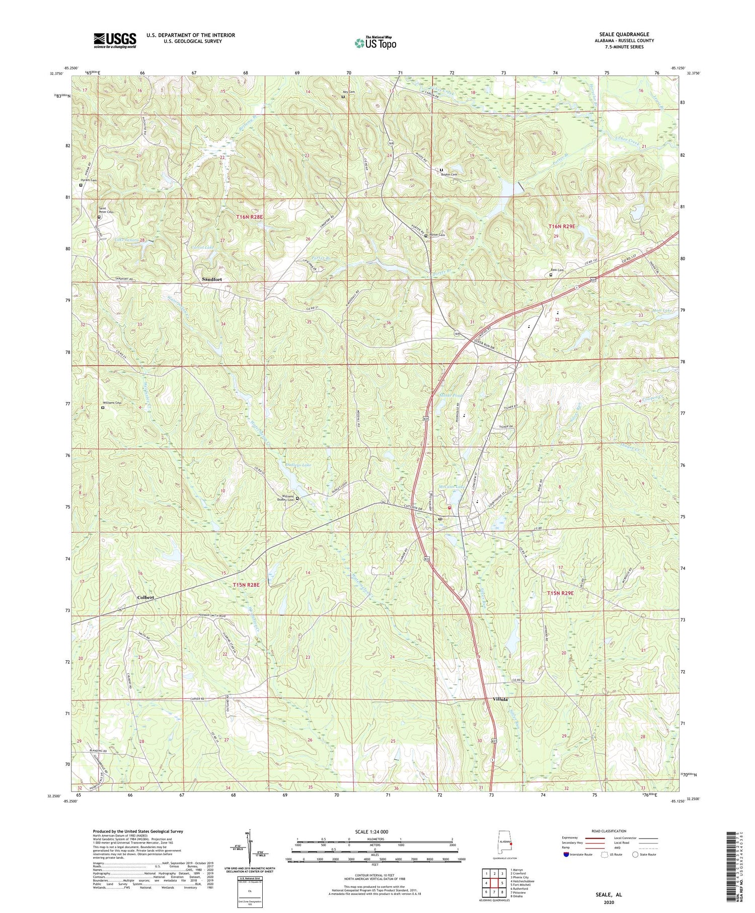
2024 topographic map quadrangle Seale in the state of Alabama. Scale: 1:24000. Based on the newly updated USGS 7.5' US Topo map series, this map is in the following counties: Russell. The map contains contour data, water features, and other items you are used to seeing on USGS maps, but also has updated roads and other features. This is the next generation of topographic maps. Printed on high-quality waterproof paper with UV fade-resistant inks.
Quads adjacent to this one:
West: Hatchechubbee
Northwest: Marvyn
North: Crawford
Northeast: Phenix City
East: Fort Mitchell
Southeast: Omaha
South: Pittsview
Southwest: Rutherford
This map covers the same area as the classic USGS quad with code o32085c2.
Contains the following named places: Bass Cemetery, Boykin Cemetery, Carrol Lake, Carroll Lake Dam, Chavale High School, Colbert, Colbert Church, Dudleys, Dudleys Lake, Friendship Church, Friendship School, Goodhope Baptist Church, Greene Number 2 Dam, Horselot Branch, Hyram, Hyram Cemetery, Hyram Post Office, Key Cemetery, Lake Lenora, Lake Lenora Dam, Lewis Branch, Lexington, Lexington Post Office, Matthews Dam, McCann Lake, Ministries of Faith Church, Monte Pond, Mott Lake Dam, Mount Hebron Baptist Church, Mount Olive Church, Natural Bridge Post Office, Perrys Steam Mill, Porter Branch, Porter Branch Lake Dam, Porter Cemetery, Ross Chapel, Russell County, Russell County Farm, Russell County Vocational School, Saint Matthews Church, Saint Peter Cemetery, Saint Peters Church, Sandfort, Sandfort Fire Tower, Sandfort School, Seale, Seale Post Office, Seale School, Seale Volunteer Fire Department, Silver Run Baptist Church, Sumbry Memorial Church, Thomas Bridge, Villula, Wadsworth Lake Dam, Williams Cemetery, Williams Dudley Cemetery, ZIP Code: 36875


