MyTopo
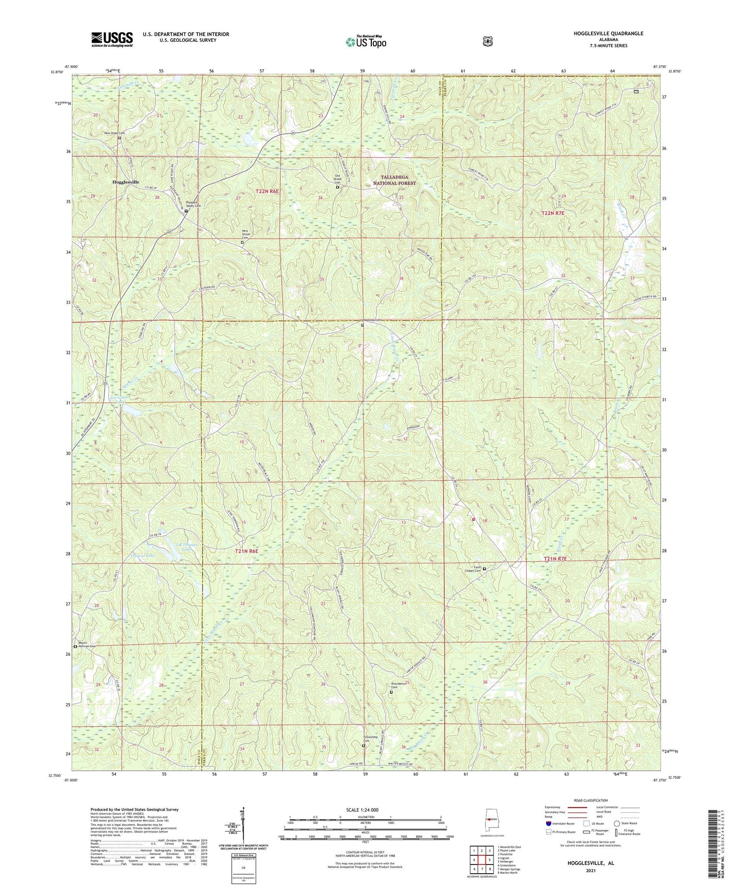
Hogglesville Alabama US Topo Map
Couldn't load pickup availability
Also explore the Hogglesville Forest Service Topo of this same quad for updated USFS data
2024 topographic map quadrangle Hogglesville in the state of Alabama. Scale: 1:24000. Based on the newly updated USGS 7.5' US Topo map series, this map is in the following counties: Perry, Hale, Bibb. The map contains contour data, water features, and other items you are used to seeing on USGS maps, but also has updated roads and other features. This is the next generation of topographic maps. Printed on high-quality waterproof paper with UV fade-resistant inks.
Quads adjacent to this one:
West: Ingram
Northwest: Moundville East
North: Payne Lake
Northeast: Pondville
East: Heiberger
Southeast: Marion North
South: Morgan Springs
Southwest: Greensboro
This map covers the same area as the classic USGS quad with code o32087g4.
Contains the following named places: Antioch Baptist Church, Bethany Church, Brush Creek, Faith Chapel Baptist Church, Faith Chapel Cemetery, Fellowship Cemetery, Fellowship Church, Hogglesville, J B Thomas Dam, J B Thomas Lake, Joe Glover Dam, Joe Glover Lake, Lake Payne Church, Mike Wurm Dam, Morgan Tabernacle, Mount Herman Cemetery, Mount Herman Church, Mount Herman School, New Hope Cemetery, New Shiloh Cemetery, North Perry, North Perry Church, North Perry School, North Perry Volunteer Fire Department, Oak Grove Church, Old Shiloh Cemetery, Pleasant Valley Cemetery, Pleasant Valley Church, Providence Cemetery, Providence Methodist Church, Salem Church, Spring Hill Church, Thomas Lake, Valley School, Wateroak, Waycross Bible Methodist Church, Waycross Cemetery