MyTopo
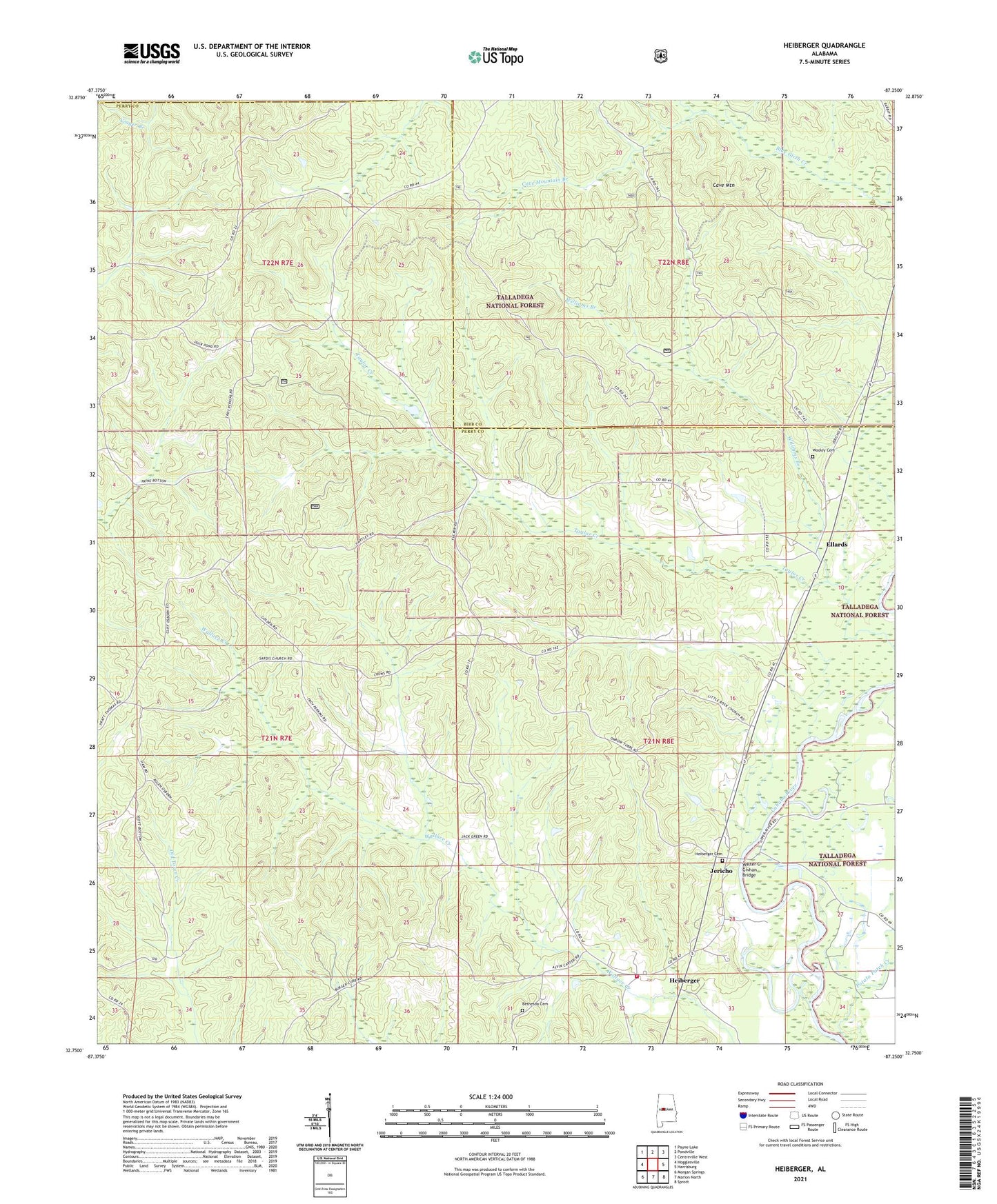
Heiberger Alabama US Topo Map
Couldn't load pickup availability
Also explore the Heiberger Forest Service Topo of this same quad for updated USFS data
2024 topographic map quadrangle Heiberger in the state of Alabama. Scale: 1:24000. Based on the newly updated USGS 7.5' US Topo map series, this map is in the following counties: Perry, Bibb. The map contains contour data, water features, and other items you are used to seeing on USGS maps, but also has updated roads and other features. This is the next generation of topographic maps. Printed on high-quality waterproof paper with UV fade-resistant inks.
Quads adjacent to this one:
West: Hogglesville
Northwest: Payne Lake
North: Pondville
Northeast: Centreville West
East: Harrisburg
Southeast: Sprott
South: Marion North
Southwest: Morgan Springs
This map covers the same area as the classic USGS quad with code o32087g3.
Contains the following named places: Bethesda Cemetery, Bethesda Presbyterian Church, Bethlehem Baptist Church, Cave Mountain, Cave Mountain Branch, Ellard School, Ellards, Heiberger, Heiberger Cemetery, Heiberger Division, Heiberger Elementary School, Heiberger Methodist Church, Heiberger Post Office, Heiberger Volunteer Fire Department, Ironville, Jericho, Little Rock Church, Mount Ivah Church, Mount Nebo Church, Nichols, Pine Grove Baptist Church, Potato Patch Creek, Sardis Baptist Church, Walter C Givhan Bridge, Williams Branch, Wooley Cemetery