MyTopo
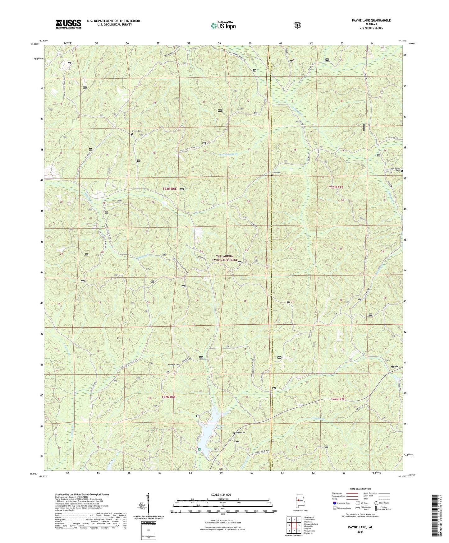
Payne Lake Alabama US Topo Map
Couldn't load pickup availability
Also explore the Payne Lake Forest Service Topo of this same quad for updated USFS data
2024 topographic map quadrangle Payne Lake in the state of Alabama. Scale: 1:24000. Based on the newly updated USGS 7.5' US Topo map series, this map is in the following counties: Hale, Bibb. The map contains contour data, water features, and other items you are used to seeing on USGS maps, but also has updated roads and other features. This is the next generation of topographic maps. Printed on high-quality waterproof paper with UV fade-resistant inks.
Quads adjacent to this one:
West: Moundville East
Northwest: Englewood
North: Duncanville
Northeast: Pearson
East: Pondville
Southeast: Heiberger
South: Hogglesville
Southwest: Ingram
This map covers the same area as the classic USGS quad with code o32087h4.
Contains the following named places: Camp Hugh, Coley School, Elliots Creek Work Center, Grimes Cemetery, Keeton Corner, Lanters, Low Gap, Mertz, Oakmulgee Wildlife Management Area, Payne Lake, Payne Lake Dam, Payne Lake Eastside Campground, Payne Lake Nature Trail, Payne Lake Recreation Area, Payne Lake Westside Campground, Payne Lookout Tower, Pine Flat Cemetery, Pine Flat Church, Pisgah Cemetery, Ragland Branch, Reed Brake Research Natural Area, South Sandy Hunter Camp, Spillway Campground, Troublesome Branch, Union Cemetery, Union Missionary Baptist Church, Wiggins Creek