MyTopo
Howe Alabama US Topo Map
Couldn't load pickup availability
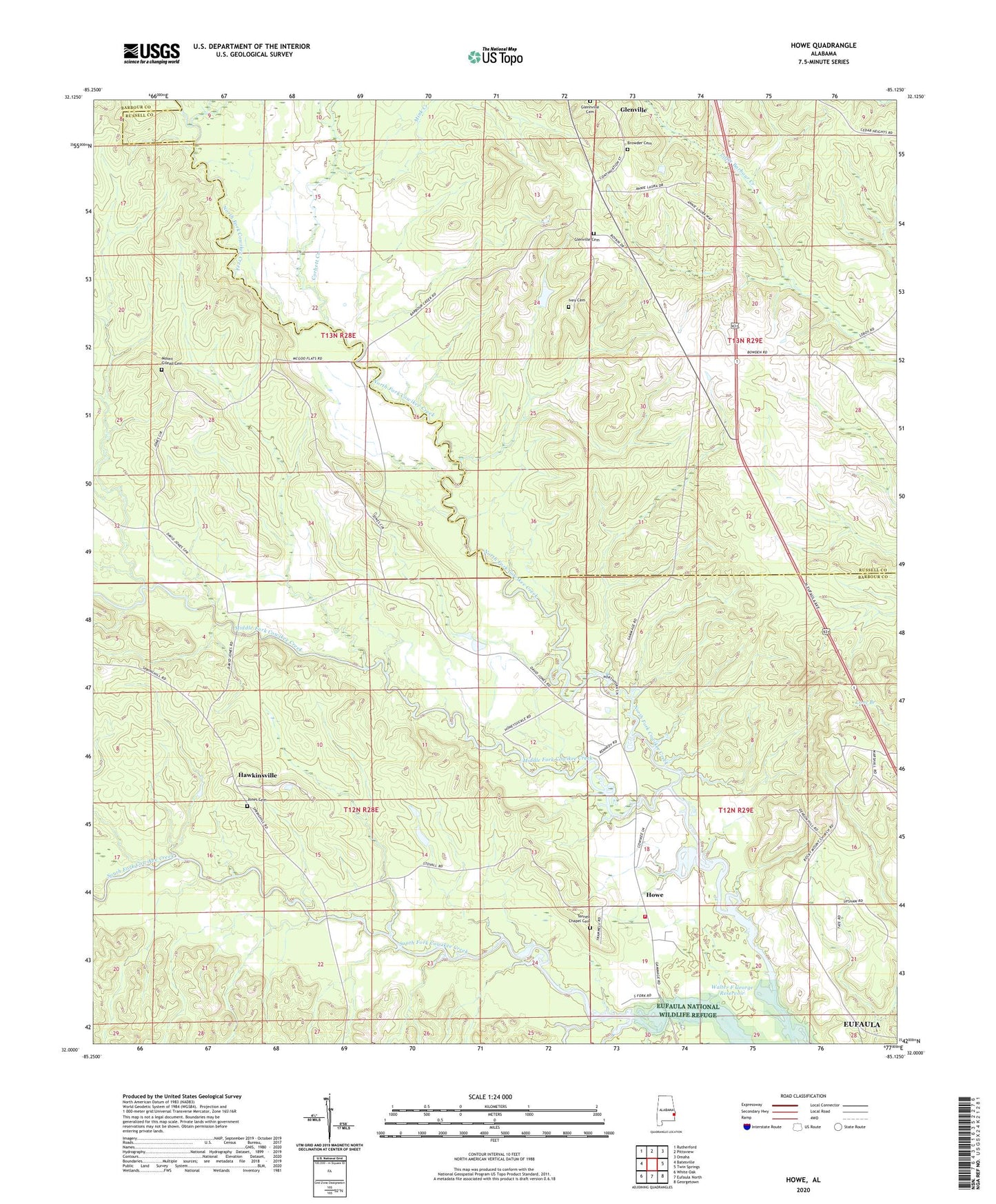
2024 topographic map quadrangle Howe in the state of Alabama. Scale: 1:24000. Based on the newly updated USGS 7.5' US Topo map series, this map is in the following counties: Barbour, Russell. The map contains contour data, water features, and other items you are used to seeing on USGS maps, but also has updated roads and other features. This is the next generation of topographic maps. Printed on high-quality waterproof paper with UV fade-resistant inks.
Quads adjacent to this one:
West: Batesville
Northwest: Rutherford
North: Pittsview
Northeast: Omaha
East: Twin Springs
Southeast: Georgetown
South: Eufaula North
Southwest: White Oak
This map covers the same area as the classic USGS quad with code o32085a2.
Contains the following named places: Browder Cemetery, Church of Christ, Comer Chapel, Corbett Creek, Cowikee Volunteer Fire Department, Davis School, Glennville Cemetery, Glenville Cemetery, Glenville High School, Hawkinsville, Howe, Ivey Cemetery, Jones Cemetery, Martin Zion Church, McGough School, Middle Fork Cowikee Creek, Mink Creek, Mount Gilead, Mount Gilead Cemetery, Mount Gilead Church, Mount Olive Church, Mount Zion Church, Rocky Mount Church, Saint Johns Church, Schoolhouse Branch, Tennell Chapel, Tennell Chapel Cemetery