
MyTopo
Omaha Georgia US Topo Map
Couldn't load pickup availability
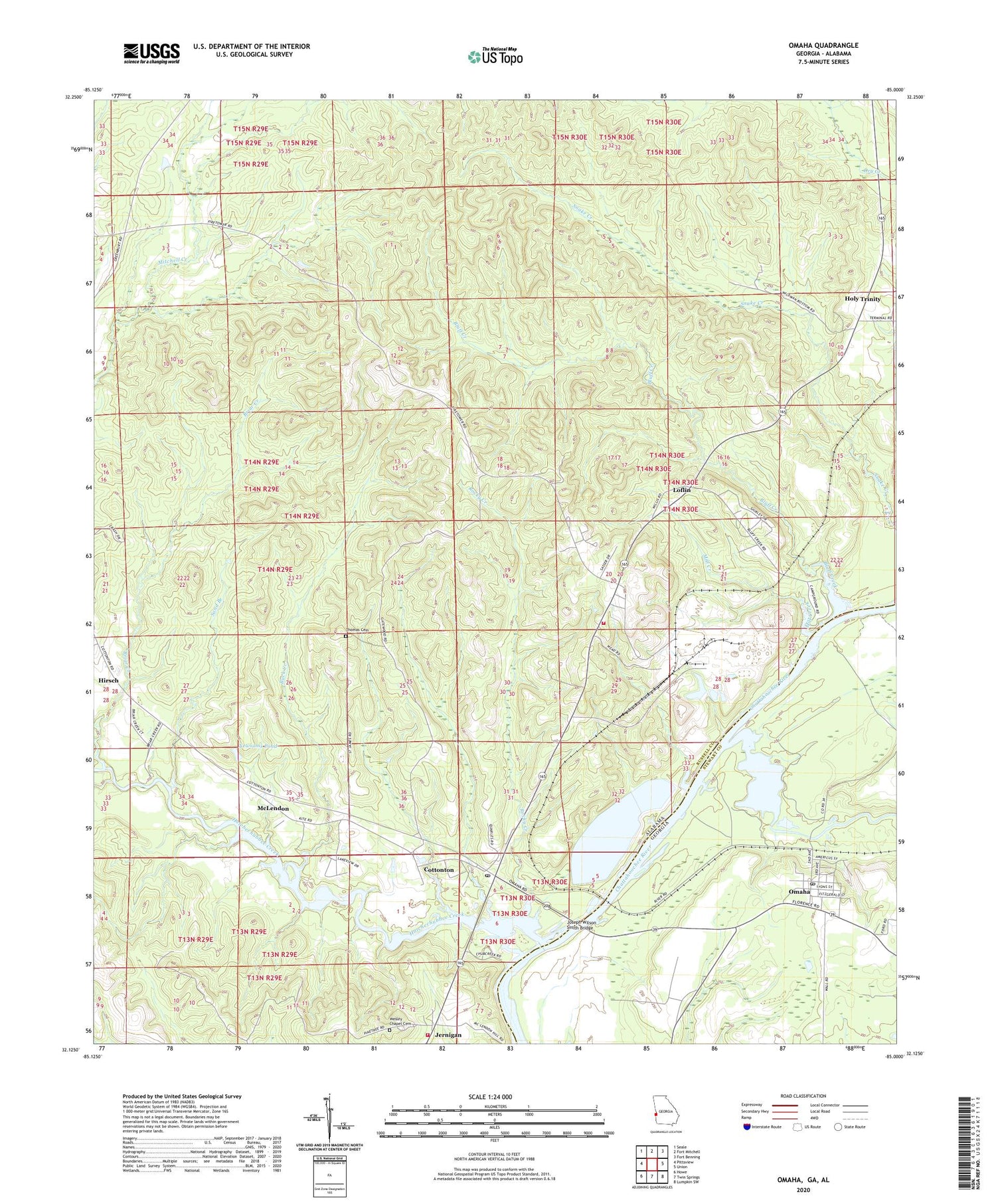
2024 topographic map quadrangle Omaha in the states of Alabama, Georgia. Scale: 1:24000. Based on the newly updated USGS 7.5' US Topo map series, this map is in the following counties: Stewart, Russell. The map contains contour data, water features, and other items you are used to seeing on USGS maps, but also has updated roads and other features. This is the next generation of topographic maps. Printed on high-quality waterproof paper with UV fade-resistant inks.
Quads adjacent to this one:
West: Pittsview
Northwest: Seale
North: Fort Mitchell
Northeast: Fort Benning
East: Union
Southeast: Lumpkin SW
South: Twin Springs
Southwest: Howe
This map covers the same area as the classic USGS quad with code o32085b1.
Contains the following named places: Bluff Creek, Bluff Creek Access Area, Briar Creek, Briar Creek Park, Buck Creek, Cottonton, Cottonton Elementary School, Cottonton Post Office, Cottonton Volunteer Fire Department Station 1, Cottonton Volunteer Fire Department Station 2, Fitzgeralds Landing, Hannahatchee Creek, Hatchechubbee Creek, Hatchechubbee Creek Park, Hirsch, Holy Trinity, Holy Trinity Post Office, Howards Landing, Jernigan, Jernigan Church, Joseph Wilson Smith Bridge, Loflin, Mahrt, Mays Landing, McClouds Ferry, McLendon, Mill Creek, Mount Canaan Church, Mount Lebanon Baptist Church, Murrell Hill Lookout Tower, New Hope Church, New Mount Cannon School, Newsoms Pond, Omaha, Omaha Post Office, Rocky Creek, Saint James Church, Saint James Elementary School, Saint Josephs Church, Saint Josephs Seminary, Saint Paul Church Cemetery, Sand Branch, Sawokli, Shady Grove Church, Spring Grove, Thomas Cemetery, Towns Landing, Wesley Chapel Cemetery, Wesley Chapel School, ZIP Code: 36859


