MyTopo
Daviston Alabama US Topo Map
Couldn't load pickup availability
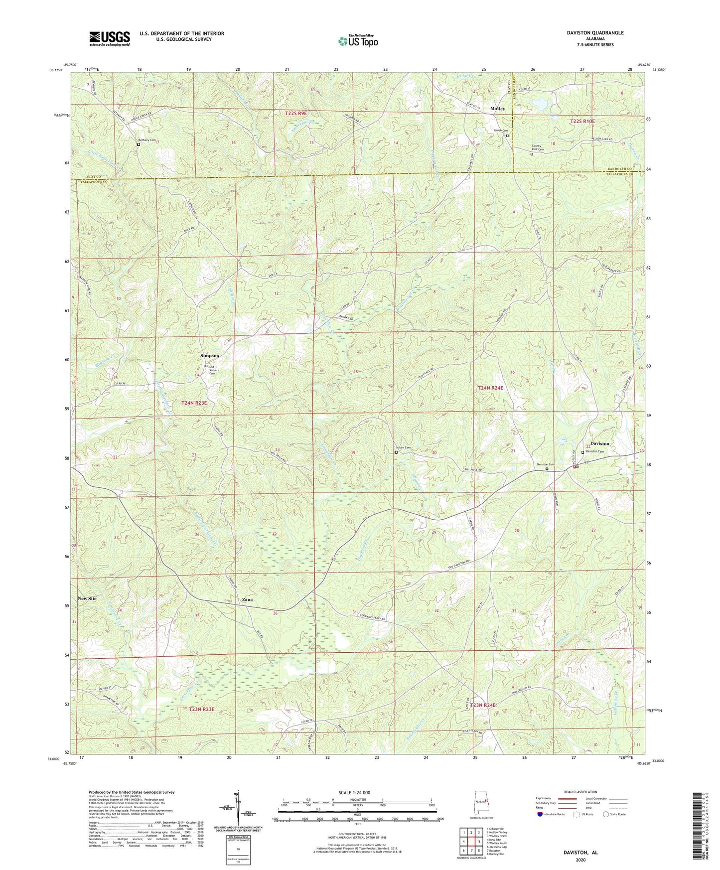
2024 topographic map quadrangle Daviston in the state of Alabama. Scale: 1:24000. Based on the newly updated USGS 7.5' US Topo map series, this map is in the following counties: Tallapoosa, Clay, Randolph. The map contains contour data, water features, and other items you are used to seeing on USGS maps, but also has updated roads and other features. This is the next generation of topographic maps. Printed on high-quality waterproof paper with UV fade-resistant inks.
Quads adjacent to this one:
West: New Site
Northwest: Gibsonville
North: Mellow Valley
Northeast: Wadley North
East: Wadley South
Southeast: Dudleyville
South: Buttston
Southwest: Jacksons Gap
This map covers the same area as the classic USGS quad with code o33085a6.
Contains the following named places: Bethany Cemetery, Bethany Primitive Baptist Church, Birdsong Creek, Coger Hill Church, County Line Baptist Church, County Line Cemetery, Daviston, Daviston Baptist Church, Daviston Cemetery, Daviston High School, Daviston Methodist Church, Daviston Post Office, Daviston Volunteer Fire Department, Dipping Vat Creek, Emuckfaw, Emuckfaw Battleground, Gin Pond Creek, Grapevine Creek, Hodges Creek, Ingram Branch, Jones Branch, Leander Church, Little Emuckfaw Creek, McGuires Chapel, Milam Cemetery, Milam Creek, Motley, Mount Pisgah Church, Mount Zion Church, Mountain Church, Mountain School, New Site Division, Oak Grove Church, Old Vickers Cemetery, Rocky Mount Lookout Tower, Rocky Mount Primitive Baptist Church, Simpson, Town of Daviston, Union Baptist Church, Union Cemetery, Zana, Zana Training School, ZIP Code: 36256